Pointe Poele Chaud
Climbing by the forest to the "Pointe de Poele Chaud", edging until the "Col de Porte" and going down by the "poele chaud" masif.
Ski Touring Moderate
- Distance
- 7.8 km
- Ascent
- 448 m
- Descent
- 448 m
- Duration
- 3-4 hrs
- Low Point
- 1.2 km
- High Point
- 1.6 km
- Gradient
- 22˚
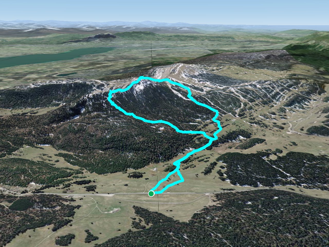
Climbing by the forest to the "Pointe de Poele Chaud", edging until the "Col de Porte" and going down by the "poele chaud" masif. Enjoyable climb by the forest, nice path and easy going with an awesome edge view over the Alps. Amazing sunrise not to lose. The way down has so many variants, to avoid the inmediate forest if not known.
Difficulty
Moderate
Slopes become slightly steeper at around 25-30 degrees.
Low Exposure (E1)

Exposure is limited to that of the slope itself. Getting hurt is still likely if the slope is steep and/or the snow is hard.
Remoteness
Close to help in case of emergency.
Best time to visit
Features
- Single Descent
- Ski Mountaineering
Equipment required
- Skins