Beinn Dòrain (1,076m) and Beinn an Dòthaidh (1,004m)
A fantastic sunrise hike!
Hiking Moderate
- Distance
- 14 km
- Ascent
- 1.2 km
- Descent
- 1.2 km
- Duration
- 4-5 hrs
- Low Point
- 160 m
- High Point
- 1.1 km
- Gradient
- 17˚

"Beinn Dòrain is one of the most instantly recognisable Munros in the southern Highlands, a huge conical peak that dominates the A82 when driving north from Tyndrum. Its ascent can easily be combined with neighbouring Beinn an Dòthaidh which has a fine outlook over Rannoch Moor."
- •
- •
Description
Source: https://www.walkhighlands.co.uk/argyll/beinn-dorain.shtml
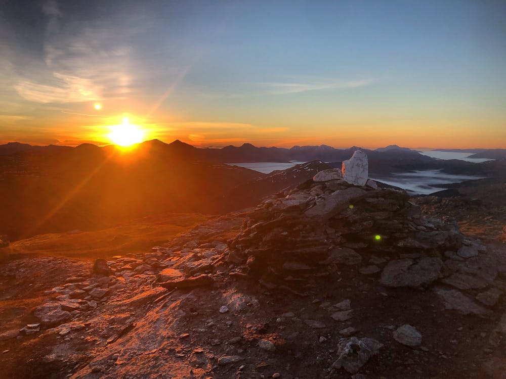
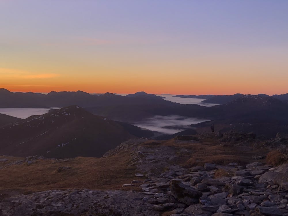
An early 0400am start from Glasgow allowed for a quick and traffic-free drive up to Bridge of Orchy for a cool but refreshing climb. A moonlit night meant great visibility in the early hours of the morning with the forecasted inversion providing incredible views from the ridge of Beinn Dorain and at the summit. Recommended spring / summer hike but if you can catch an early to mid spring ascent in the dark, it's worth it for the sunrise! Path begins to fade slightly on initial route to Beinn an Dòthaidh summit but before long you'll start to find the trail.
This hike and guide was completed during spring weather conditions.
Difficulty
Moderate
Hiking along trails with some uneven terrain and small hills. Small rocks and roots may be present.
Medium Exposure

The trail contains some obstacles such as outcroppings and rock which could cause injury.
Remoteness
Away from help but easily accessed.
Best time to visit
Features
- Picturesque
- Summit Hike
- Dog friendly