9 km away
Dragon Bowl
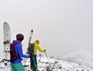
The remote bowl that is clearly visible from Glencoe Mountain, but is only skied by the committed!
Difficult Ski Touring
- Distance
- 7.2 km
- Ascent
- 864 m
- Descent
- 841 m
Mellow ski tour to gain the summit ridge of Beinn Achaladair
Ski Touring Moderate

This is a popular ski touring route which is generally considered to be moderate. It's very remote, it features medium exposure (e2) and is typically done between December and March. From a low point of 172 m to the maximum altitude of 1 km, the route covers 16 km, 904 vertical metres of ascent and 908 vertical metres of descent. It's graded 2.1 and Labande grade 2. You'll need skins to complete it safely.
Ascent/descent through reasonable mellow and safe ground, never skiing anything too challenging. Navigation can be difficult in poor visibility conditions.
Moderate
Slopes become slightly steeper at around 25-30 degrees.

As well as the slope itself, there are some obstacles (such as rock outcrops) which could aggravate injury.

Little chance of being seen or helped in case of an accident.
9 km away
The remote bowl that is clearly visible from Glencoe Mountain, but is only skied by the committed!
Difficult Ski Touring