6.7 km away
High Street from Haweswater
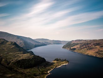
People have walked High Street for thousands of years, and they'll probably be doing so for generations to come.
Difficult Hiking
- Distance
- 9.8 km
- Ascent
- 638 m
- Descent
- 632 m
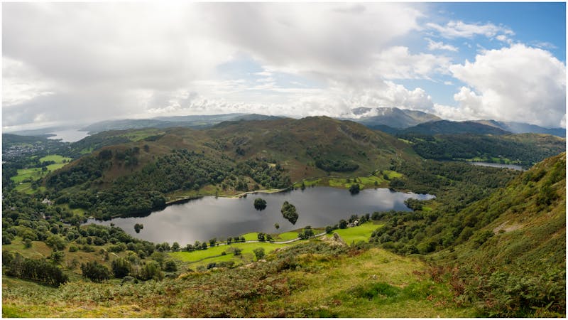
Kentmere Round from Kentmere
Hiking Difficult

This is a popular hiking route which is generally considered to be difficult. It's remote, it features medium exposure and is typically done all year round. From a low point of 171 m to the maximum altitude of 826 m, the route covers 22 km, 1198 vertical metres of ascent and 1199 vertical metres of descent.
Kentmere - Sallows - Yoke - Ill Bell - Froswick - Thornthwaite Crag - High Street - Mardale Ill Bell - Harter Fell - Kentmere Pike - Shipman Knotts - Kentmere
Difficult
Hiking trails where obstacles such as rocks or roots are prevalent. Some obstacles can require care to step over or around. At times, the trail can be worn and eroded. The grade of the trail is generally quite steep, and can often lead to strenuous hiking.

The trail contains some obstacles such as outcroppings and rock which could cause injury.
Away from help but easily accessed.
6.7 km away
People have walked High Street for thousands of years, and they'll probably be doing so for generations to come.
Difficult Hiking
8 km away
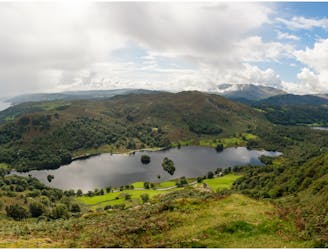
This celebrated round packs a lot into its ten and a half miles, giving easy striding and ever-improving vistas culminating on one of the best-loved peaks in Lakeland.
Difficult Hiking
9.5 km away
Circumnavigate a beautiful little lake and visit one of the Lake District's most famous manmade landmarks.
Moderate Hiking
5 routes · Hiking

7 routes · Hiking