1.4 km away
Tryfan and the Glyderau: Cwm Bochlwyd Loop
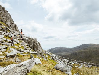
Snowdon's horseshoe may have the majesty, but Ogwen's own circular classic boasts more and better scrambling.
Extreme Hiking
- Distance
- 6.2 km
- Ascent
- 916 m
- Descent
- 913 m
One of Snowdonia's most classic hikes along one of its most scenic ridges
Hiking Difficult

Taking in Wales' 5th highest mountain and one of the best - and best known - ridgelines in the UK, this is one of Snowdonia's most popular hikes, and with good reason. The hiking is never overly difficult and there's no scrambling involved (although it's not uncommon for less confident hikers to do brief sections of the initial scree-filled descent on their backsides!) so this is an ideal objective for experienced mountain folk who want to tick a classic route. Navigation will be an issue in bad weather, and the expansive views on the main Glyder ridge are one of the main attractions on this journey, so save it for a sunny day.
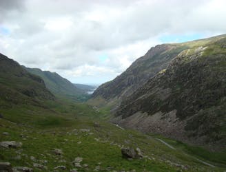
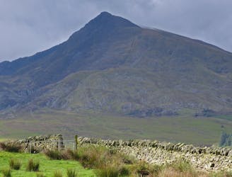
The trip begins at the Ogwen Cottage carpark (which is home to an excellent cafe) and begins with the enjoyable climb up to Llyn Bochlwyd, right below the imposing bulk of Tryfan. From the lake, follow the miner's track to the col which separates that peak from Glyder Fach, hang a right and make the - at times - steep and loose climb to the summit. Very competent scramblers might consider tackling Bristly Ridge, which branches off from this path and is a classic Welsh scramble, but we've drawn the route up the main Glyder Fach path.
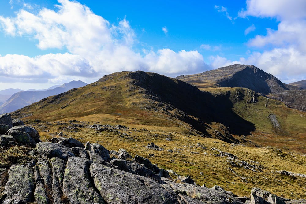
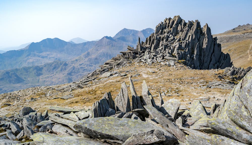
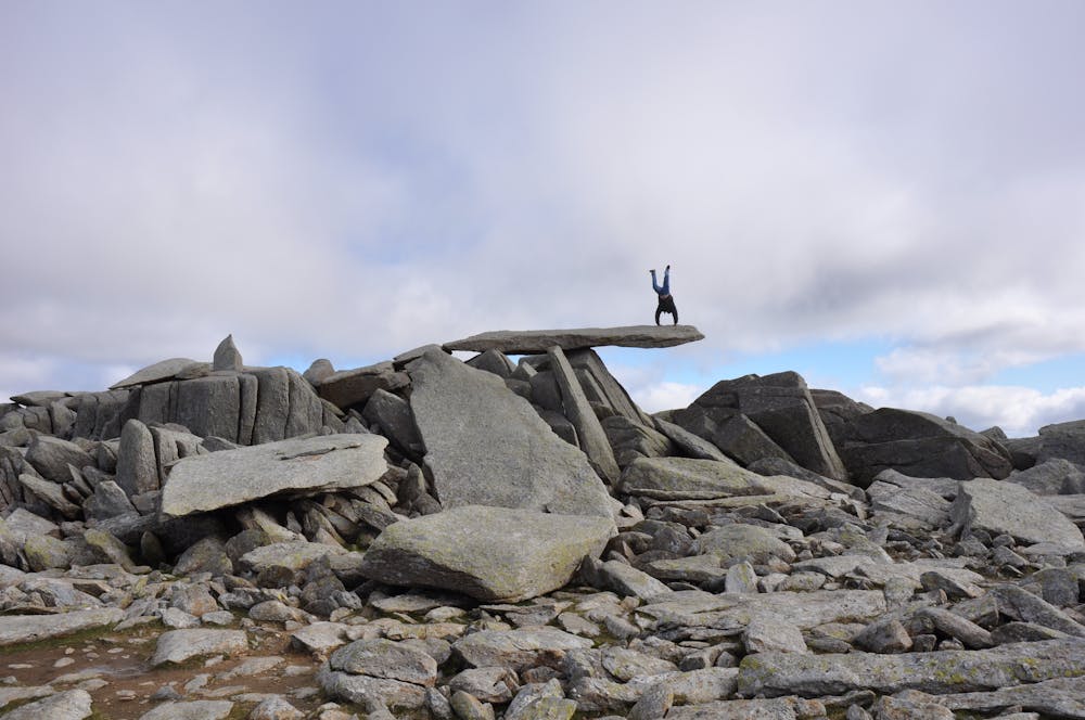
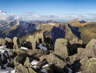
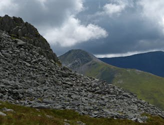
Once on the main Glyder ridge the terrain is open, barren and almost moon-like. The contrast with the valleys below is startling, and the scenery utterly breathtaking. The rocky terrain doesn't make travel particularly easy but the wild feeling of the ridge and the jaw-dropping panorama across Snowdon, the Carneddau range and out to the Irish Sea make it a wonderful journey. One particular highlight, near the summit of Glyder Fach, is the Cantilever Stone - a well known landmark because of the superb photo opportunity it provides.
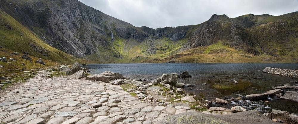
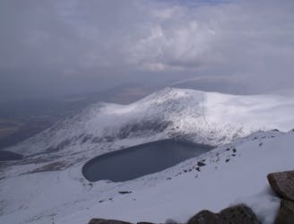
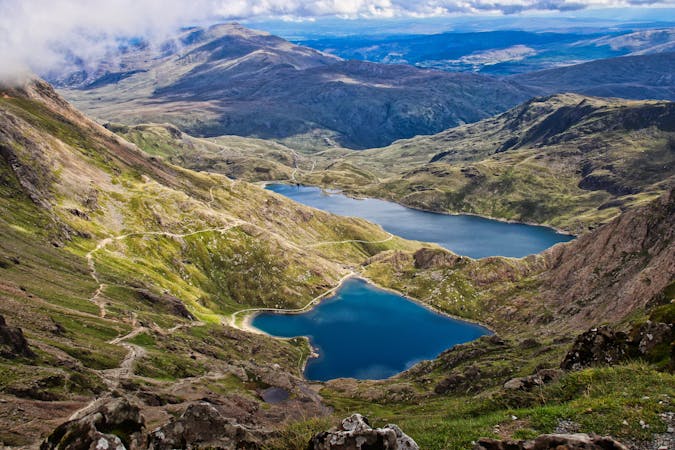
Having passed over the summit of Glyder Fawr, make the sometimes slippery descent down scree to Llyn y Cwn and then continue more easily and enjoyably down through the somewhat scarily-named Devil's Kitchen to reach the shores of Llyn Idwal. Stroll alongside this and return to the carpark/cafe!
Difficult
Hiking trails where obstacles such as rocks or roots are prevalent. Some obstacles can require care to step over or around. At times, the trail can be worn and eroded. The grade of the trail is generally quite steep, and can often lead to strenuous hiking.

The trail contains some obstacles such as outcroppings and rock which could cause injury.

Little chance of being seen or helped in case of an accident.
1.4 km away
Snowdon's horseshoe may have the majesty, but Ogwen's own circular classic boasts more and better scrambling.
Extreme Hiking
1.9 km away
If it’s a superb walk in relative solitude you’re after then folk in the know will point you at those big old lumps where scenes of genuine grandeur can also be won, but unlike the cheap thrills of their Ogwen brethren, the secrets of the Carneddau must be earned.
Difficult Hiking
4.8 km away
Perhaps it's only fitting that the highest mountain in Wales boasts the country's greatest all-day scrambly ridge traverse.
Extreme Hiking
5.9 km away
Hideously scarred and cruelly exploited it may well be, but Elidir Fawr is often the choice of the connoisseur when a quick 3000er is the order of the day.
Difficult Hiking
7.2 km away
A good challenge for any fit walker, which also is one of the best walks in Snowdownia.
Extreme Hiking
9.2 km away
When it comes to half day outings in Snowdonia, the ascent of Moel Siabod via the ridges that enclose Cwm y Foel is up there with the very best.
Moderate Hiking

18 routes · Alpine Climbing · Hiking
10 routes · Hiking