1.9 km away
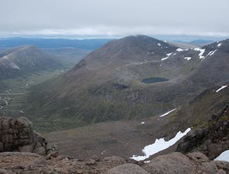
Ben Macdui
A very pleasant ascent up Britain's 2nd highest mountain with wonderful views of the Cairngorms.
Moderate Hiking
- Distance
- 16 km
- Ascent
- 771 m
- Descent
- 771 m
A short walk from Ptarmigan building to access some of the steepest freeride lines on the map
Hiking Easy

This hike goes from the Ptarmigan top station building, travelling up to the summit of CairnGorm at 1244 metres, and continues in a westerly direction, accessing the ridge of Coire an t-Sneachda at 1176 metres.
The hike to the summit takes approximately 30 minutes. There is a fence that marks the route, which is usually partly visible in winter. From the summit cairn, you can ride down the Coire Cas headwall, or continue in a westerly direction to access the significantly more challenging terrain in Coire an t-Sneachda, such as Jacob's Ladder and Aladdin's Couloir.
The route can be made in to a loop, by skiing out of Coire an t-Sneachda all the way back over in to lower Coire Cas. If snow conditions allow, it's also possible to ski right out of Coire an t-Sneachda and finish near the Cairngorm base station and car park.
Easy
Walking along a well-kept trail that’s mostly flat. No obstacles are present.

The trail contains some obstacles such as outcroppings and rock which could cause injury.
Away from help but easily accessed.
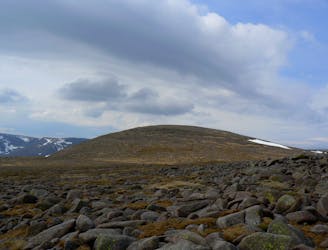
1.9 km away
A very pleasant ascent up Britain's 2nd highest mountain with wonderful views of the Cairngorms.
Moderate Hiking
1.9 km away
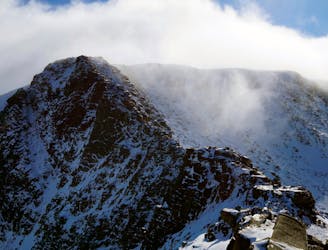
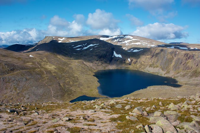
A classic and easily accessible hike/scramble in the Northern Corries
Severe Hiking
1.9 km away
A classic hike around of Scotland's most famous peaks.
Difficult Hiking
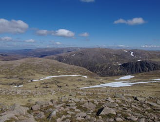
3.2 km away
A committing loop taking in all five Munros located in the Cairngorms National park
Difficult Hiking
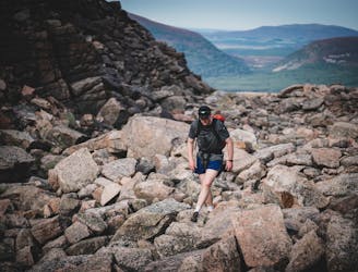
3.2 km away
With its wide rolling plateau and monumental corrie system Scotland's third highest mountain is also one of its most interesting and impressive.
Extreme Hiking
3 routes · Hiking