
15 routes · Hiking
A combination of waterfalls, moors, summits and one of the best pubs in England make this one of the best days on the whole trip.
Hiking Difficult

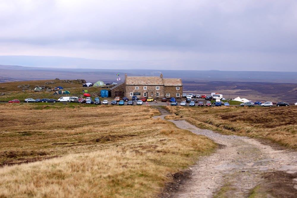
Each hiker will have their own criteria for what makes a great day, but regardless of how you judge these things, this is a classic journey. It might even be - whisper it quietly - the best single day on the entire Pennine Way. The accommodation at the end of it (the Tan Hill Inn) is certainly the best spot you'll stay on the whole trip.
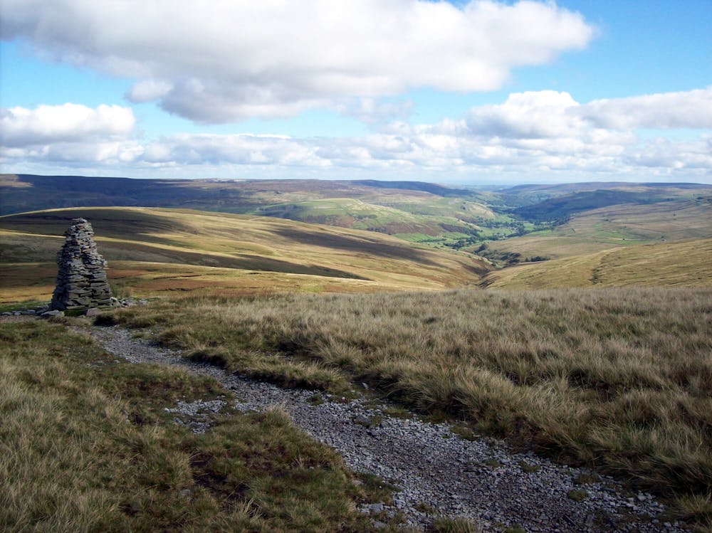
After leaving Hawes it's worth making the very short detour to see the Hardraw Force waterfall before then beginning the steady climb up onto Great Shunner Fell - the highest point reached so far on the Pennine Way and the first time you'll have found yourself over 700 metres above sea level since the trip began. The view from the summit is everything you'd hope it to be, and the descent down to the charming village of Thwaite is pleasant too.
From Thwaite you'll skirt the minor summit of Kisdon, cross the legendary Swaledale and then follow West Stone Dale past some waterfalls to its eponymous moor. Climb up onto this and then cross it to reach the fabulous Tan Hill Inn. The pub is perched in a pretty windswept spot and in bad weather must be one of the cosiest spots in northern England! The ideal way to experience the pub is to see it in good weather and then spend the evening watching rain lash the windows while you eat and drink inside! There is camping available at the pub, but staying in one of its rooms is far preferable to sleeping under canvas in such an exposed spot.
If the pub doesn't have any rooms available and you don't have a tent then shortening the day and staying at Keld or Thwaite is your best option.
Difficult
Hiking trails where obstacles such as rocks or roots are prevalent. Some obstacles can require care to step over or around. At times, the trail can be worn and eroded. The grade of the trail is generally quite steep, and can often lead to strenuous hiking.

The trail contains some obstacles such as outcroppings and rock which could cause injury.

Little chance of being seen or helped in case of an accident.
15 routes · Hiking