3.5 km away
Glentress Black XC Trail
Classic black-graded XC trail at the UK's leading MTB trail centre.
Severe Mountain Biking
- Distance
- 26 km
- Ascent
- 915 m
- Descent
- 914 m
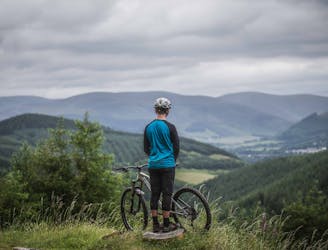
The classic natural ridge line trail out of Peebles
Mountain Biking Difficult

This is the classic backcountry ridge ride straight out of the Tweed Valley. The broad ridgeline can be seen from town and extends all the way from the high point on the route, meaning you can see the full descent that lies ahead to entice you in. While it’s best kept for dry conditions, it is still relatively rocky in places, but winter (or wet summers) brings boggy sections unless it’s frozen.

Starting from Peebles means you end the ride on the epic singletrack descent, but there are a few starting options at Cardrona Forest or Nashy’s coffee shop in Cardrona village.
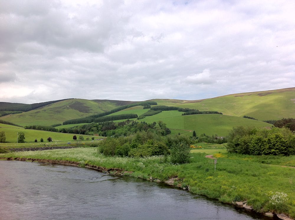
From Peebles you’ll start out along the Tweed Valley cycle path, a wide traffic-free route following the river Tweed. You’ll spot fisherman hoping for some of the mighty salmon that make this river the most expensive place to fish in Scotland.
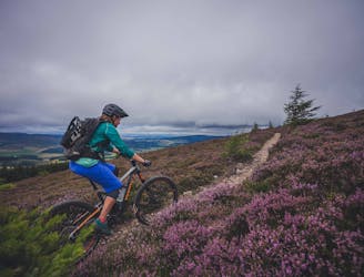
From here you reach Cardrona and can stop for last minute cake or coffee before the relentless climb begins. Up through quiet forest, you eventually emerge onto the heather clad moorland – infamous in late summer for the sea of purple flowers.
The final climb on the moors is super steep but perfectly rideable in a cramp-inducing kind of challenge.
From here you follow that clearly visible broad but undulating ridge back to the town of Peebles. It varies from rocky fall line singletrack to fast, swooping sections (watch out for walkers). If ridden in the evening you get the golden light of the sun setting as the trail mostly snakes along the western side of the ridge.
It can be extended by adding on the excellent local trails in Cademuir forest south of Peebles. Or for the more adventurous, link it up with the John Buchan way to Broughton if conditions are dry under-tyre.
It’s altogether best left for summer and drier days when the boggy sections become dusty loam and make it far more fun.
Difficult
Mostly stable trail tread with some variability featuring larger and more unavoidable obstacles that may include, but not be limited to: bigger stones, roots, steps, and narrow curves. Compared to lower intermediate, technical difficulty is more advanced and grades of slopes are steeper. Ideal for upper intermediate riders.

The trail contains some obstacles such as outcroppings and rock which could cause injury.
Away from help but easily accessed.
3.5 km away
Classic black-graded XC trail at the UK's leading MTB trail centre.
Severe Mountain Biking
9.7 km away
A fantastic trail ride up to the views of the windswept Minch Moor before a fast, flowy, and rocky descent.
Severe Mountain Biking