6.4 km away
Glentress Black XC Trail
Classic black-graded XC trail at the UK's leading MTB trail centre.
Severe Mountain Biking
- Distance
- 26 km
- Ascent
- 915 m
- Descent
- 914 m
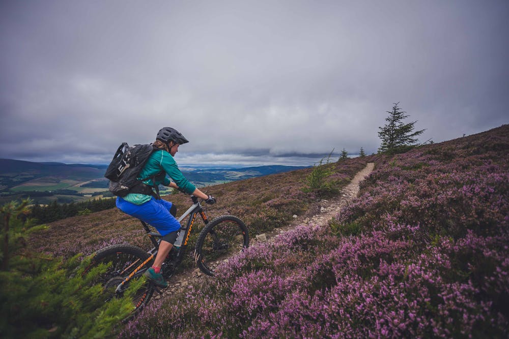
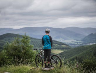
A fantastic trail ride up to the views of the windswept Minch Moor before a fast, flowy, and rocky descent.
Mountain Biking Severe

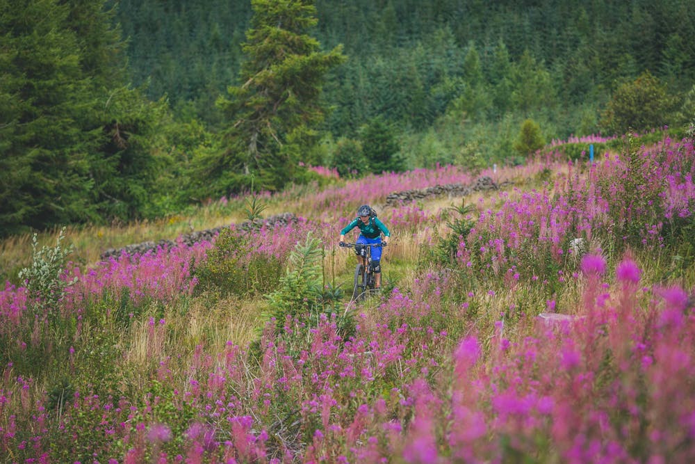
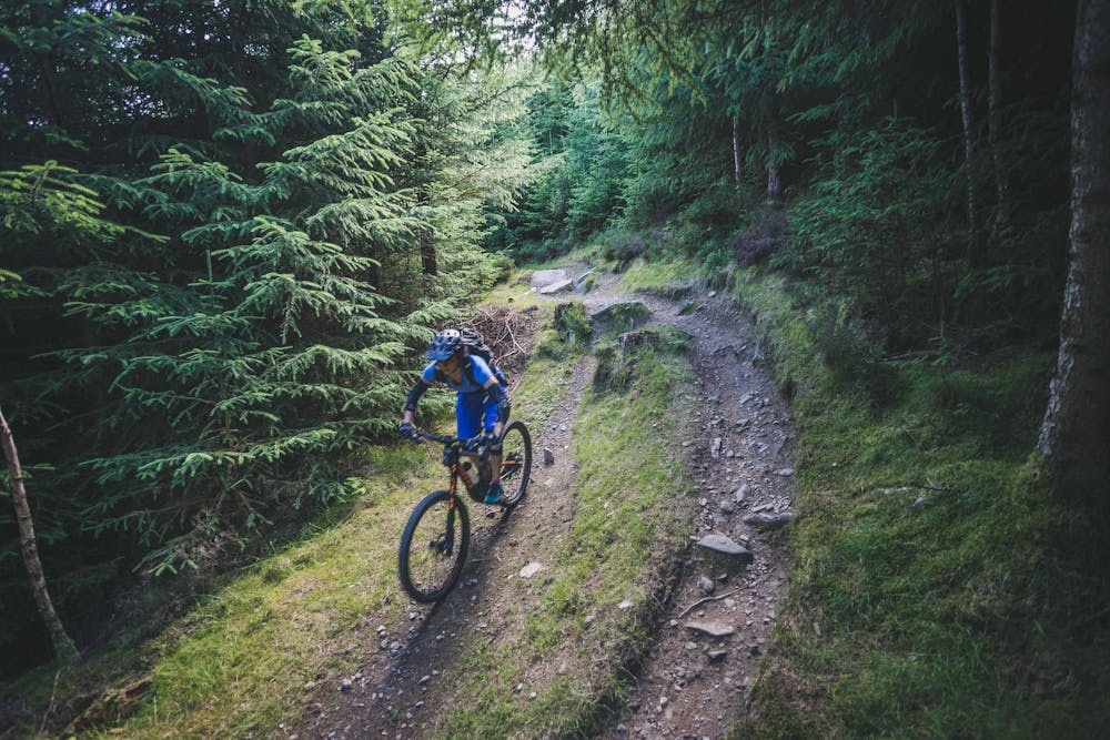
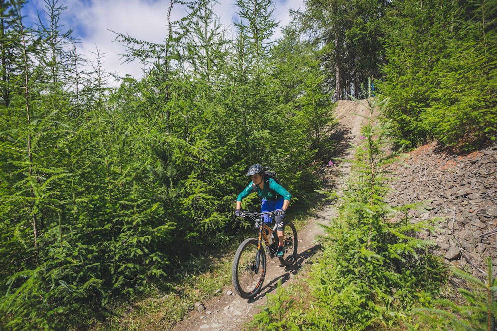
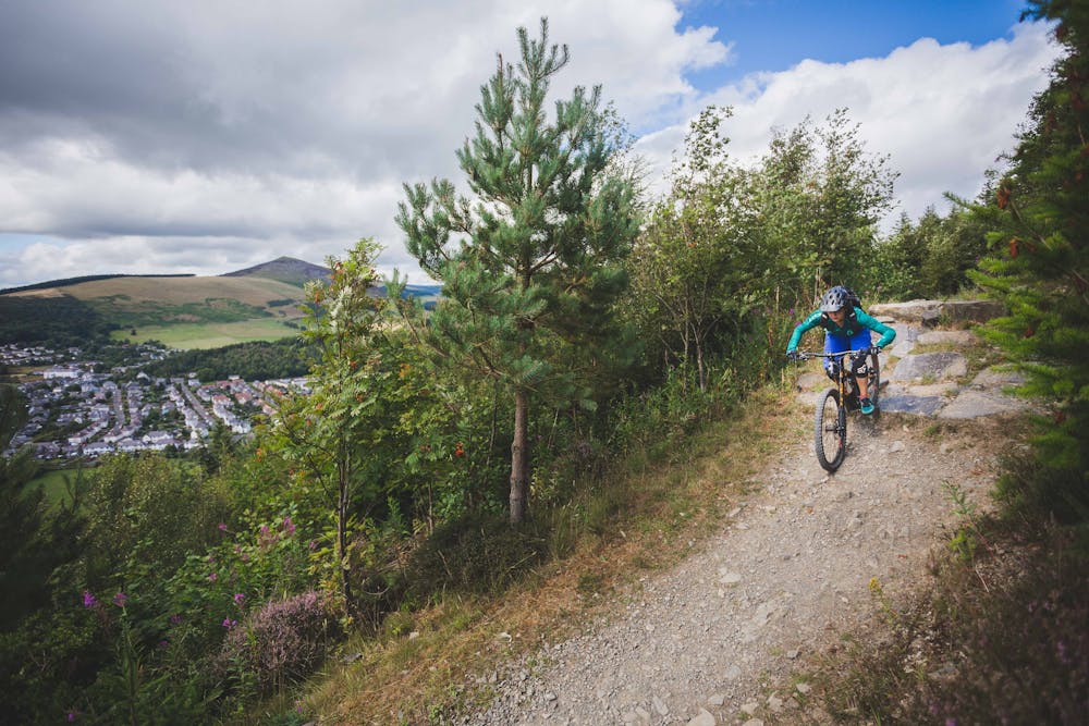
This is a classic trail loop that makes up one of the 7stanes trail centres which are dotted across the south of Scotland. This red-graded route at Innerleithen is made up of a long and undulating climb to one of the highest summits in the Tweed Valley. This big ascent is a challenge but quickly followed by a seemingly never-ending descent back down to the valley floor. It has everything you’d want from a trail: from narrow all-weather singletrack, good views, and even black options with hair-raising rock drops.
After the trail leaves the car park it soon switchbacks straight uphill. After flattening out it dips downhill into an old quarry for a steep rocky section, and then it's uphill again all the way to the top of the moors. The final descent has sections of rough tight trails, smooth jumps, and then finishes on the evergreen Caddon Bank with classic rollercoaster flow that keeps egging you faster.
While sometimes overshadowed by the more extreme DH trails in the same forest or the seemingly-infinite number of short enduro lines, it’s well-worth riding this varied and stunning loop that will test the fitness and skill levels of all riders. The loop is best attempted on short travel trail bikes but is fine on hardtails through to enduro riders.
Innerleithen is a hub of bike culture and the top-notch cafes can be 5 bikes deep outside, while local riders sipping coffee inside perform at the highest level on the world stage. It is a place that buzzes with bikes and is a vital stop for a few days—if not longer—on any Scottish MTB tour.
This Red loop can then be combined with longer XC loops, shuttling DH trails, or riding enduro trails that have seen EWS races.
Severe
Widely variable, narrow trail tread with steeper grades and unavoidable obstacles of 15in/38cm tall or less. Obstacles may include unavoidable bridges 24in/61cm wide or less, large rocks, gravel, difficult root sections, and more. Ideal for advanced-level riders.

The trail contains some obstacles such as outcroppings and rock which could cause injury.
Away from help but easily accessed.
6.4 km away
Classic black-graded XC trail at the UK's leading MTB trail centre.
Severe Mountain Biking
9.7 km away
The classic natural ridge line trail out of Peebles
Difficult Mountain Biking