10 routes · Hiking
A deceptively-challenging segment of the Pinhoti ending at Alabama's high point.
Hiking Difficult

This portion of the Pinhoti Trail begins at the trailhead along Ashland Highway, also referred to as AL-77. An unpaved parking area lies on the east side of the road and is easy to locate.
Making your way north, the trail quickly hurdles up and over a high point before crossing a railroad track. Shortly after, a bridge crosses over Talladega Creek. As much of this hike is atop a ridge, the next reliable water source is almost 13 miles ahead.
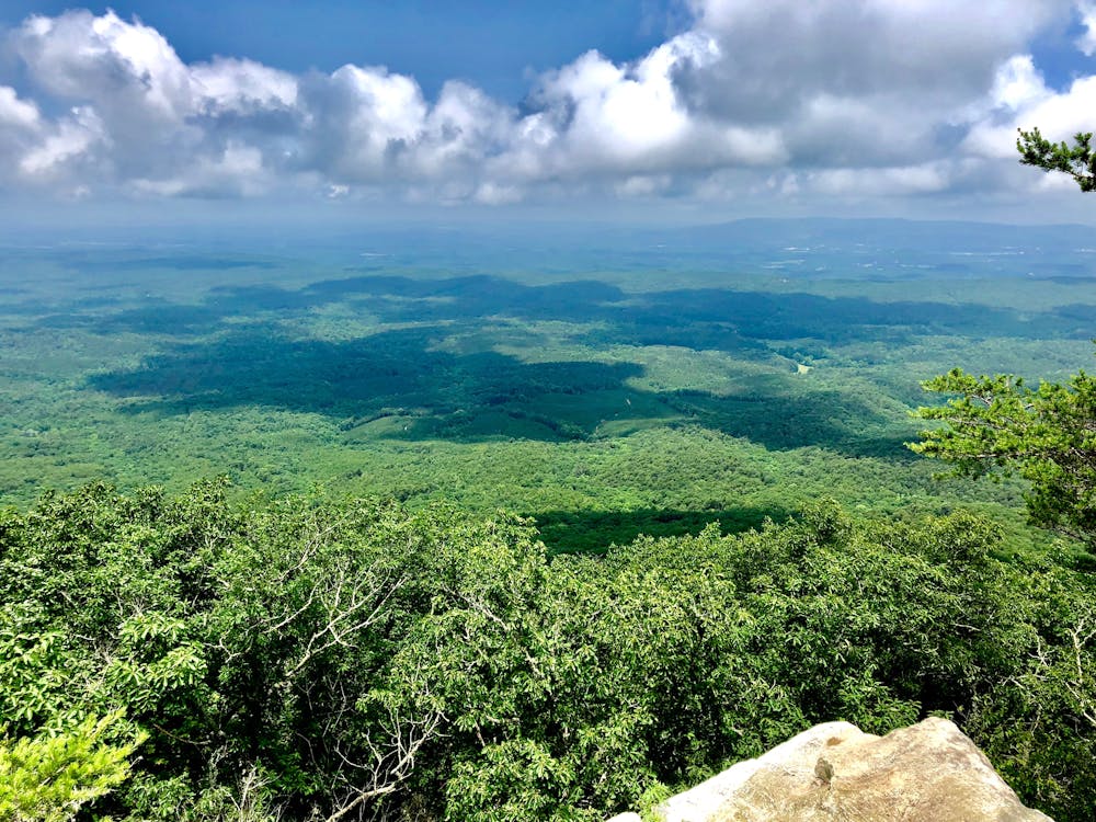
Ahead, the trail alternates along the eastern and western slopes of a long ridge that leads to Adam's Gap. Several small primitive campsites and countless views line the way. An old overgrown two track leads to the summit of Burgess Point and the former site of a fire tower. Its remnants double as a perfect campsite offering seasonal views in the winter.
As you near Adam's Gap, you will find another reliable water source as well as multiple large campsites under a mile from the Pinhoti on the Skyway Loop Trail. Ahead, the path enters the Cheaha Wilderness, one of the most coveted portions of the entire 330-mile long trail.
According to the Pinhoti Trail Alliance, "the Cheaha Wilderness is the # 1 destination on the Alabama section of the Pinhoti because of its stunning views and numerous side trails, which offer a lot of different loop trail possibilities. There are 26 fire rings on the Pinhoti in the next 11.4 miles."
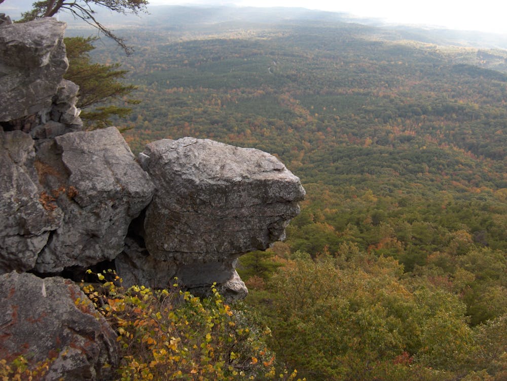
Less than 4 miles from Adams Gap, the Pinhoti climbs the appropriately named "Stairway to Heaven." A rugged, grueling climb begins the ascent towards Cheaha State Park and picturesque views from exposed bluffs will begin to present themselves.
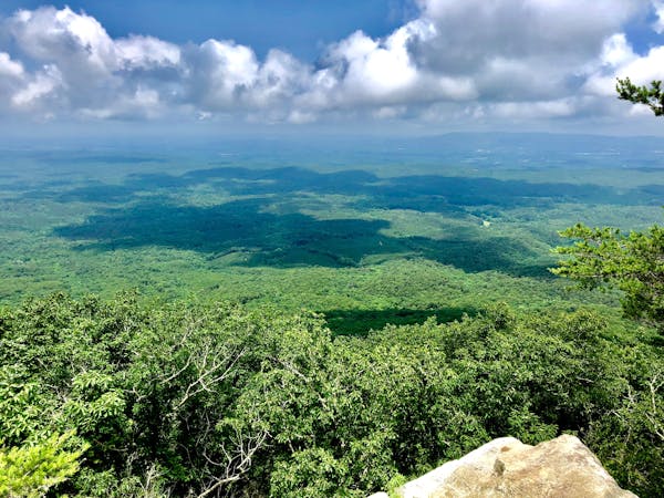
Rounding out this portion, the trail double-backs so it can pass over McDill Point at 2,100'. A phenomenal vista offers a sweeping view of the surrounding region.
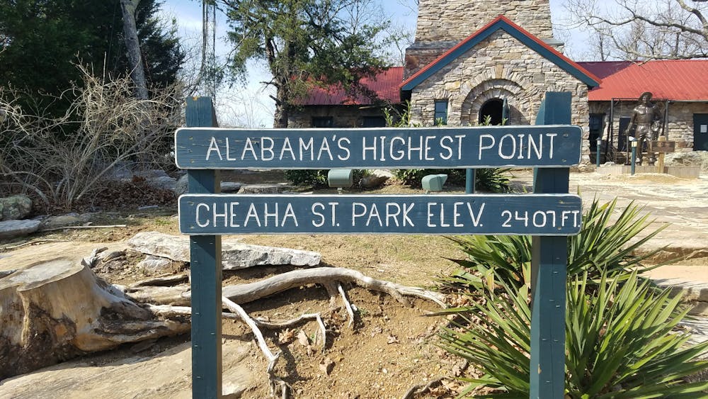
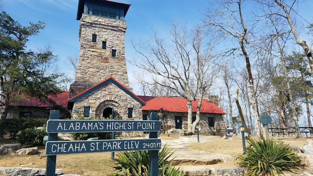
This segment ends at Talladega Scenic Drive. Should this be the end of your hike, be sure to visit Cheaha Mountain State Park. Though the Pinhoti doesn't directly pass over the summit, several side trails offer the opportunity to visit Alabama's high point.
Sources: http://www.pinhotitrailalliance.org/section-5..html http://www.pinhotitrailalliance.org/section-6..html
Difficult
Hiking trails where obstacles such as rocks or roots are prevalent. Some obstacles can require care to step over or around. At times, the trail can be worn and eroded. The grade of the trail is generally quite steep, and can often lead to strenuous hiking.

The trail contains some obstacles such as outcroppings and rock which could cause injury.

Little chance of being seen or helped in case of an accident.
10 routes · Hiking