1 m away
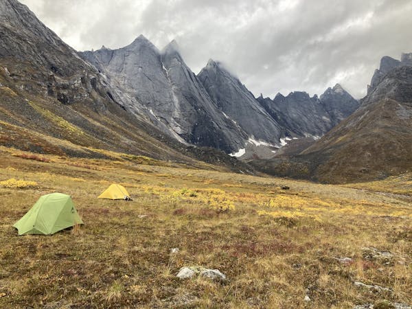
Upper Arrigetch Valley
Journey along Arrigetch Creek to its headwaters, among the glaciers at the feet of impossible peaks.
Severe Hiking
- Distance
- 15 km
- Ascent
- 927 m
- Descent
- 927 m
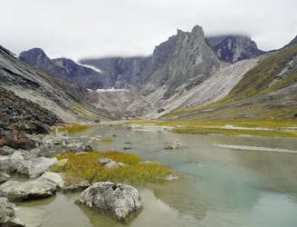
An alpine valley of blue lakes and bare rock, amid unclimbed peaks and beyond the reach of any trails.
Hiking Severe

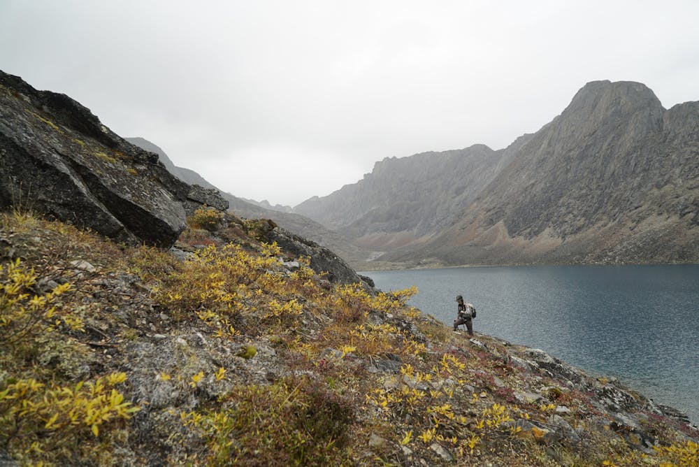
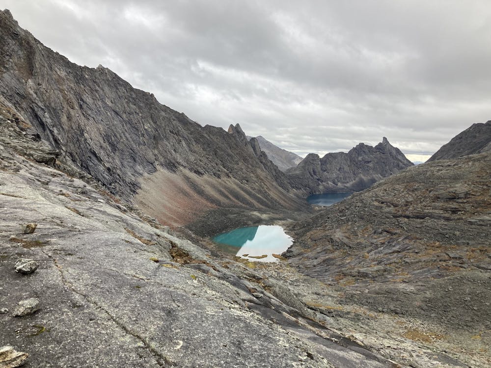
Aquarius Valley is perhaps the most frequented side trip from Arrigetch Valley. Aquarius is famed for its string of photogenic alpine lakes. These iridescent pools sit high above the timberline, fringed by just a touch of green among miles of granite rubble beneath rows of sheer-walled peaks.
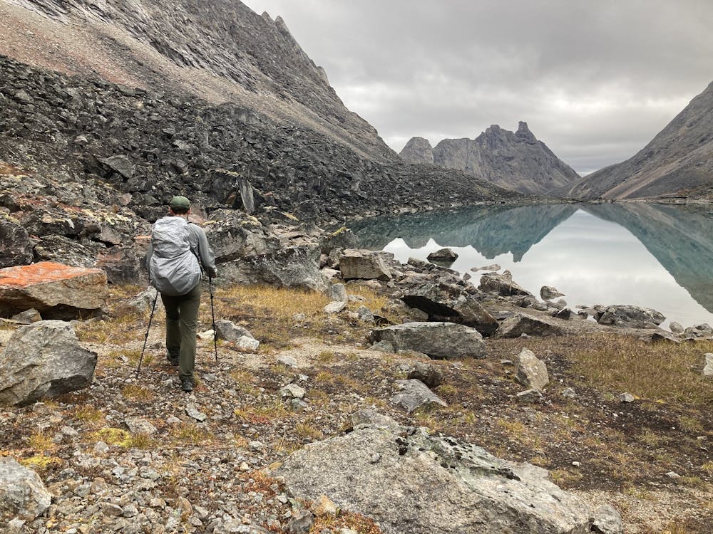
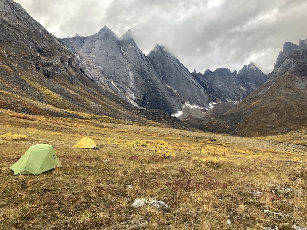
The route mapped here begins from a possible basecamp location near Arrigetch Creek and makes a return trip to the head of Aquarius Valley. You may choose to cover it in a day or to camp somewhere along the route. The mapped track is only an approximation, so you can expect to deviate significantly as you navigate the terrain. As with other routes in the area, this does not follow a defined trail, so take care to minimize your impact on the tundra. Walk on rocks or in streams as much as possible.
From Arrigetch Creek, you’ll trace a side stream up a valley bound by giant granite teeth. Turn and follow a smaller tributary into the arm of the drainage that is Aquarius. A steep rock slope leads into it, then the gradient lessens, but talus hopping remains constant. The first lake is the largest. You might find a flat tent spot on ledges near its shore if you choose to camp this high in the valley. Moving upward, the next lakes are smaller but equally beautiful, with their own shades of blue and unique granite backdrops. If you continue the extent of the route mapped here, you’ll find the glacier at the top of the valley, plus a view of all the lakes strung out in a row.
Sources: https://www.nps.gov/gaar/planyourvisit/backpackingandhiking.htm https://mclaine.org/aquarius-valley/ https://sonjasaxe.com/blog/2016/8/20/the-last-frontier-gates-of-the-arctic-national-park-part-2-of-3
Severe
Hiking challenging trails where simple scrambling, with the occasional use of the hands, is a distinct possibility. The trails are often filled with all manner of obstacles both small and large, and the hills are very steep. Obstacles and challenges are often unexpected and can be unpredictable.

Some trail sections have exposed ledges or steep ascents/descents where falling could cause serious injury.

In the high mountains or remote conditions, all individuals must be completely autonomous in every situation.
1 m away
Journey along Arrigetch Creek to its headwaters, among the glaciers at the feet of impossible peaks.
Severe Hiking
7 routes · Hiking

63 routes · Alpine Climbing · Hiking