1 m away
Aquarius Valley
An alpine valley of blue lakes and bare rock, amid unclimbed peaks and beyond the reach of any trails.
Severe Hiking
- Distance
- 12 km
- Ascent
- 784 m
- Descent
- 784 m
Journey along Arrigetch Creek to its headwaters, among the glaciers at the feet of impossible peaks.
Hiking Severe

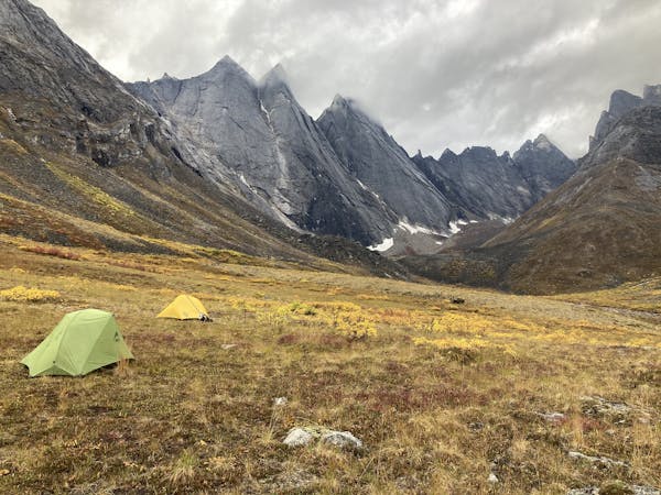
The most dramatic of the Arrigetch Peaks are rooted in the upper end of the valley, flanked by glaciers that melt into Arrigetch Creek. Most parties camp at least one night in the Aquarius Junction area before embarking on the section mapped here. This out and back is doable as a day hike, but it’s a big one. If your main objective is exploring the Upper Arrigetch Valley (as opposed to Aquarius Valley or elsewhere), consider camping higher along Arrigetch Creek so you can make shorter day trips.
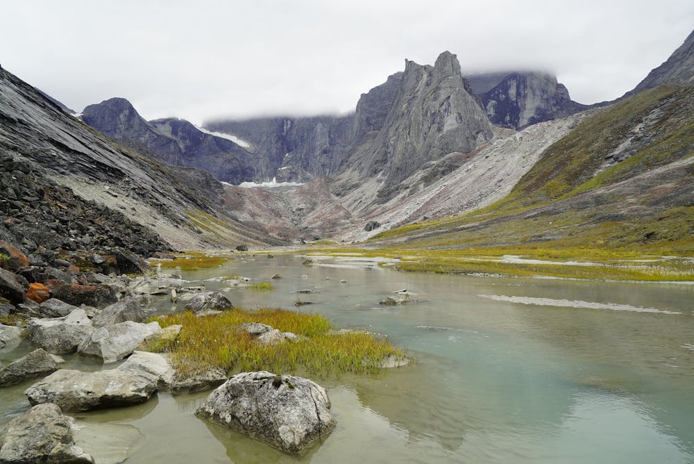
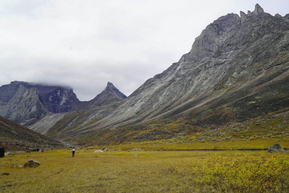
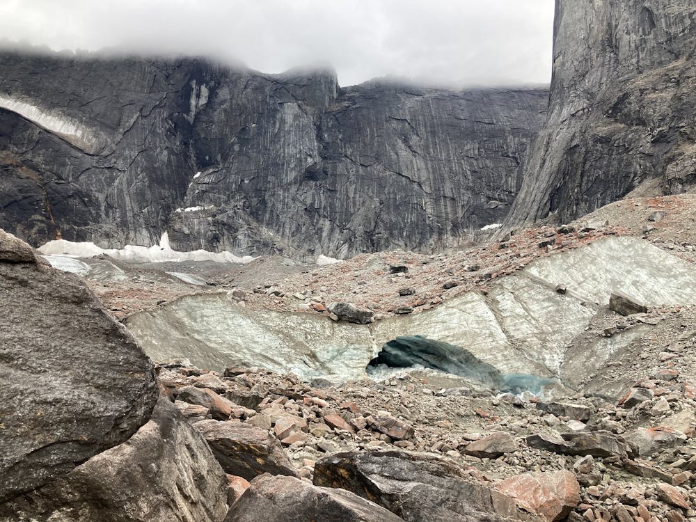
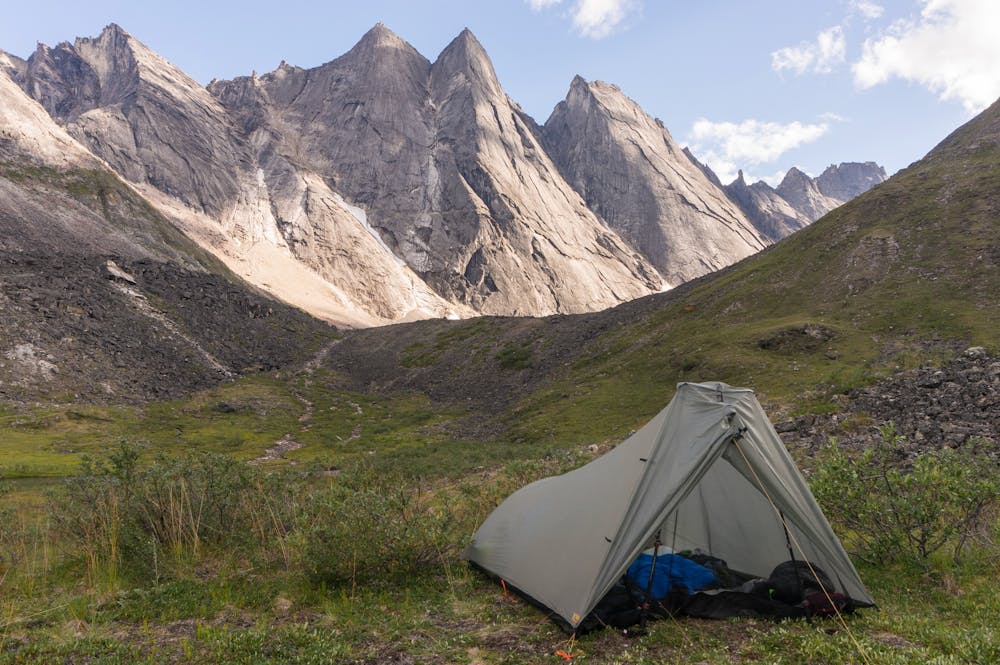
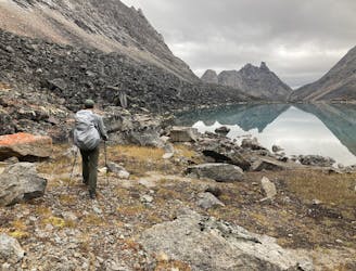
In the upper valley, the creek spreads out into braids and pools among meadows and cobble bars. Though the gradient is slight, walking remains difficult due to mud, vegetation, water crossings, and talus. Near the head of the valley, bouldery moraine slopes lead to glacial tarns and eventually the glaciers themselves. By this point, the peaks tower directly overhead, in sheer cliffs of dark, streaked granite. Various ridge scrambles and rock climbs are possible for those who come prepared.
Keep in mind that the track shown here is not an exact route, but simply the general way up the valley from Aquarius Junction to one of the glaciers. Expect the actual mileage to be greater.
Sources: https://www.nps.gov/gaar/planyourvisit/backpackingandhiking.htm https://mclaine.org/arrigetch-peaks/
Severe
Hiking challenging trails where simple scrambling, with the occasional use of the hands, is a distinct possibility. The trails are often filled with all manner of obstacles both small and large, and the hills are very steep. Obstacles and challenges are often unexpected and can be unpredictable.

The trail contains some obstacles such as outcroppings and rock which could cause injury.

In the high mountains or remote conditions, all individuals must be completely autonomous in every situation.
1 m away
An alpine valley of blue lakes and bare rock, amid unclimbed peaks and beyond the reach of any trails.
Severe Hiking
7 routes · Hiking

63 routes · Alpine Climbing · Hiking