5 routes · Mountain Biking
A fantastic lollipop ride anchored by the INHT.
Mountain Biking Moderate

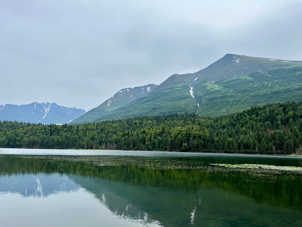
This lollipop-style ride traverses one of the newest sections of the Iditarod National Historic Trail (INHT), at least of the time of this writing in summer 2022. It also reaches an isolated lake set against a stunning mountain backdrop that's a worthy destination all in its own right.
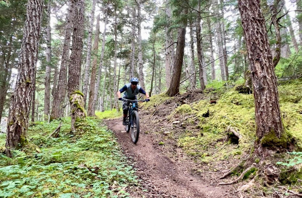
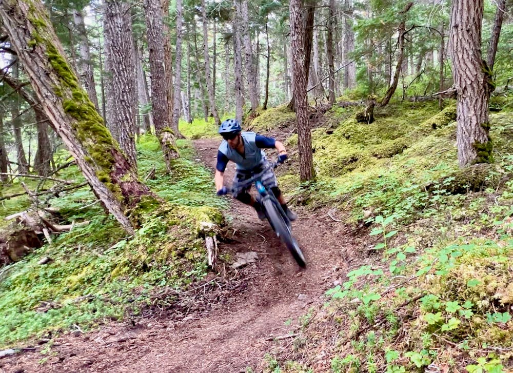
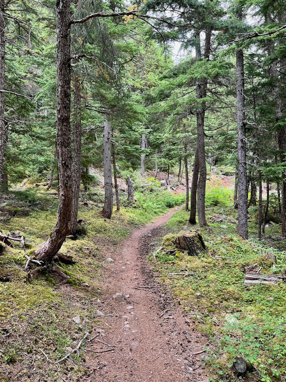
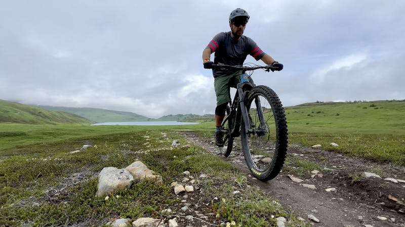
The ride begins from the Ptarmigan Creek trailhead on a crushed gravel path before turning off onto the Falls Creek section of the INHT. This first section of trail is slightly older and more established than the new Vagt Lake section. You'll enjoy some fantastic, loamy singletrack covered in pine needles that rolls up and down beneath a dense forest canopy. Riding beneath the canopy prevents the undergrowth from growing too thick, which is a welcome relief from many other overgrown trails on the Kenai Peninsula.
The first part of the Falls Creek section mostly climbs, then you'll enjoy a rolling descent that crosses a massive bridge above a roaring glacier-fed stream. Next, you'll cross an ATV trail and come to a junction, with a singletrack going left. That will be the final descent of your ride—the rest of the singletrack is currently an out-and-back, forming the stick on the lollipop.
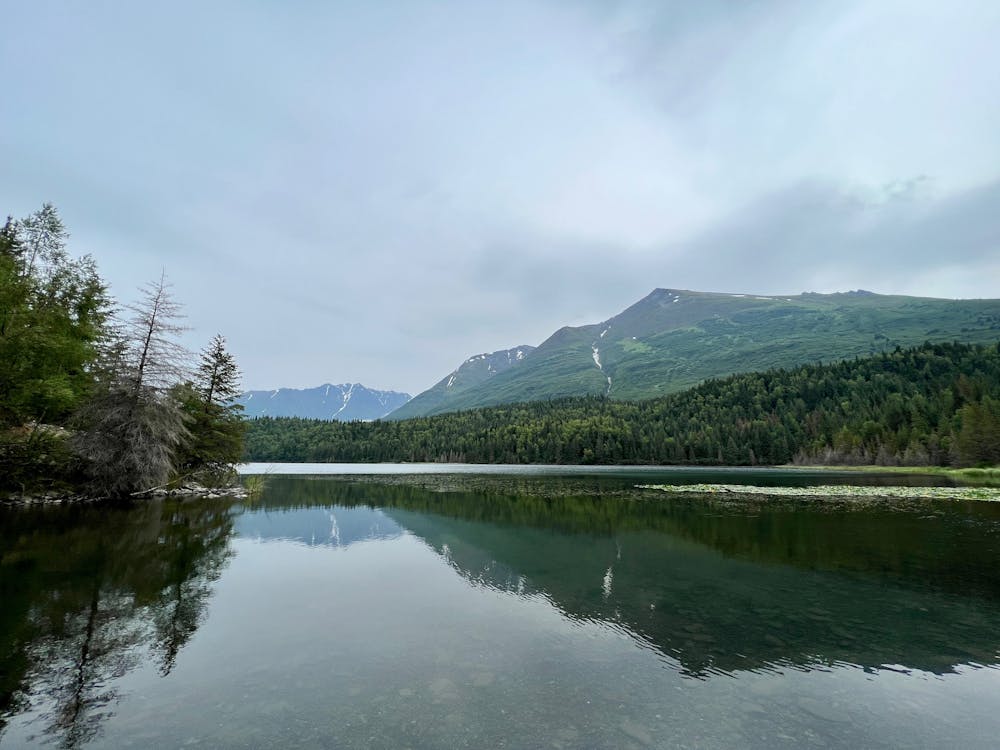
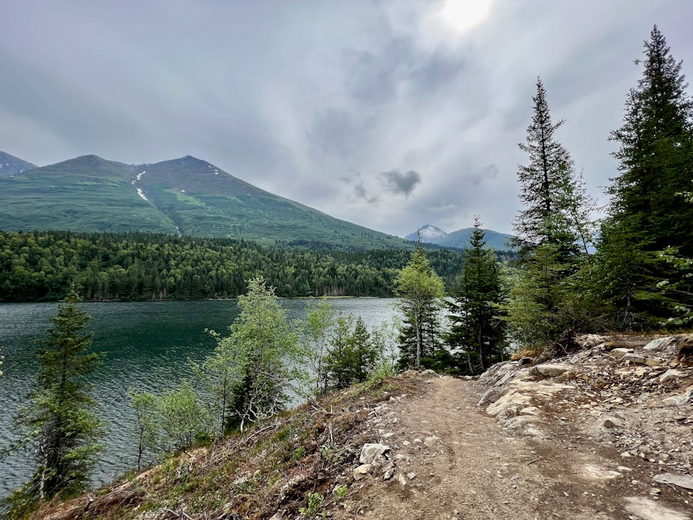
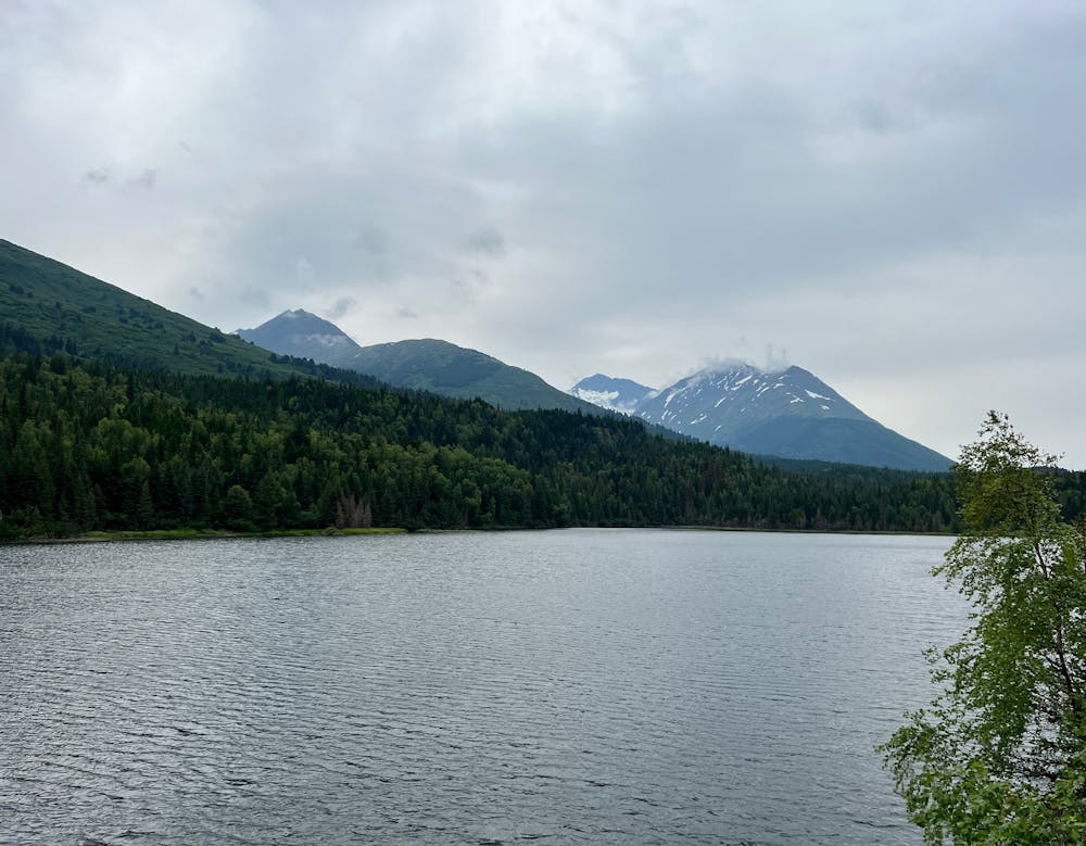
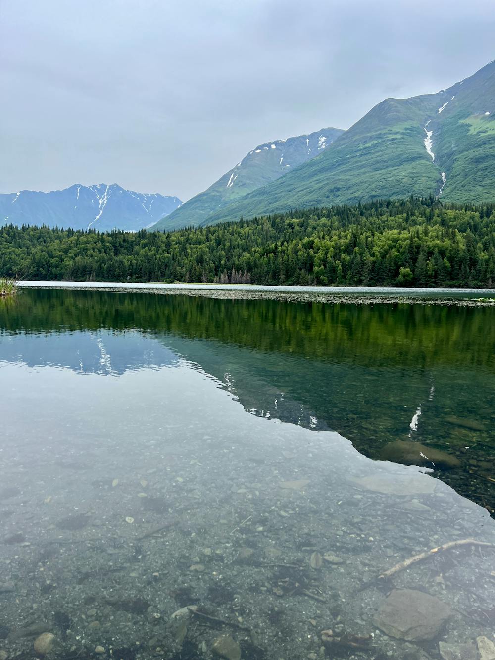
This out-and-back section might seem superfluous, but it is one of the highlights of the ride! This section leads to the shores of Vagt Lake itself, where you might even spot a canoe upside down on the beach with a paddle propped next to it, inviting you to take it out onto the lake. It's up to you if you trust the hull patches and liberal swathes of duct tape to hold the canoe together.
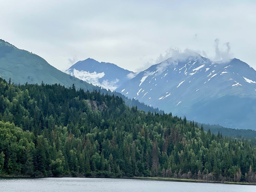
Further on, the newly-built trail character made itself evident in 2022. The freshly-cut singletrack climbs up a bluff and affords beautiful views of the lake, the mountains in the background, and a few glaciers high above. There are a couple of gorgeous spots to stop and soak in the beauty, including an overlook with a wooden diving platform built on top of a small cliff band.
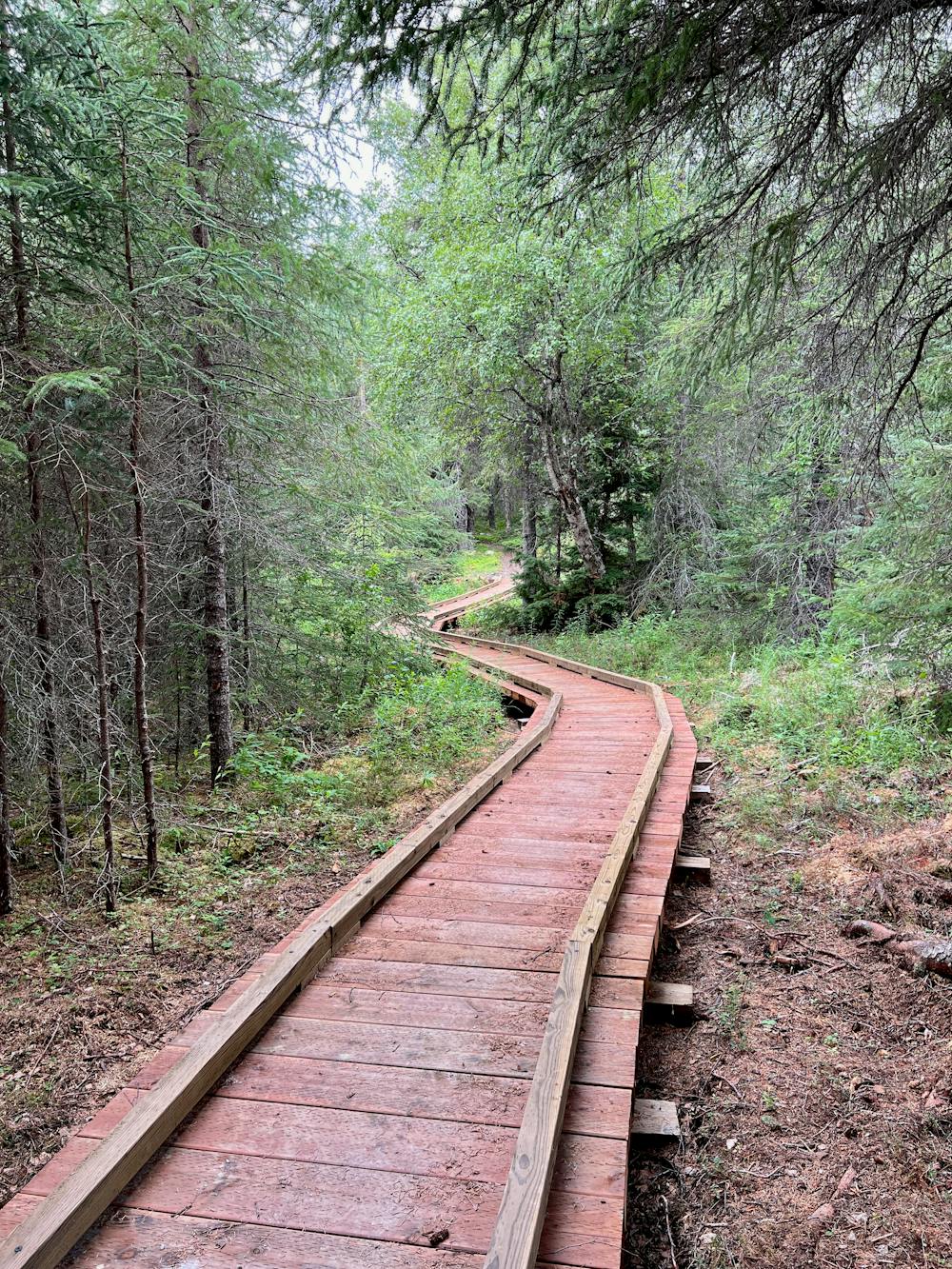
The final stretch of this trail traverses an extensive boardwalk over a marshy area, then rolls up and down before abruptly ending at another thundering glacier-fed creek. Based on the scale of the bridge you pedaled across earlier, you'll see why the trail currently ends here. Eventually, a bridge will be built, and additional singletrack is planned to turn the INHT into a massive, contiguous trail.
Retrace your tire tracks along the lake, then take the right turn to descend to the highway. You'll enjoy a brief bit of fast, slightly techy singletrack whipping through the trees before the grade mellows out on a gravel path and then pops out near the highway. Take a left on the dirt road and then a left on the highway for a couple of miles of paved pedaling to complete the loop.
Moderate
Mostly stable trail tread with some variability, with unavoidable obstacles 8in/20cm tall or less. Other obstacles such as rock gullies and steep sections may exist. Ideal for lower intermediate riders.

The trail contains some obstacles such as outcroppings and rock which could cause injury.

Little chance of being seen or helped in case of an accident.
5 routes · Mountain Biking