2.6 km away
Cliff Spring Trail
Quick hike to Native American rock art and a natural spring in a secluded side canyon.
Easy Hiking
- Distance
- 1.2 km
- Ascent
- 75 m
- Descent
- 75 m
Peaceful forest hike to an especially vast panorama of the Grand Canyon.
Hiking Easy

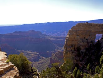
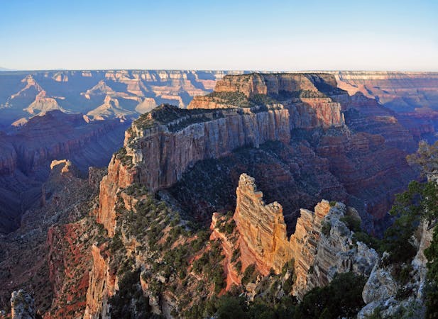
Most people drive Cape Royal Road to reach its namesake overlook at the end, but Cape Final is not to be missed if you have the time. Cape Final is different but similarly spectacular. It’s less developed and less crowded than Cape Royal, though, thanks to the longer hike to reach it.
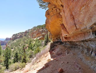
The trail travels through a sunny forest of tall ponderosa pines, and intermittent clearings dotted with shorter oaks and juniper. There are no views of the canyon at first, but you’ll earn them soon enough. Near the end of the trail, you’ll catch glimpses of the rim through the trees, then the full expanse suddenly bursts into view.
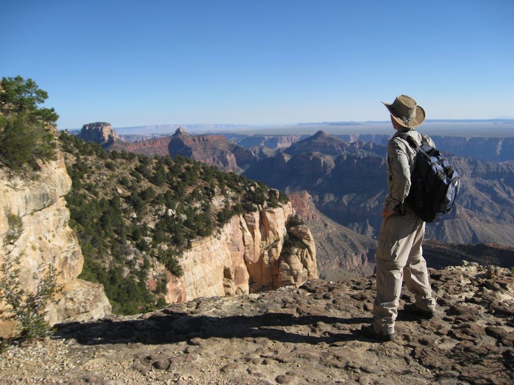
Cape Final juts into one of the widest parts of the Grand Canyon, and its high elevation grants amazing vantage. You’ll see the innermost gorge of the Colorado River far below, sheer cliffs rising beyond, and vast desert unfolding farther east. Look for the mouth of another large canyon opening in the opposite rim—it’s the confluence of the Little Colorado River, the largest tributary of the Grand Canyon.
The geographic significance and mind-blowing views at Cape Final deserve time to appreciate. Explore the various outcrops and ledges for your favorite photo spots, but use caution, of course, because the edge is unprotected and a fall would be disastrous.
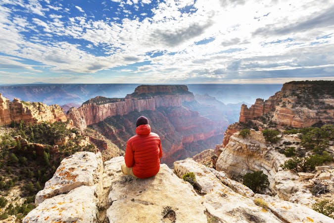
You can even spend the night here if you plan ahead. One of the park’s coolest backcountry campsites (and also one of the easiest to hike to) sits near the end of this trail, right on the rim. It’s available only by reservation and permit through the Backcountry Office.
Sources: https://www.nps.gov/grca/learn/news/upload/nr-pocket-map.pdf
Easy
Walking along a well-kept trail that’s mostly flat. No obstacles are present.

The trail contains some obstacles such as outcroppings and rock which could cause injury.
Away from help but easily accessed.
2.6 km away
Quick hike to Native American rock art and a natural spring in a secluded side canyon.
Easy Hiking
2.9 km away
Paved path to one of the Grand Canyon's grandest viewpoints, and a perch atop a natural arch.
Easy Hiking
14 routes · Hiking
9 routes · Hiking