1 m away
Mount Elden Lookout Trail
A classic hike in Flagstaff with breathtaking views and incredibly diverse plant life.
Difficult Hiking
- Distance
- 8.4 km
- Ascent
- 728 m
- Descent
- 728 m
A classic and moderately-easy hike just along the base of Mount Elden.
Hiking Moderate

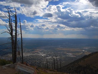
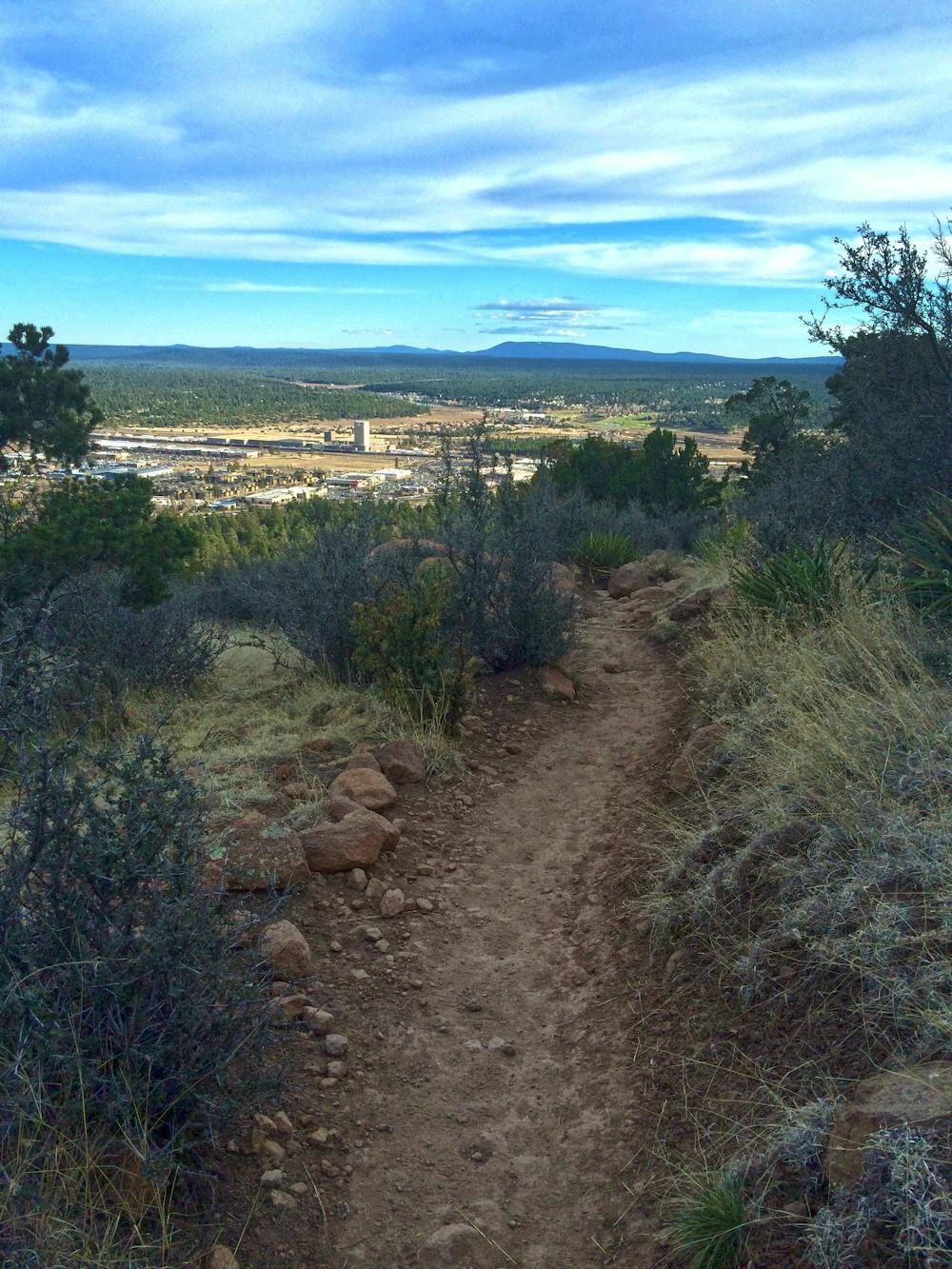
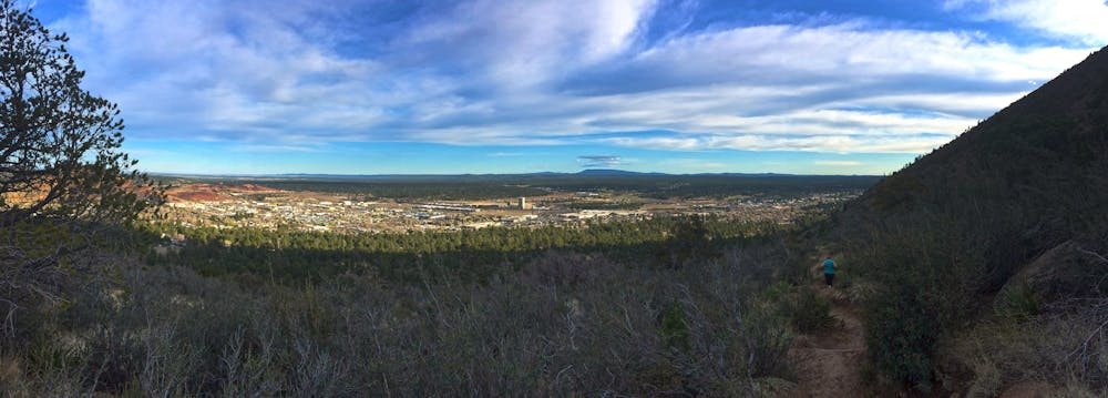
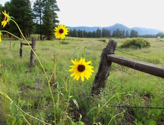
Fatman's Loop offers a relaxing walk along the base of Elden Mountain, where you will enjoy unique rock formations, diverse plant life, and panoramic views of Flagstaff and the surrounding suburbs. Juniper, fir, and yucca define much of the landscape, and sightings of squirrel, mule deer, and fox are common in the area. The hillsides provide excellent habitat for a variety of bird species such as Steller's jays and ravens, the USFS notes. The spring and summer award a stunning selection of wildflowers, and the well-marked loop is a perfect option for a family-friendly hike close to town.
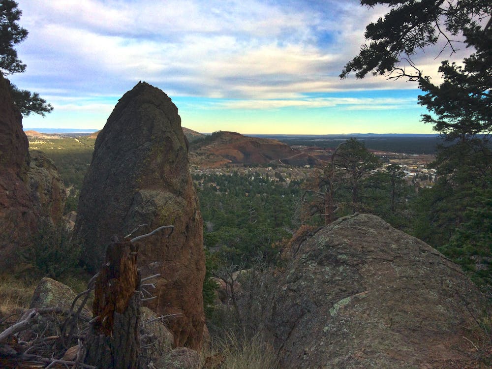
Of the unique rock formations you will encounter, all pay homage to Mount Elden's volcanic origins. One in particular, a narrow passage just 4 - 5' wide, is how the trail earned its name. According to this source, the peak was named after John Elden, "an early settler who arrived in the area in 1875," just prior to the founding of Flagstaff. "In 1887, his son was shot and killed, apparently as part of a dispute over the use of water at a nearby spring," of which Elden Spring was named in his honor. His son's gravesite can still be visited near the spring.
The trailhead for this hike is off of Highway 89, just north of town. As you pass the mall on the right, the Ranger Station is on your left, and the trailhead is your next left turn. Neither restrooms nor water are available at the trailhead, though there are plenty of nearby stores and gas stations should you need to stop on the way.
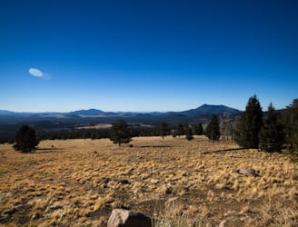
For those looking for a longer, more challenging hike, consider a trip up the rugged Mount Elden Lookout Trail, where you'll earn even more impressive views nearly 2,300 feet above town.
Sources: https://www.theoutbound.com/arizona/hiking/hike-fatman-s-loop
Moderate
Hiking along trails with some uneven terrain and small hills. Small rocks and roots may be present.

The trail contains some obstacles such as outcroppings and rock which could cause injury.
Away from help but easily accessed.
1 m away
A classic hike in Flagstaff with breathtaking views and incredibly diverse plant life.
Difficult Hiking
5.9 km away
Hike amongst ancient pinyon and juniper trees at the base of a former cinder cone volcano.
Moderate Hiking
7.6 km away
A classic hike through canyons and along hillsides with spectacular views of Flagstaff.
Moderate Hiking

10 routes · Hiking