2.2 km away
The Wave
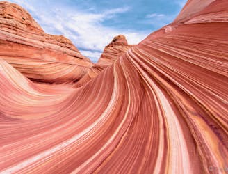
Hike to the Desert Southwest's most famous photographic destination!
Difficult Hiking
- Distance
- 11 km
- Ascent
- 446 m
- Descent
- 446 m
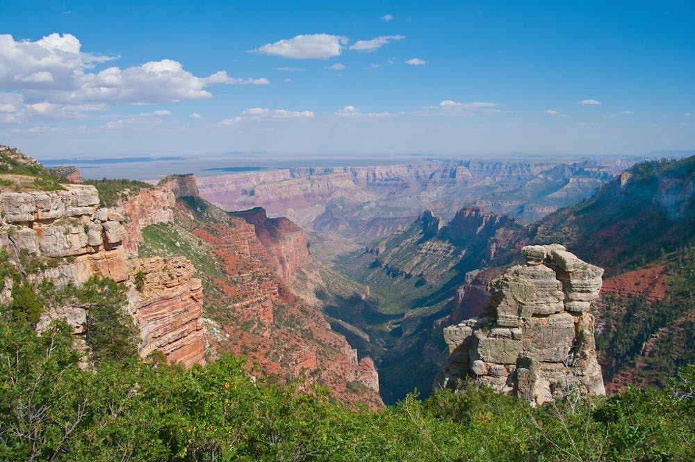
Wander through montane forest and meadows of the Kaibab Plateau to reach the rim of the Grand Canyon.
Hiking Difficult

On this section, the Hayduke joins the Arizona Trail to cross the Kaibab Plateau toward the Grand Canyon’s North Rim. You’ll climb away from the desert and enter a high-elevation realm once again, but a much flatter one than the Henry Mountains. Prepare for chilly and possibly snowy conditions here, even in late spring when the surrounding desert heats up. Winter’s snow may not melt from the trail until late May, and monsoon thunderstorms are common July-September. Plan accordingly.
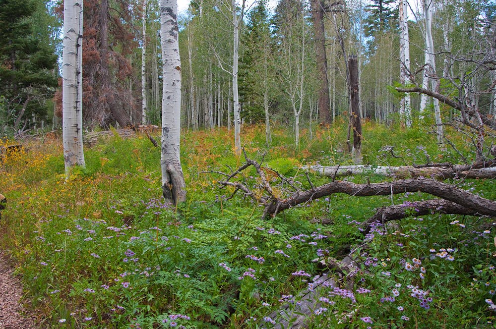
From Stateline Campground, you’ll soon leave sagebrush meadows for juniper and pine-forested slopes at higher elevation. A long set of gentle switchbacks ascends Buckskin Mountain and finds flatter terrain. The trail rambles in and out of small drainages through sunny ponderosa forest for quite a few miles, working its way southward and gradually upward along the Kaibab Plateau.
Water can be scarce, though it does collect in small tanks that you may have to deviate from the trail to find. Detour to Jacob Lake if you need to resupply. It’s the only store and restaurant for miles, but note that services are especially limited when the Grand Canyon North Rim is closed, mid-October to mid-May. Some distance south of Jacob Lake, the trail feels suddenly less remote as it nears Highway 67, which is the road into the national park. It also travels through a burn area for about seven miles, where sun and wind can be surprisingly intense some days.
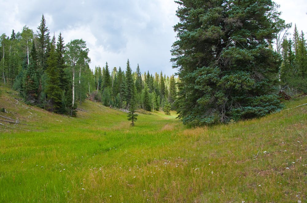
Continuing more or less parallel to the highway and rising in elevation, the trail eventually returns to more pleasant, shady forest, and the scenery soon becomes resplendent. At the height of the Kaibab Plateau, around 9000 feet, the surroundings resemble something like Yellowstone, not what you’d expect in Arizona. Spruce, fir, aspen, and wildflower-filled forest surrounds broad meadows where deer, elk, and even bison graze. Water is easier to find at these higher elevations, in natural depressions caused by underlying sinkholes.
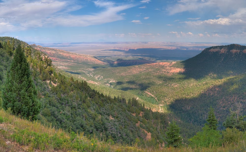
The trail does not stick with the highway; it soon breaks away to find quieter meadows then the plateau’s airy East Rim, where you can see down to House Rock Valley and the thin shadow of a gorge that lies in the bottom—a peek at the Grand Canyon. After returning to more interior drainages on the plateau, Hayduke leaves the Arizona Trail by following a forest road toward the East Rim once more, and soon finds the rim of the real Grand Canyon at Nankoweap Trailhead. The view from there is phenomenal. Staring down a large side canyon, you’ll gaze over countless sheer-walled towers and promontories, clear across to planar desert on the South Rim, and see the dark cleft of the Little Colorado River meeting the greater gorge.
Sources: http://www.hayduketrail.org/TheRoute.html https://aztrail.org/explore/passages/ https://www.little-package.com/blog/2017/11/hayduke-trail-tips https://caltopo.com/m/5J0S https://caltopo.com/m/HVQD
Difficult
Hiking trails where obstacles such as rocks or roots are prevalent. Some obstacles can require care to step over or around. At times, the trail can be worn and eroded. The grade of the trail is generally quite steep, and can often lead to strenuous hiking.

The trail contains some obstacles such as outcroppings and rock which could cause injury.

Little chance of being seen or helped in case of an accident.
2.2 km away
Hike to the Desert Southwest's most famous photographic destination!
Difficult Hiking
2.2 km away
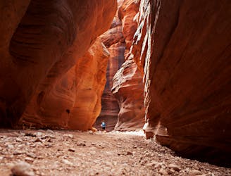
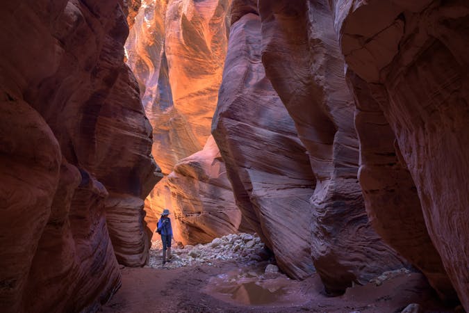
Buckskin Gulch is renowned as one of the longest slot canyon hikes in Utah.
Severe Hiking

14 routes · Hiking

25 routes · Alpine Climbing · Hiking

10 routes · Hiking
9 routes · Hiking