6.6 km away
Indian Maiden Falls
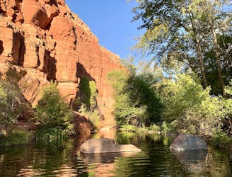
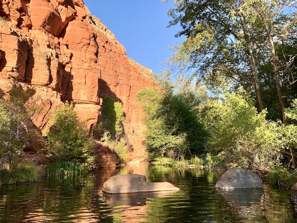
A rugged hike and rock hop through the creek, to a waterfall and swimming holes among desert red rocks.
Severe Hiking
- Distance
- 11 km
- Ascent
- 640 m
- Descent
- 640 m
A maintained trail into the wilderness area, with access to backcountry camping, swimming, and fishing.
Hiking Moderate

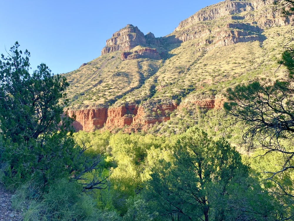
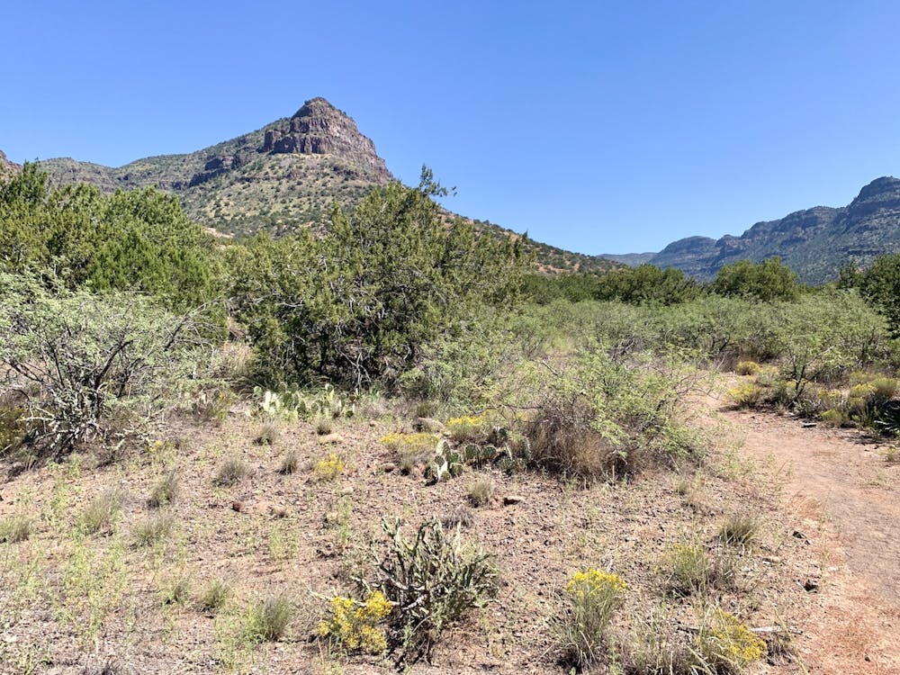
The West Clear Creek Wilderness stretches many miles along the narrow but deep canyon corridor of West Clear Creek. This is the longest official trail within the wilderness, entering at its western bound near the mouth of the canyon. Other than this trail, traveling through the wilderness area involves difficult bushwacking and wading along the creek. Even on this trail you must ford the creek and negotiate some rugged terrain. However, most of the distance is smooth walking through sunny desert, contouring the slopes above the riparian zone.
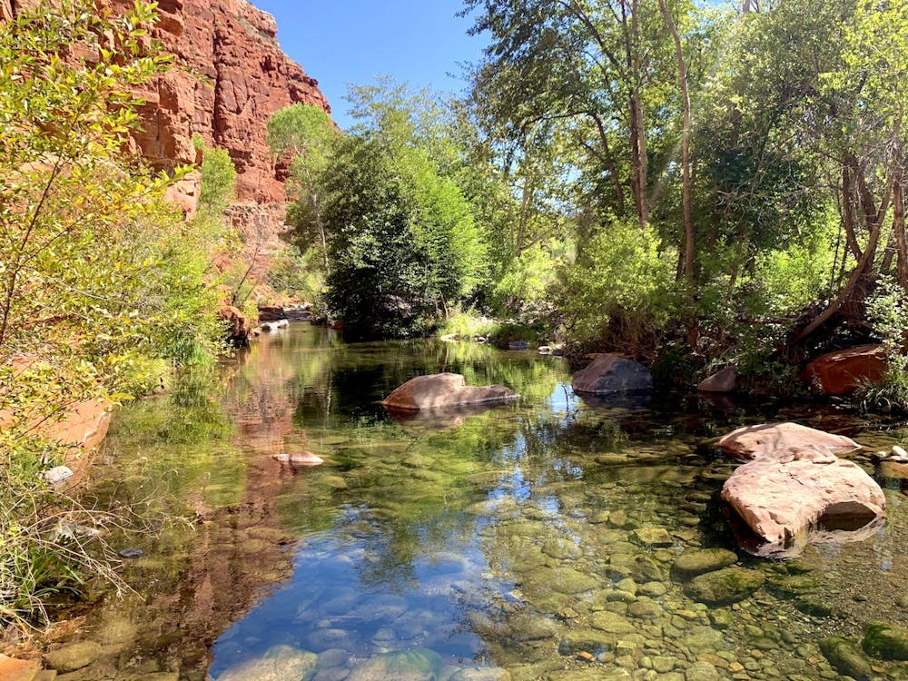
The trail can be used to access several miles of the lower canyon, reaching secluded camp spots and untouched fishing holes. Though the trail itself only crosses the creek four times, there are ample opportunities to bushwack from the path or walk in the creek itself to access other areas. There are no designated campsites, but suitable clearings can be found here and there. Keep in mind that this is designated wilderness and a rare aquatic habitat in Arizona. Be sure to always Leave No Trace and adhere to the wilderness regulations that apply.
What’s mapped here is the 6.5 miles of trail in the bottom of the canyon, which makes a good out-and-back overnight or day hike. If you camp overnight, or if you want a very strenuous day hike, you might continue past the end of this trail by following the creek. Rock hopping, wading, and swimming eventually leads to a red-rock waterfall about 2 miles upstream. See the Indian Maiden Falls route for more information, and a shorter alternative for reaching the falls in a day.
Moderate
Hiking along trails with some uneven terrain and small hills. Small rocks and roots may be present.

The trail contains some obstacles such as outcroppings and rock which could cause injury.

Little chance of being seen or helped in case of an accident.
6.6 km away
A rugged hike and rock hop through the creek, to a waterfall and swimming holes among desert red rocks.
Severe Hiking