37 m away
Little Elden -> Christmas Tree Shuttle
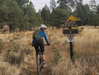
An epic bang-for-the-buck shuttle from Schultz Pass to the mall in Flagstaff.
Moderate Mountain Biking
- Distance
- 13 km
- Ascent
- 128 m
- Descent
- 471 m
Follow the historic stagecoach line from Flagstaff to Grand Canyon during this 100-mile adventure.
Mountain Biking Moderate

Follow the historic stagecoach line from Flagstaff to Grand Canyon during this 100-mile adventure. Over four days you’ll see terrain as diverse as anywhere in northern Arizona, from the fern and aspen groves of the San Francisco Peaks, to the big sky country across the Babbitt Ranch, and through pinon-juniper forests that lead right up to the South Rim of Grand Canyon. This is a classic mountain biking route that is ideal for upper beginner and intermediate riders.
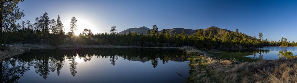
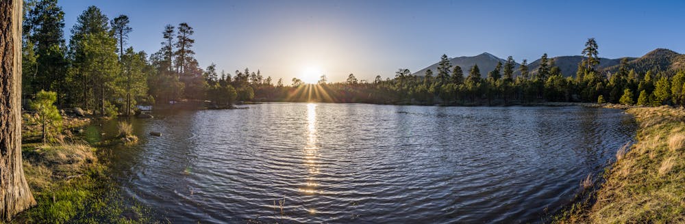
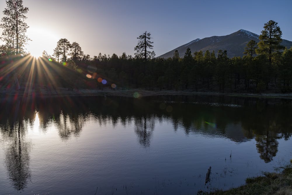
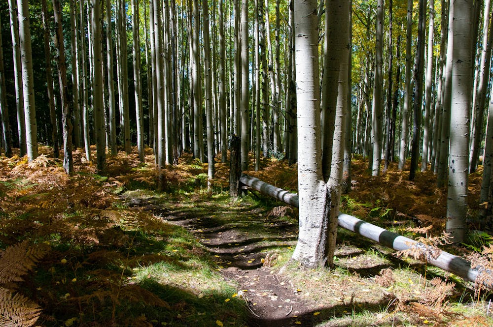
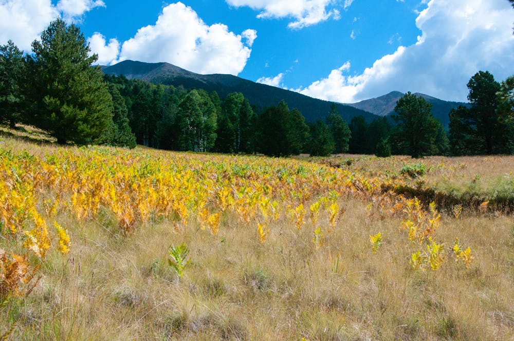
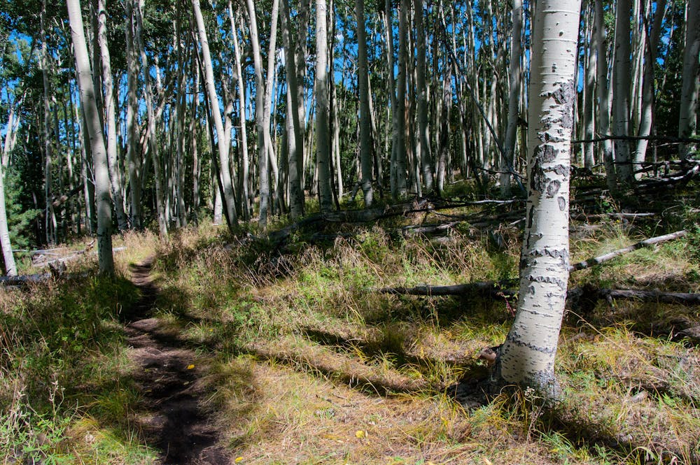
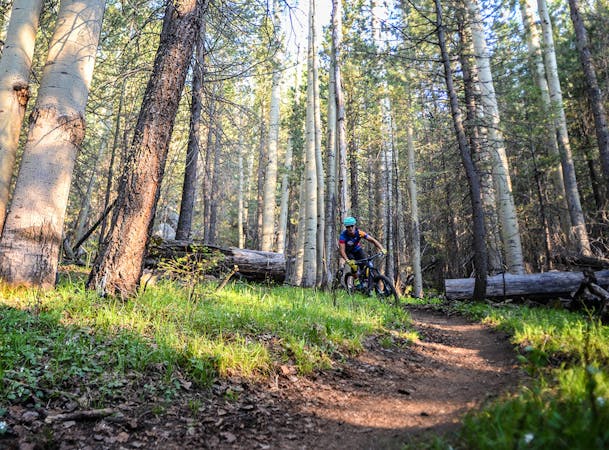
This AZT Expedition begins on Schultz Creek near Flagstaff, one of the most popular segments of the entire Arizona Trail. The fast, flowing tread takes you through beautiful pine forest where you’re likely to see hikers, trail runners and other mountain bikers…but the farther north you ride the fewer people you’ll see. After twisting and turning for the first six miles you’ll cross Snowbowl Road and enter the “yellow brick road” of trails in northern Arizona. The Arizona Trail winds and bends through lush aspen forests with spectacular views of the San Francisco Peaks. This is among the final pieces of Arizona Trail to be built, and you’ll feel how much effort went into the design and construction of this amazing trail. It climbs gently along the slopes of the San Francisco Peak, just outside the wilderness boundary. Beyond Bismarck Lake the trail descends through a sea of white-bark aspens before arriving at our camp at Kelly Tank. If you’re not giggling hysterically by the time you hop off your bike, you should ride it again. Ride length is 23 miles.
For more information and to book a tour, visit: http://aztexpeditions.com/arizona-trail-20.html
Moderate
Mostly stable trail tread with some variability, with unavoidable obstacles 8in/20cm tall or less. Other obstacles such as rock gullies and steep sections may exist. Ideal for lower intermediate riders.

The trail contains some obstacles such as outcroppings and rock which could cause injury.
Away from help but easily accessed.
37 m away
An epic bang-for-the-buck shuttle from Schultz Pass to the mall in Flagstaff.
Moderate Mountain Biking
6 km away
A classic loop linking some of the best trails around Schultz Pass just north of Flagstaff.
Difficult Mountain Biking

23 routes · Mountain Biking · Hiking
7 routes · Mountain Biking