FATMAP by Strava

Bridle Path

Shady path on the North Rim that is open to pets and bikes.

Mountain Biking Easy

Distance
4.4 km
Ascent
91 m
Descent
91 m
Duration
0-1 hrs
Low Point
2.5 km
High Point
2.5 km
Gradient
Bridle Path Map

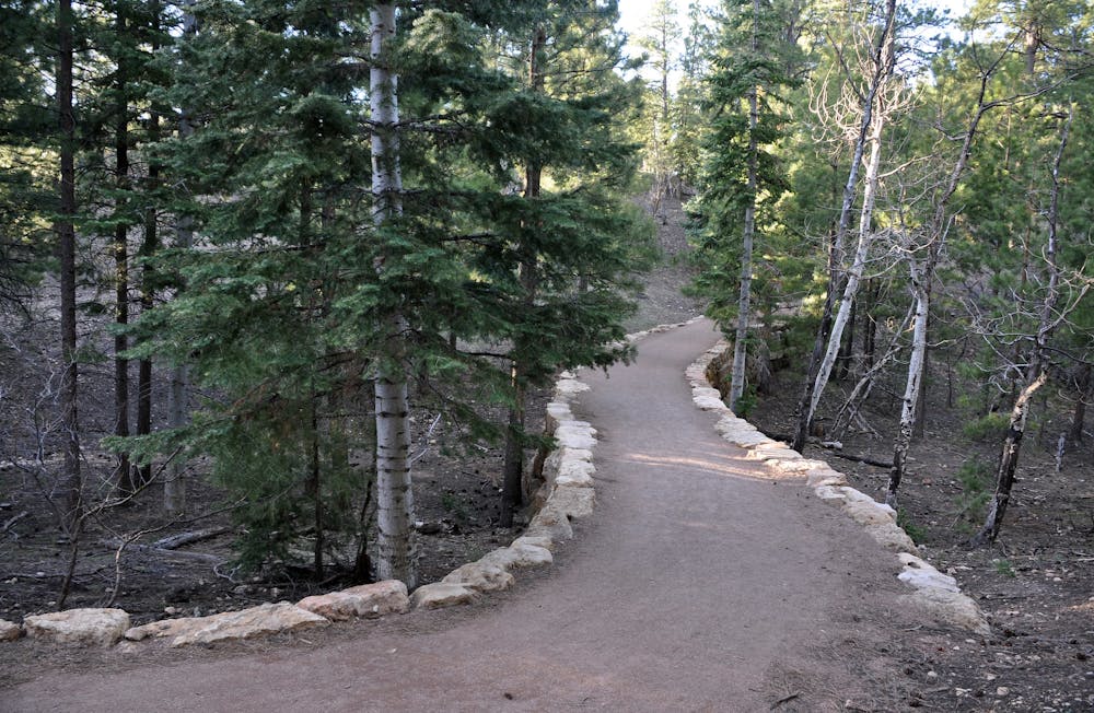
Most trails in Grand Canyon National Park do not allow bicycles or pets, but this one does, allowing the whole family to get exercise while camping at the North Rim. It runs close to the road but is somewhat shrouded among conifer and aspen forest. It’s not especially scenic by Grand Canyon standards, but it is convenient for a quick ride if you have your bike at the North Rim. Bridle Path connects the visitor center parking lot with North Kaibab Trailhead, passing close to the cabins and the campground. Despite its proximity to developed areas, you may still see mule deer grazing in the understory and Kaibab squirrels scampering in the trees.

Description

The trail surface is hard-packed dirt and fairly even, with a gradient that’s not too steep. Therefore, it’s beginner-friendly and good for almost any bicycle. There’s a chance you’ll share the trail with some serious bikepackers, however. Riders on the Arizona Trail must carry their bikes and gear across the Grand Canyon via North Kaibab Trail, and they often use Bridle Path to link with facilities at the North Rim before continuing the journey.

Sources: https://www.nps.gov/grca/learn/news/upload/nr-pocket-map.pdf

Difficulty

Easy

Mostly smooth and non-technical singletrack with unavoidable obstacles 2in/5cm tall or less. Avoidable obstacles may be present. Ideal for beginner riders.

Medium Exposure

2 out of 4

The trail contains some obstacles such as outcroppings and rock which could cause injury.

Remoteness

1 out of 4

Close to help in case of emergency.

Best time to visit

between May and October

Features

  • In the forest
  • Road sections
  • Wet-weather friendly

Similar routes nearby

Guidebooks in this area