7.5 km away
Redington Pass
Beautiful gravel grind from the outskirts of Tucson.
Easy Mountain Biking
- Distance
- 41 km
- Ascent
- 789 m
- Descent
- 789 m
Difficult 4x4 road ride to a beautiful oasis.
Mountain Biking Difficult

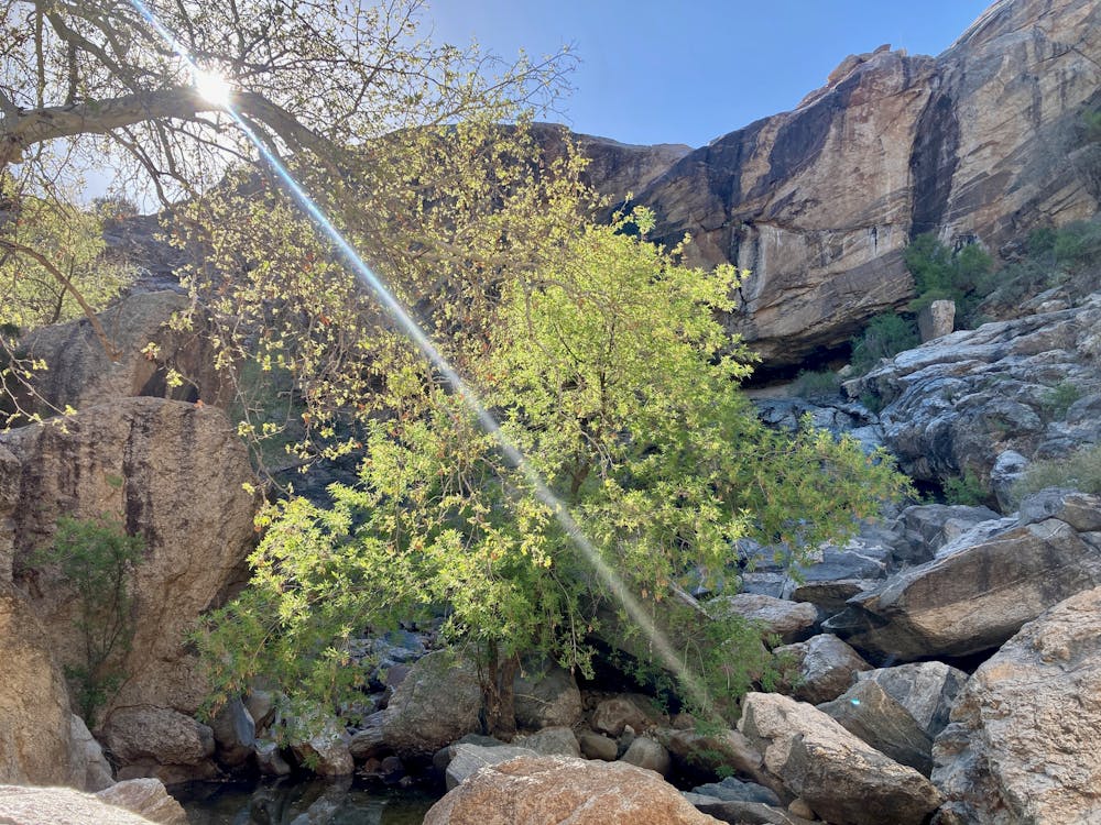
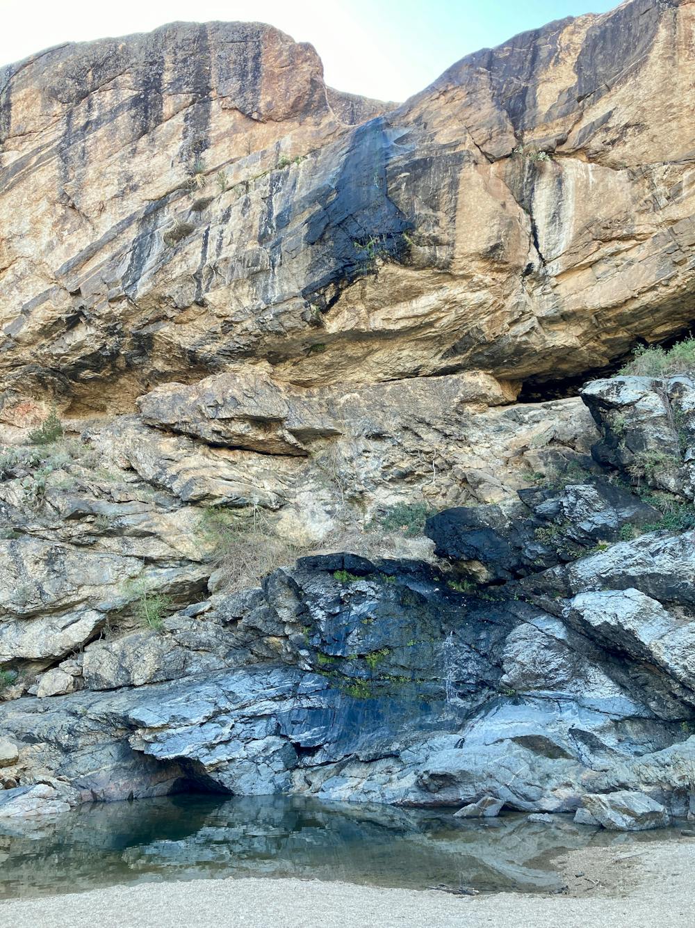
Chiva Falls is a beautiful waterfall hidden at the end of a canyon deep in the Rincon Mountains. When you reach the falls, this otherwise arid landscape transforms into a lush oasis with running water, green trees, and cool temperatures in the shade. Exactly how much water is flowing over Chiva Falls depends on the time of year and how much moisture the surrounding mountains have received. Don't expect much in the summer, but in the winter and early spring you may be rewarded with a thundering waterfall!
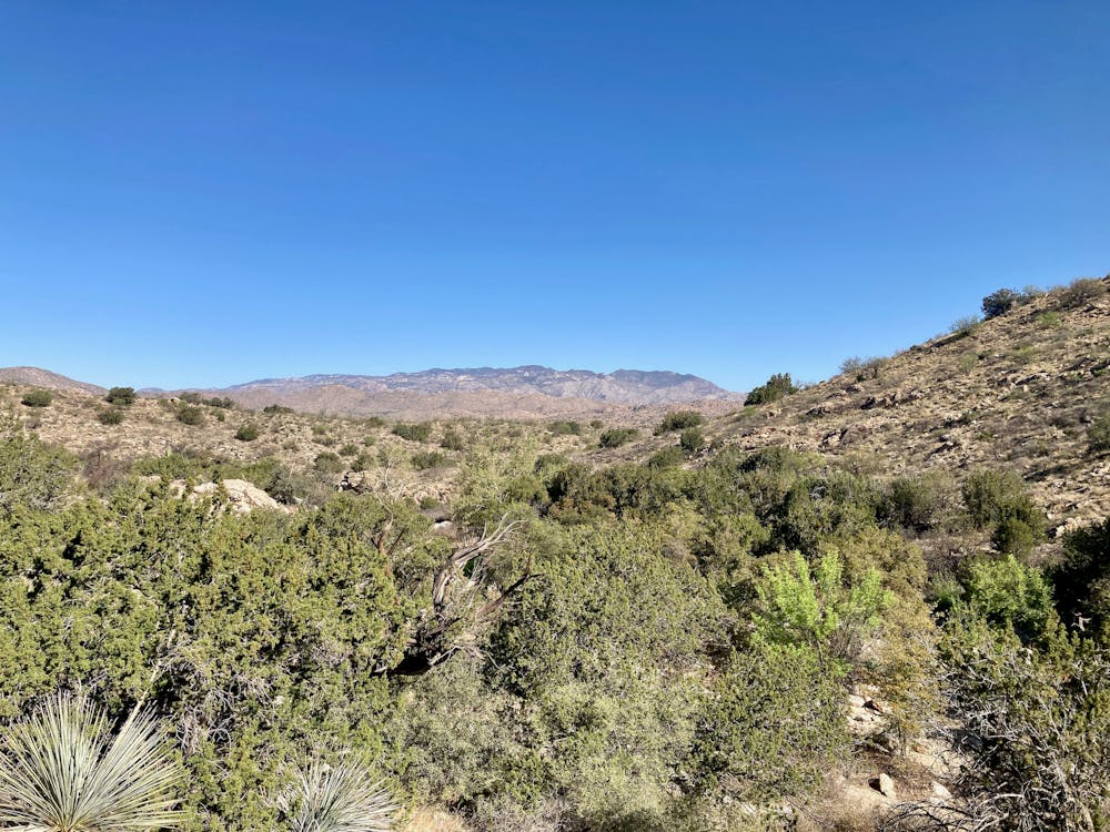
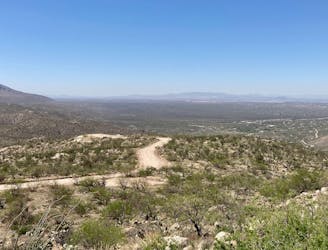
This ride to Chiva Falls almost entirely follows 4x4 roads, and yet it is still deserving of a "Difficult" or even a "Severe" FATMAP rating. Some portions of these jeep roads drop down massive rock slabs with big ledge drops and loose rocks. You can usually find a somewhat easy line down most of these sections, but other lines could be radically more difficult. Jeep road riding is truly the "choose your own adventure" version of mountain biking, allowing you to tailor the difficulty to your own desires.
However, this is by no means the best 4x4 road ride out there. It can be a somewhat brutal endeavor, with short, steep climbs straight up the fall line and short, fast, technical descents back down. Laboring under the harsh sun on such demanding terrain is a chore, with the oasis at the end being the only respite.
While you can pedal right up to the first signs of water, to reach the waterfall at the end of the canyon you'll eventually have to abandon your bike and scramble through and over the massive boulders that fell into this canyon eons ago. The final push to the waterfall could pose a challenge for some riders, especially if you're scaling the somewhat slick, rounded rocks with clipless mountain bike shoes. But the falls and the final pool of water with the welcome shade at the end of the canyon is well worth the effort to reach it!
Difficult
Mostly stable trail tread with some variability featuring larger and more unavoidable obstacles that may include, but not be limited to: bigger stones, roots, steps, and narrow curves. Compared to lower intermediate, technical difficulty is more advanced and grades of slopes are steeper. Ideal for upper intermediate riders.

The path is on completely flat land and potential injury is limited to falling over.

Away from help but easily accessed.
7.5 km away
Beautiful gravel grind from the outskirts of Tucson.
Easy Mountain Biking
9.4 km away

A difficult gravel road ride looping Mount Lemmon.
Easy Mountain Biking

32 routes · Mountain Biking · Hiking · Road Biking