3.1 km away
Dirty Lemmon Loop
A difficult gravel road ride looping Mount Lemmon.
Easy Mountain Biking
- Distance
- 183 km
- Ascent
- 3.4 km
- Descent
- 3.4 km
Beautiful gravel grind from the outskirts of Tucson.
Mountain Biking Easy

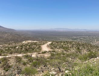
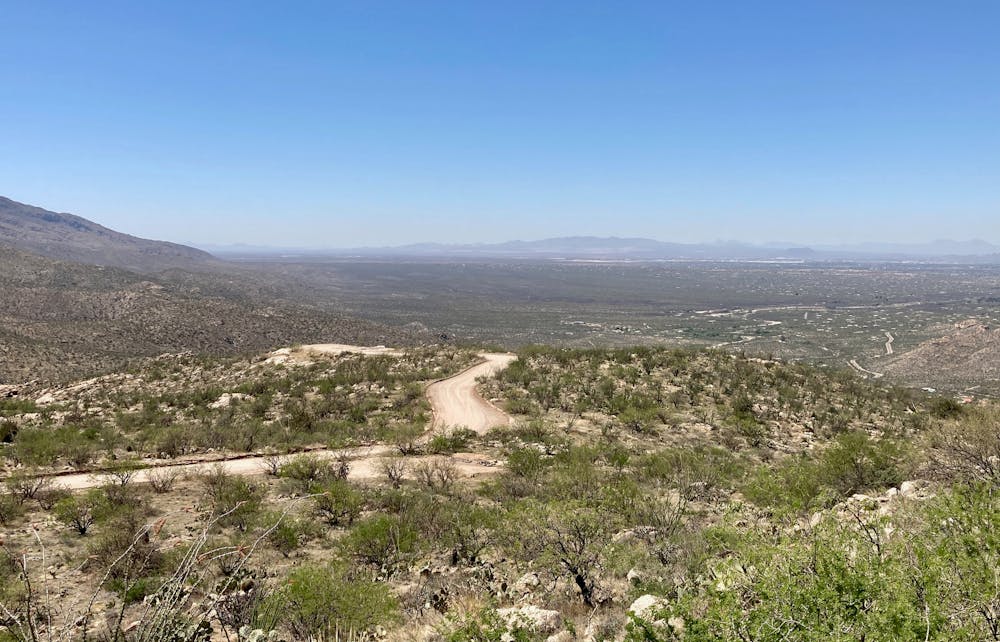
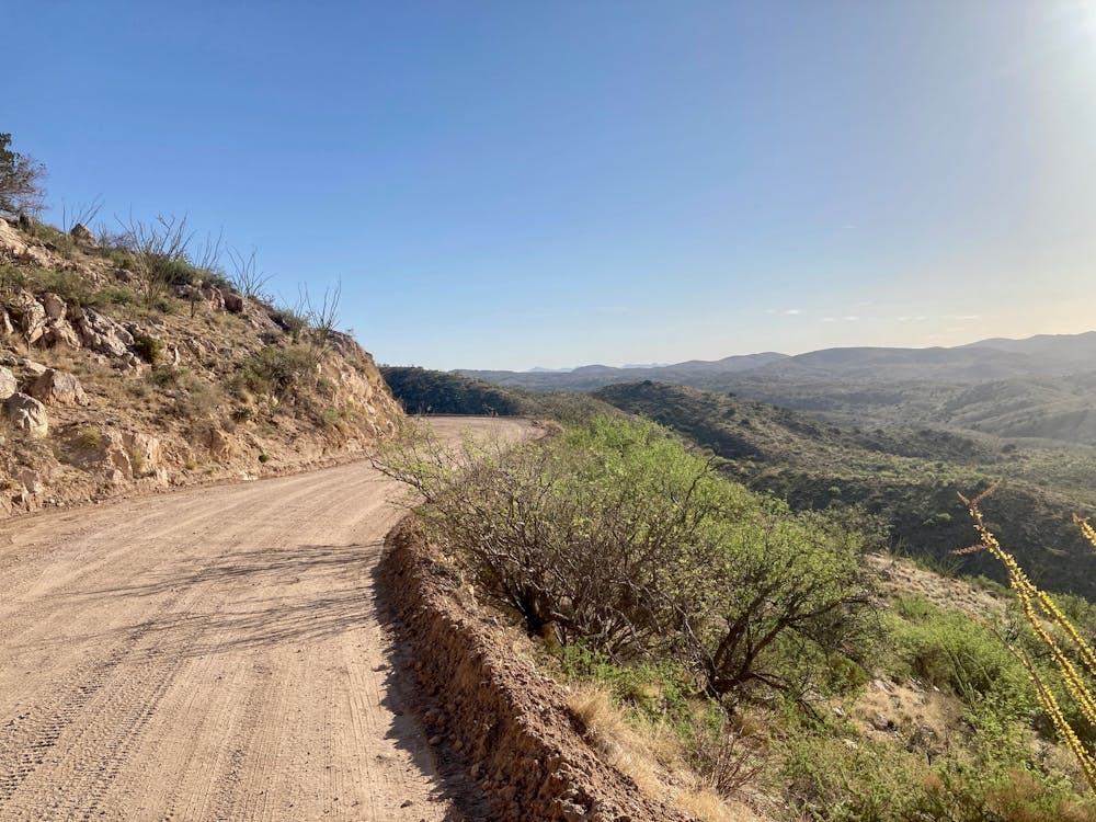
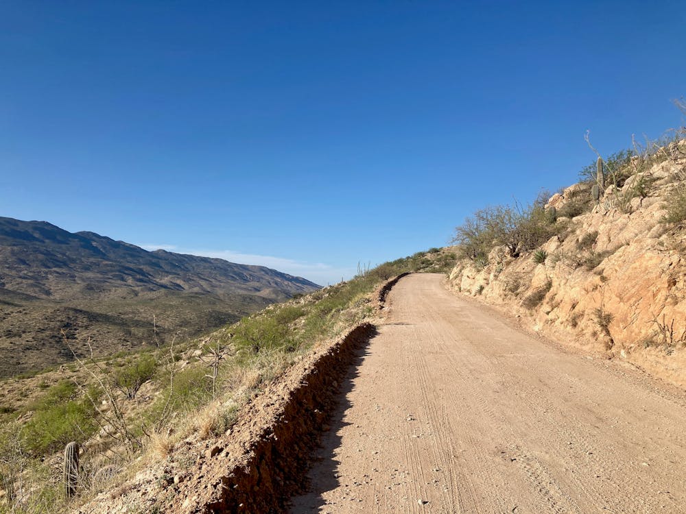
Redington Pass rises directly from the outskirts of Tucson, quickly transitioning from a paved road to a winding, switchbacked dirt road climbing high into the Rincon Mountains above the city. This delightfully accessible stretch of dirt boasts some considerable elevation gain, making it a go-to training ride for cyclists of all stripes in the city.
This ride is best on a gravel bike, aka an all-road bike with wide tires. However, it could be great on a mountain bike as well, although you'll have to put up with some paved sections.
The route as mapped begins at a good trailhead on the outskirts of Tucson, albeit a ways from Redington Pass. There's no good option for parking near the bottom of Redington Pass, so you'll have to approach it from a distance. After traversing a combination of dirt and paved roads to reach the pass, you'll turn left onto the pavement. Shortly after the road begins climbing in earnest, you'll leave the pavement behind, climbing high into the mountains on a steep but manageable road.
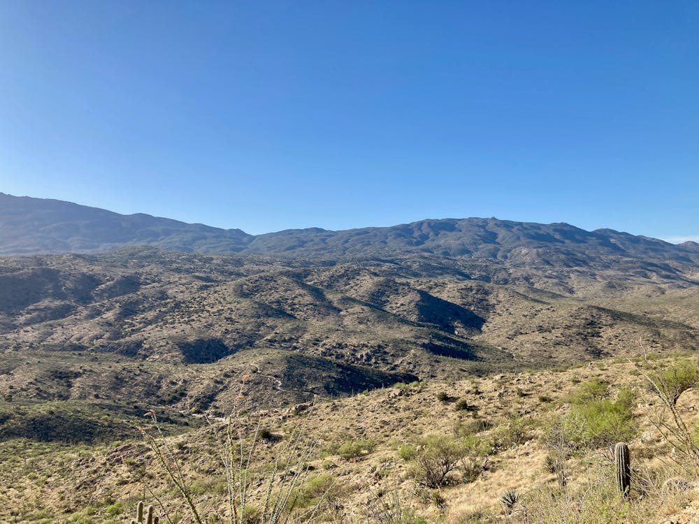
The scenery surrounding you is guaranteed to keep you entertained, with beautiful mountains, the stunning saguaro-filled Sonoran Desert, and eventually, views of the city spread out below you.
The turnaround point marked here is nothing special, aside from being the high point of the road. Redington Road continues for many miles beyond this point, so you can choose to extend your ride significantly. For a longer route utilizing Redington Pass Road, be sure to check out "The Dirty Lemmon Loop."
Note: Redington Pass can get quite busy with vehicle traffic, as the pass itself and roads connected to it are very popular with the OHV crowd. Especially on weekends, expect to contend with a lot of traffic on this ride.
Easy
Mostly smooth and non-technical singletrack with unavoidable obstacles 2in/5cm tall or less. Avoidable obstacles may be present. Ideal for beginner riders.

The path is on completely flat land and potential injury is limited to falling over.

Away from help but easily accessed.
3.1 km away
A difficult gravel road ride looping Mount Lemmon.
Easy Mountain Biking
7.5 km away
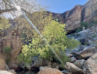
Difficult 4x4 road ride to a beautiful oasis.
Difficult Mountain Biking

32 routes · Mountain Biking · Hiking · Road Biking