1.8 km away
Soldier Trail

A classic ride near Flagstaff though a county park that has something to offer for everyone.
Moderate Mountain Biking
- Distance
- 8.5 km
- Ascent
- 117 m
- Descent
- 117 m
A longer ride on groomed singletrack to one of Flagstaff's classic rides near Rogers Lake.
Mountain Biking Moderate

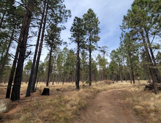
The Gold Digger Loop is a classic ride just outside of Flagstaff through the Rogers Lake County Natural Area. According to this source, the trails and parking areas are the direct result of a sustainability project to utilize recycled asphalt and other Arizona DOT projects to build and develop the region. Well-signed and lined with stunning wildflowers, this longer XC ride offers a great tour of some of Flagstaff's more mellow trails.
Entirely singletrack, the Gold Digger Trail is lined with endless wildflowers and shaded mostly by pine trees. A ramada was also constructed along the loop to provide shade and harvest rainwater for a variety of bird species throughout the year. And while the name may suggest water along the trail, the warmer months may yield drought-like conditions, so pack plenty of water. That said, the county maintains the area to protect "wildlife habitat, preserve rare native plants, provide environmental education and scientific research and allow low-impact, non-motorized recreation" for regional residents and visitors, this source notes.
While parking nearer to the start of the loop is an option, many of the roads are filled with washboards and may not be suitable for all vehicles. With some creative planning and an adventurous spirit, you may be able to cut out a few miles of this ride and start closer to the 4-mile loop. Woody Mountain Road and the Rogers Lake Connector, seen here, both offer popular access points to Rogers Lake and are just minutes from the nearest interstate. Neither water nor restrooms are available where this ride begins or anywhere along the trail.
Moderate
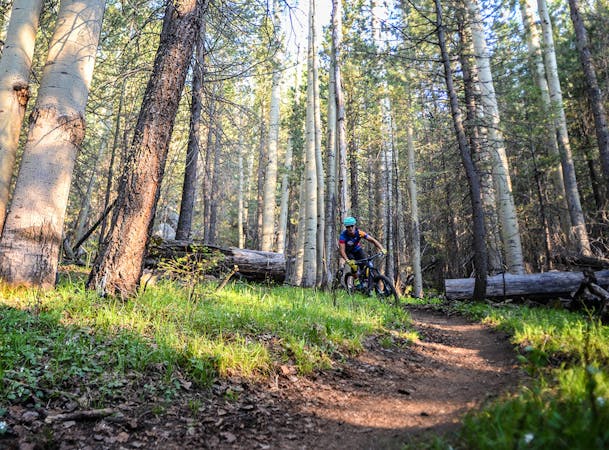
Mostly stable trail tread with some variability, with unavoidable obstacles 8in/20cm tall or less. Other obstacles such as rock gullies and steep sections may exist. Ideal for lower intermediate riders.

The trail contains some obstacles such as outcroppings and rock which could cause injury.
Away from help but easily accessed.
1.8 km away
A classic ride near Flagstaff though a county park that has something to offer for everyone.
Moderate Mountain Biking
8.2 km away

A classic singletrack ride near Flagstaff known for its unique rock formations.
Moderate Mountain Biking
9.3 km away
A classic loop linking some of the best trails around Schultz Pass just north of Flagstaff.
Difficult Mountain Biking
7 routes · Mountain Biking