1 m away
McDowell Mountain: Escondido Loop
A beautiful beginner-friendly loop that sees much less traffic than the Pemberton Loop.
Moderate Mountain Biking
- Distance
- 15 km
- Ascent
- 204 m
- Descent
- 204 m
One of the best cross country loops at McDowell Mountain Park.
Mountain Biking Moderate

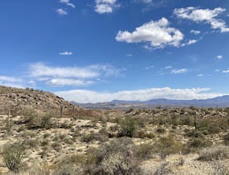
McDowell Mountain Park is an exceedingly popular mountain bike trail system in the Phoenix Metro Area. While flooded with locals and visitors alike, tourists tend to flock to the area thanks to one of the best campgrounds in the Phoenix area. While you’ll have to book your campsite months in advance if you want to stay during peak season, the miles and miles of singletrack rideable directly from your campsite make the planning well worth it.
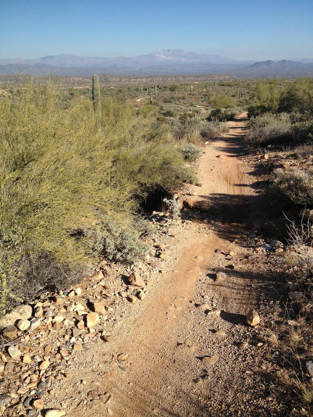
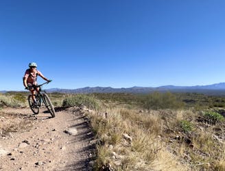
The Pemberton Loop, mapped here, is one of the easiest-to-follow cross country loops in the network. This ~14-mile loop rolls through the wide-open desert terrain on smooth, fast singletrack. With only 827 feet of climbing and descending, it’s relatively flat in the grand scheme of things, but if you pay attention, it does climb gradually along the first half of the ride and then descend back to the trailhead.
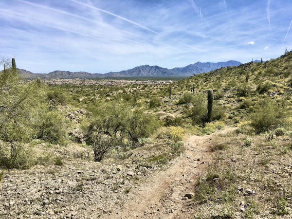
The northern side of the Pemberton Loop offers a smooth, wide climb up the sloped mesa. You'll climb fairly consistently, gaining elevation on a consistent grade.
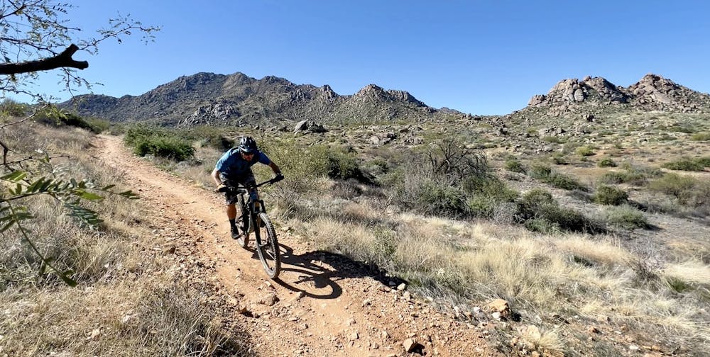
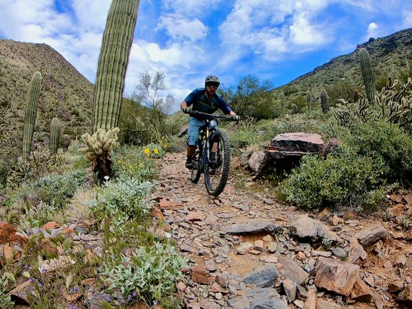
On the western side of the loop, you'll roll up and down a series of ridges as you make your way across and to the south. Here, the singletrack begins to get a bit rougher and a bit more technical.
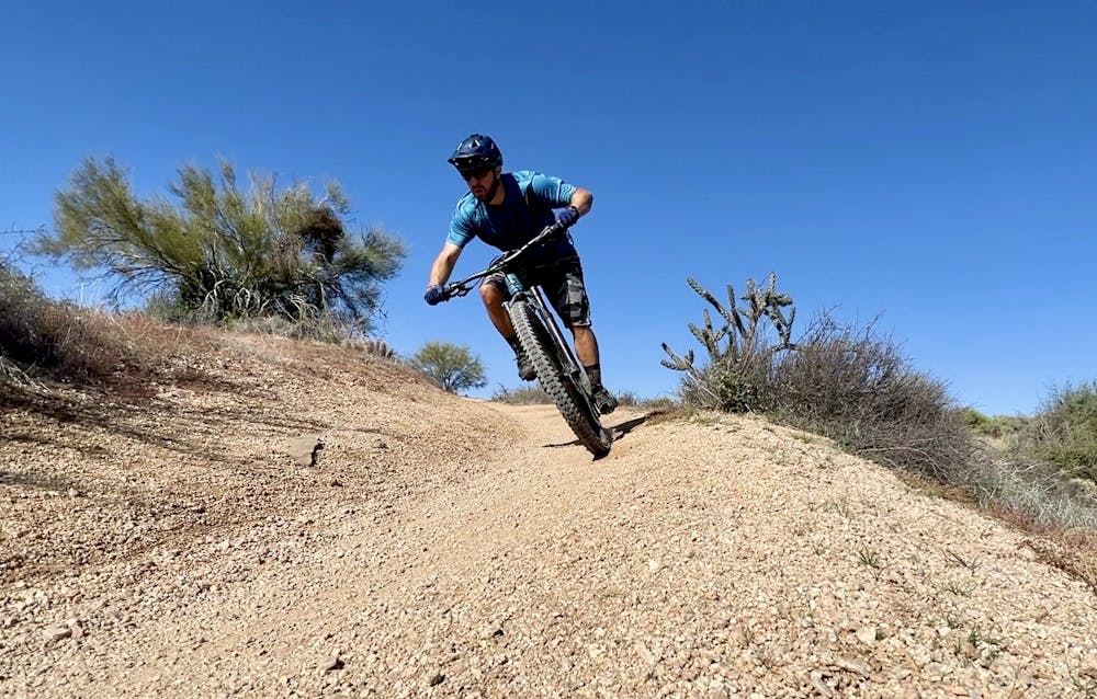
Finally, the descent back down the mesa on the southern side of the loop is a fair bit rougher than the climbing trail, earning it an intermediate difficulty according to some sources. This fast, flowy descent flies down rocky singletrack that can feel a bit rough but is generally not too technical. Instead of big rock features, it's simply a rough onslaught of small embedded rocks in the trail tread. The occasional water bar across the trail offers air opportunities, too!
The smooth, non-technical trails in the area—of which this is one—make the trail system at McDowell Mountain Park popular with cross country and endurance racers looking to escape the mid-winter cold and snow in the northern reaches of the country. Combine a great campground with easy access to miles and miles of singletrack in one of the warmest cities in the country, and you have the perfect recipe for a mid-winter training getaway!
Source: https://www.theoutbound.com/arizona/mountain-biking/bike-the-pemberton-loop-in-mcdowell-mountain-park https://www.maricopacountyparks.net/mcdowell-mountain-regional-park-mm/
Moderate
Mostly stable trail tread with some variability, with unavoidable obstacles 8in/20cm tall or less. Other obstacles such as rock gullies and steep sections may exist. Ideal for lower intermediate riders.

The path is on completely flat land and potential injury is limited to falling over.

Away from help but easily accessed.
1 m away
A beautiful beginner-friendly loop that sees much less traffic than the Pemberton Loop.
Moderate Mountain Biking
2.8 km away
The classic race track used for the Cactus Cup.
Moderate Mountain Biking

37 routes · Mountain Biking
10 routes · Mountain Biking
8 routes · Mountain Biking