4 km away
Chuckwagon Loop

A beautiful loop on iconic Sedona trails.
Difficult Trail Running
- Distance
- 27 km
- Ascent
- 525 m
- Descent
- 525 m
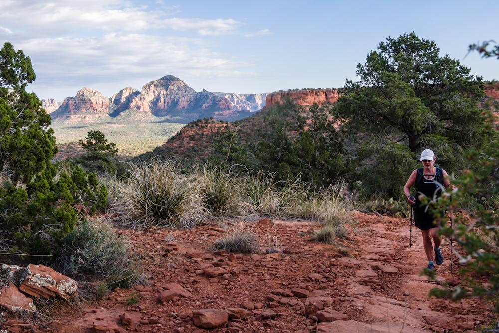
This Sedona run provides gorgeous views of canyons & red rock formations.
Trail Running Severe

The Bear Mountain trail begins at a very popular trailhead, which requires a recreation pass (either a Red Rock Pass or a Federal Interagency Pass). Park at the Doe/Bear Mountain trailhead, but cross the Boynton Canyon road to find the start of the run. The top of Bear Mountain is not visible from this point.


The run begins as a deceptively mellow grade; savor that 1/3 mile, because it will get much steeper! The remaining 2.1 miles gain 2,100', including a few significant wash crossings for some loss and re-gain of elevation.
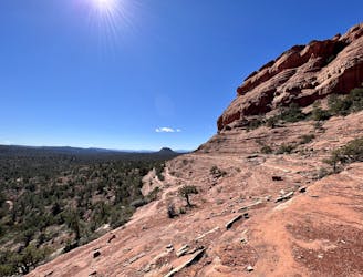
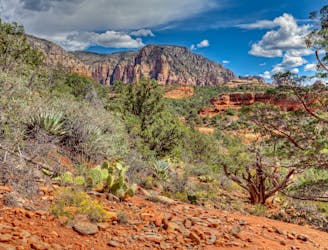
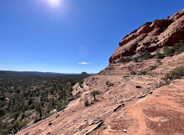
The surrounding red rock formations are excellent visual diversions from the steep ascent. It is well worth stopping frequently to drink in the views... and to let the legs recover from the many, many rock step-ups that comprise the route.
This trail is not technically difficult, but does require some minor scrambling to get up through a narrow, rocky passage. There is also some exposure to major drop-offs. Trekking poles are very useful on the climb and even more so on the descent.
When the trail crosses areas of slickrock, look for white painted arrows to follow the route. Sometimes these arrows are highly obvious, but sometimes take a bit of searching.
The top of Bear Mountain doesn't have a stereotypical “summit”; it is more broad, expansive terrain. The end of the trail is marked, appropriately enough, by a wood sign that says, “End of Trail”. From that point, there are truly magnificent views, enhanced by the light from a setting sun, if run in the late afternoon. Across from Bear Mountain is Doe Mountain, the top of which is a large, extremely flat plateau.
On the descent, stay aware of the white arrows and the trail itself; it is just a bit easier to get off-track on the return. Plan on ample time for this run—it is not much faster to descend than ascend due to the large rocks that require careful stepping down.
Severe

The trail contains some obstacles such as outcroppings and rock which could cause injury.

Little chance of being seen or helped in case of an accident.
4 km away
A beautiful loop on iconic Sedona trails.
Difficult Trail Running
5.5 km away
A long loop connecting Sedona trails both old and new.
Difficult Trail Running
7.5 km away
A fantastic 5-mile loop around Brin's Butte.
Difficult Trail Running
8.8 km away

Gorgeous loop around Airport Butte offering spectacular views of the valley.
Moderate Trail Running
10 routes · Trail Running