19 m away
Grand Canyon: Rim to Rim to Rim via South Kaibab
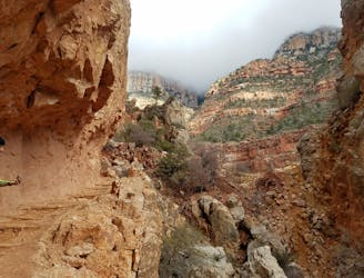
An internationally-recognized trail run through the United State's largest canyon.
Severe Trail Running
- Distance
- 66 km
- Ascent
- 4 km
- Descent
- 4 km
An easy trail traversing the South Rim of the Grand Canyon.
Trail Running Moderate

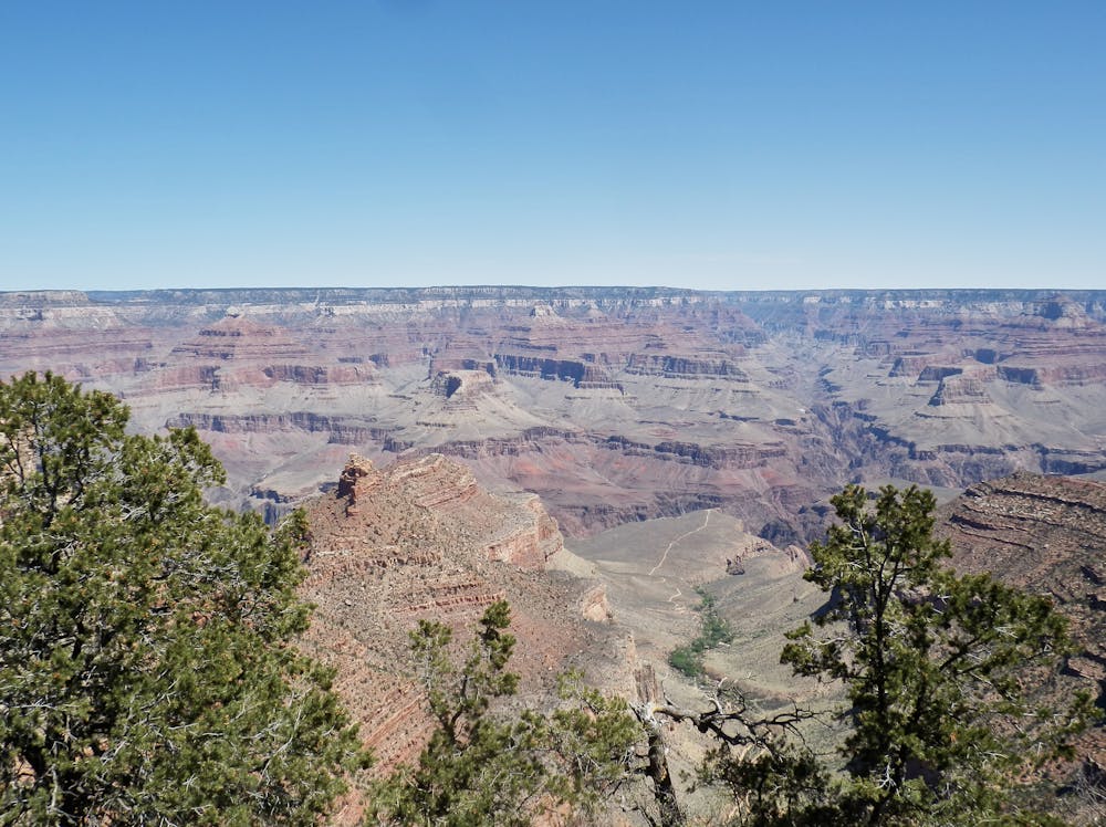
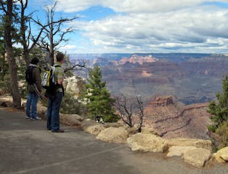
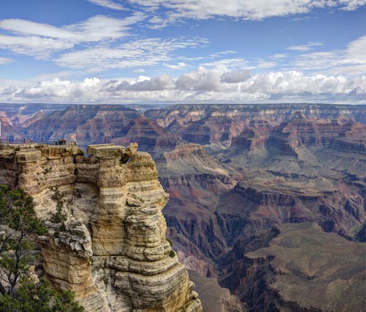
The South Rim Trail, or simply the Rim Trail, is one of the best ways for Grand Canyon visitors to enjoy breathtaking, dramatic views of the largest canyon in the United States. 4,500' above the Colorado River, the trail is mostly flat, full of panoramic vistas, and easily accessible from the campground or Visitor Center at Grand Canyon Village.
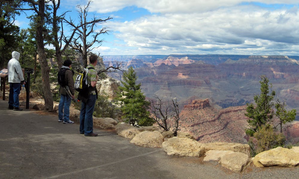
Thanks to countless access points, this one of the most versatile hikes on the south rim. Out and back runs are an excellent option if you're staying at the campground, but most runners would opt for a shuttle, utilizing one of the free shuttle busses to return to their vehicle or campsite. If you were to run the full length of the trail, the run would be near 13 miles. Though debatable, this may be the most scenic half-marathon in the entire country!
The eastern trailhead doubles as the start of the South Kaibab Trailhead, one of two popular routes to reach the Colorado River. The other, Bright Angel Trail is located at the Grand Canyon Village also along the South Rim Trail. With the campground and adjacent Visitor Center nearby, this is one of the busiest areas in the entire park. It is also the only place to refill on water until the trail's end.
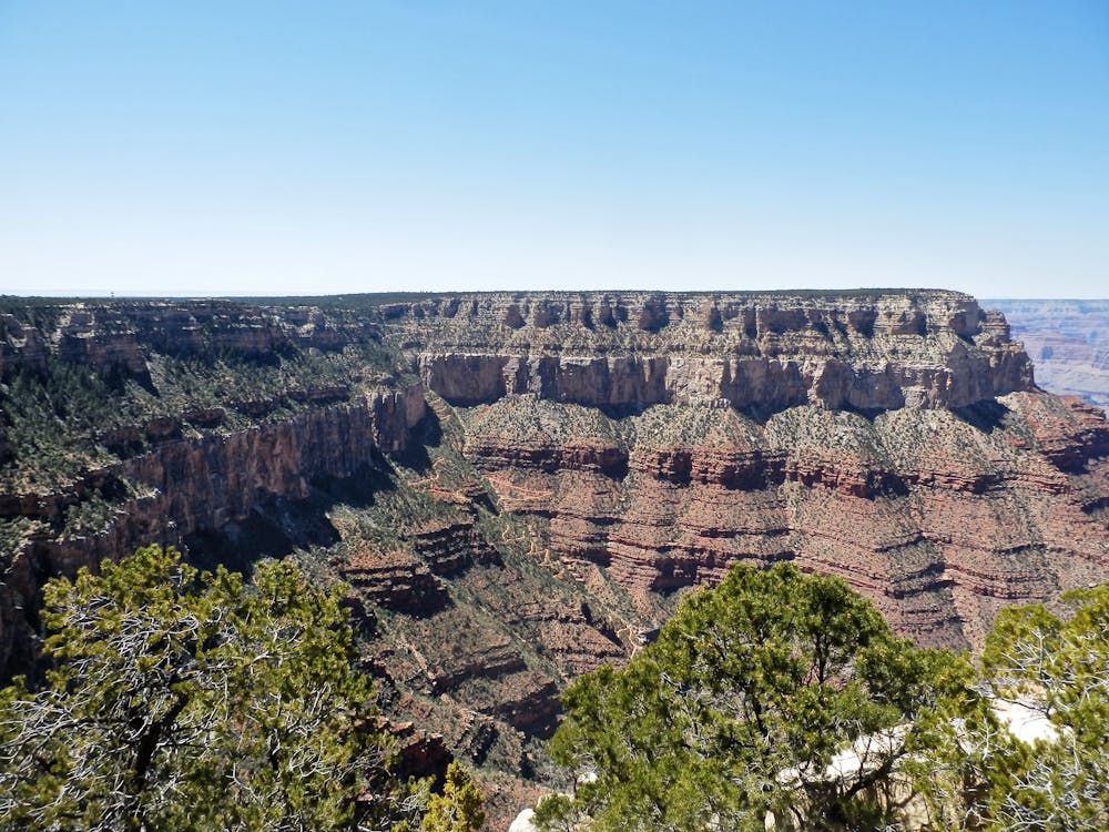
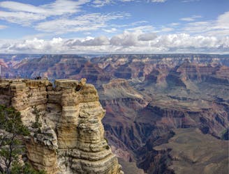
As you head further west, the Rim Trail parallels Hermit Road, often incredibly close to the edge of the rim. Other than the overlooks, many sections are unpaved and shaded by trees, though it never ventures far from the road.
Finishing out the final leg, the trail showcases several excellent vistas including Hopi Point, Mojave Point, Monument Creek Vista, Pima Point, before its final terminus at Hermit's Rest.
Sources: https://www.10adventures.com/hikes/grand-canyon-national-park/south-rim-trail/
Moderate

The trail contains some obstacles such as outcroppings and rock which could cause injury.

Close to help in case of emergency.
19 m away
An internationally-recognized trail run through the United State's largest canyon.
Severe Trail Running
19 m away
A epic trail run that can be shuttled or completed as a loop utilizing the South Rim Trail.
Difficult Trail Running
2.4 km away
An easy running tour of the South Rim with campground access, restrooms, and drinking water available.
Easy Trail Running
5.5 km away
An internationally-recognized trail run through the United State's largest canyon.
Severe Trail Running
9.2 km away
A developed Greenway Trail connecting the town of Tusayan to the South Rim Visitor Center.
Easy Trail Running
11 routes · Trail Running

17 routes · Hiking · Trail Running
10 routes · Trail Running