8 routes · Hiking
This section routes hikers through one of the most scenic areas in Arkansas and also past a huge natural bridge.
Hiking Moderate

After exiting the Fort Douglas Trailhead parking, the OHT crosses the Big Piney River on a picturesque 1931 one-lane steel bridge. You might want to top off your water bottles in the river because in dry months it is six miles to the next reliable water.
Turn left after crossing bridge, as the OHT follows a gravel road for a couple of hundred yards before heading up some rock steps to the right. You now enter one of the most scenic spots in Arkansas—the 15,000 acre Hurricane Creek Wilderness Area (HCWA).
To preserve the wilderness feel, the Forest Service asked that the white blazes be spaced out further than on other parts of the trail. You may also encounter more downed trees in this area.
There is a pretty good climb at the start of this section, but it soon levels off for a nice stroll through beech trees. At mile 107.8 you encounter a signed intersection. To the right is a high-water bypass route to use during wet seasons. The bypass is 2.8 miles, and the main trail is 5.6 miles, plus it also avoids crossing Hurricane Creek, while the main route includes two, usually wet, crossings. However, unless it has been raining a lot, I recommend taking the main trail. It is well worth the extra miles of hiking and getting a little wet.
It’s almost a two-mile descent to Hurricane Creek. Along the way, the trail passes some excellent rock outcrops, as it switchbacks down the mountainside.
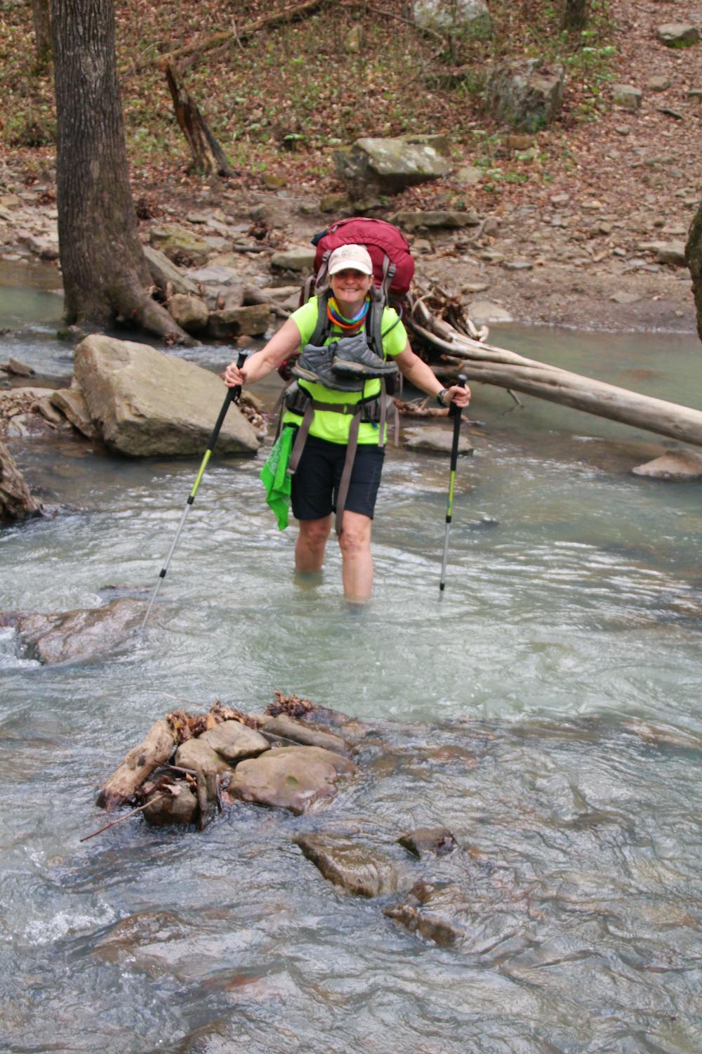
At mile 109.5 you reach the creek. Fording the stream almost always requires some wading. Crossing to the left is shallower; however, the solid rock bottom is very slippery. To the right, it is deeper but doesn’t have as slippery of a bottom. Plus there is a small island in the middle on this route to shorten your wading. Use caution because this water can be very swift.
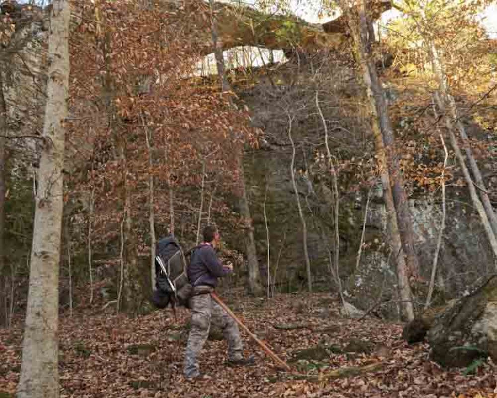
Following the crossing, as you hike along an old pioneer road, when passing a tall bluff on your left, start watching for the spur trail which will take you to the most massive arch in the state, the Hurricane Creek Natural Bridge. This area is a great place to drop your pack to explore. If you backtrack on the OHT to the start of the bluff, it’s an easy hike to the top of the bluff for a better view of the bridge.
Once back on the OHT, the trail continues to follow the old pioneer road. You pass several house-sized boulders resting right down at the edge of the creek. You will also spot several great places to camp. Just before mile 112, you pass a rock wall and an old rock chimney remaining from John Pellham’s homesite. This was part of the original 160-acre land grant deeded to Pellham in 1904.
Another cabin once stood farther upstream on Hurricane Creek. It was built by Pellham’s brother, Bill, on the 160 acres deeded to him. And still further upstream are the remains of Cora Pellham’s cabin.
At one time the area had as many as five cabins full of Pellhams. John’s chimney is located at the confluence of Greasy Creek. If you have time, it is a great bushwhack up this drainage, with waterfalls and beautiful sheer rock bluffs.
The OHT routes hikers up a steep climb, but there are nice views into both Hurricane and Greasy creeks.
At mile 113.4 the trail brings you to your second Hurricane Creek crossing. The water is usually deeper at this crossing, so roll up your pants, or better yet strip them off, and trudge on across.
There is a popular campsite on the opposite side of the creek. Just past this is the intersection where the bypass spur trail rejoins the main trail. The trail follows the creek for a ways until reaching a signed intersection for a spur trail off to your left. This is a 0.6-mile path that you can use to bail early on the hike at the Chancel Trailhead. The main trail continues straight, with a gradual climb up the hillside past more beautiful huge boulders
If it happens to be raining while hiking through this area, if you keep your eyes out you can seek shelter under some of these boulders. Once the trail drops down and leaves the boulder area, it crosses an old CCC rock bridge over Buck Branch Creek. It is well worth scrambling down to admire the craftsmanship still standing firm almost a century later.
After crossing the bridge, the trail leaves the old road to begin the two-mile climb to Fairview Campground Trailhead on Hwy 7, the end of this section. The campground was closed the last time I was there, but the pit toilet and water faucet remained.
Moderate
Hiking along trails with some uneven terrain and small hills. Small rocks and roots may be present.

The trail contains some obstacles such as outcroppings and rock which could cause injury.
Away from help but easily accessed.
8 routes · Hiking