1 km away
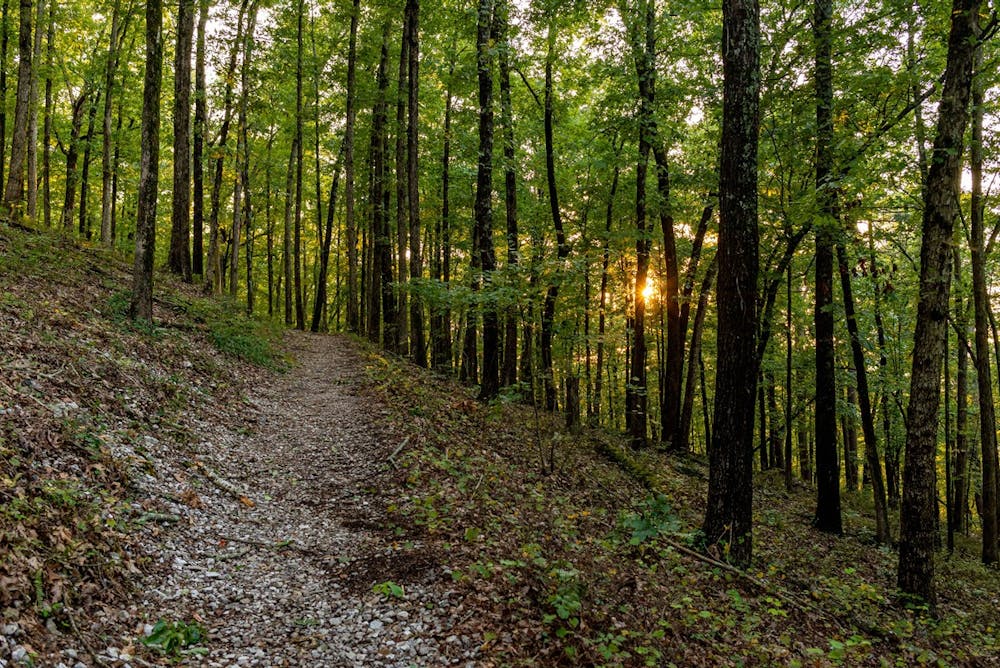
West Mountain Loop

A popular 2-mile hike on West Mountain with easy access from town.
Moderate Hiking
- Distance
- 3.2 km
- Ascent
- 89 m
- Descent
- 89 m
The longest hiking trail in Hot Springs with several popular access points around the park.
Hiking Difficult

The Sunset Trail is the longest and most challenging trail in Hot Springs National Park. Beginning on West Mountain, it circles around town following a ridge bounding the park to the northwest. The trail offers spectacular views, and numerous connecting trails offer options for shorter hikes and loops from different trailheads. To form a long day hike recommended by the park, it "can be combined with Hot Sunset Springs and North Mountain trails and West Mountain trails to complete a strenuous 15-17-mile loop hike."
As the longest maintained trail in Hot Springs, the park has divided it into three sections: West Mountain (2.8 miles), Sugarloaf Mountain (2.6 miles), and Stonebridge Road (3.8 miles). West Mountain reaches "the highest point in the park, Music Mountain (1405')," while Sugarloaf Mountain offers a beautiful ridgetop traverse with the option to visit the scenic Balanced Rock.
The final Stonebridge Road Section links Cedar Glades Road and Gulpha Gorge Campground and passes through land "once part of the Fordyce family estate," plus Rick's Pond and several historic stone structures. Parking is available at both ends of the trail and virtually any time it crosses a major road.
In a detailed trail guide, the park notes how many false trails spur from the Sunset Trail. They often lead to private property, where you would then be trespassing. Orange blazes and signage are posted along the trail to help you navigate the well-traveled path, so you shouldn't worry about getting lost. Take note, though, "An old roadbed and power line near Cedar Glades Road can confuse hikers," according to the NPS. "Remain north of the water tank here (keep left if hiking from Cedar Glades Road to Gulpha Gorge Campground, and keep right if hiking from Gulpha Gorge Campground to Cedar Glades Road)."
As alternatives to hiking all nine miles, the West Mountain Loop is a great two-mile hike near the start of the Sunset Trail, and Goat Rock visits a stunning overlook just above the trail's end.
Source: NPS)https://www.nps.gov/hosp/planyourvisit/sunset-trail.htm)
Difficult
Hiking trails where obstacles such as rocks or roots are prevalent. Some obstacles can require care to step over or around. At times, the trail can be worn and eroded. The grade of the trail is generally quite steep, and can often lead to strenuous hiking.

The trail contains some obstacles such as outcroppings and rock which could cause injury.
Away from help but easily accessed.
1 km away
A popular 2-mile hike on West Mountain with easy access from town.
Moderate Hiking
1.5 km away
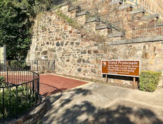
A historic brick walkway designated a National Recreation Trail in 1982.
Easy Hiking
3.3 km away

A short hike to one of Hot Spring's must-see overlooks.
Easy Hiking

4 routes · Hiking

63 routes · Alpine Climbing · Hiking