Tanyard Creek Falls
Short hike to a beautiful waterfall.
Hiking Easy
- Distance
- 1.7 km
- Ascent
- 23 m
- Descent
- 23 m
- Duration
- 0-1 hrs
- Low Point
- 305 m
- High Point
- 317 m
- Gradient
- 1˚

This short one-mile hike to Tanyard Creek Falls provides a fantastic dose of nature just outside of the city of Bella Vista. Easily accessible from Tanyard Creek Park, the trail begins on pavement, transitions to a wide dirt path, then narrows down to singletrack. However, the entire hike is quite easy—perfect for the entire family.
- •
- •
- •
Description
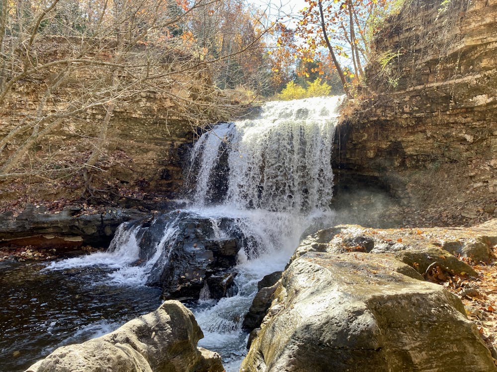
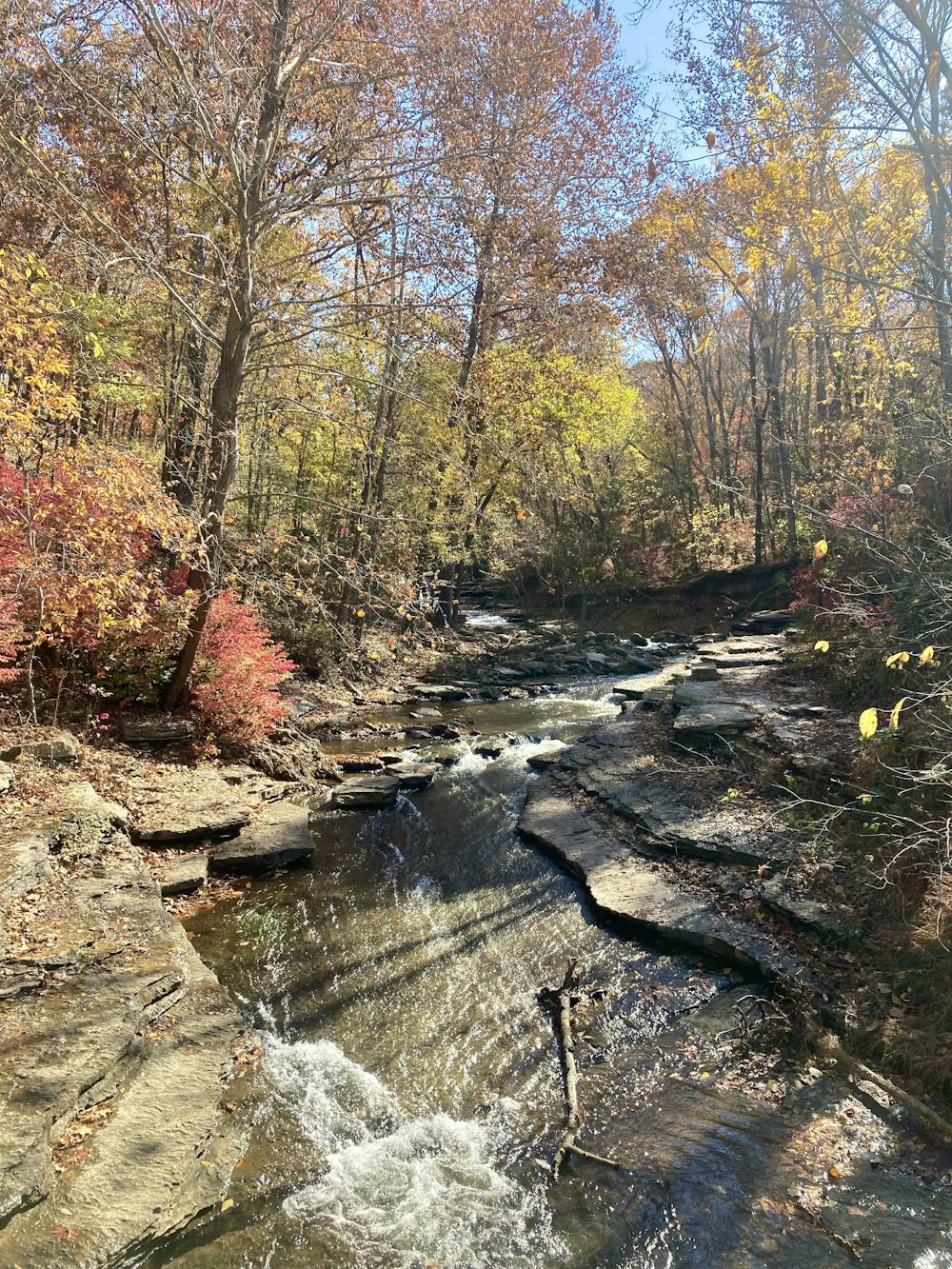
The falls itself is an impressive torrent, rushing off a cliff and plummeting into the canyon below. The rapids continue below the falls as the creek takes a sharp left turn in the canyon bottom, rushing down and over exposed slabs of bedrock.
This small, mist-filled canyon is an idyllic haven! When sitting here below the falls, you'll feel a million miles away from the stress and worry of civilization. Here, you can simply bask in the beauty of crashing water, the sound enveloping cyour senses.
If you return directly to the car, you'd make this hike less than one mile in length. However, I recommend a dogleg across the bridge to check out the rapids below the falls and an extra loop along the creekside on the return trip.
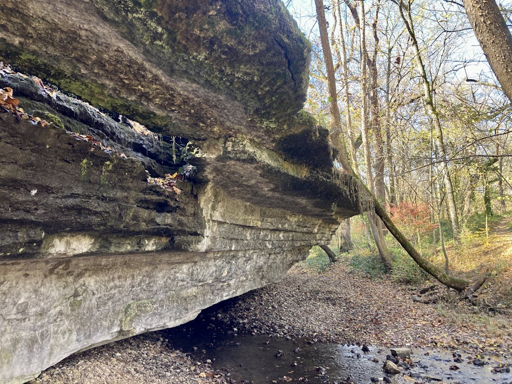
This additional loop to the west traverses below some beautiful cliffs, with natural springs weeping out the sides, providing sustenance to ferns growing along the rock faces. Eroded overhangs provide interesting geology to appreciate and make for an entertaining conclusion to the hike.
Difficulty
Easy
Walking along a well-kept trail that’s mostly flat. No obstacles are present.
Low Exposure

The path is on completely flat land and potential injury is limited to falling over.
Remoteness
Close to help in case of emergency.
Best time to visit
Features
- Picturesque
- Water features
- Family friendly