9 routes · Mountain Biking
A wild, remote IMBA Epic trail system in the Ozark Mountains.
Mountain Biking Severe

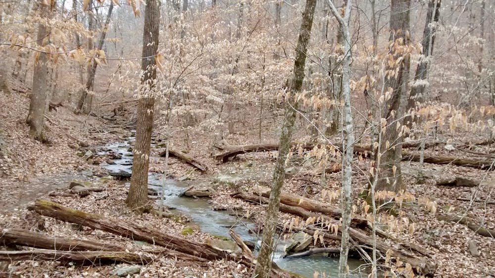
The Upper Buffalo Headwaters trail system redefines remoteness. Located miles from the nearest town, you’ll lose cell phone service almost an hour before you reach the turn off of the highway toward the trailhead. But once you turn off the pavement, another 15 minutes of dirt road driving faces you before you even reach the beginning of the singletrack.

The trails, similarly, are remote and challenging. As you pedal deep into the trail system, technical, narrow singletrack interspersed with the occasional machine-built section forces you to ride in control at all times.
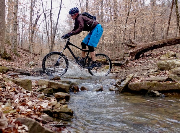
In the most remote reaches of the trail system, steep, fall line trails drop down root and rock-infested hillsides, often ending in small cliff drops and rocky chutes. At the bottoms of the hills, inevitably you’ll have to splash through a stream crossing... or wade through in the case of the deepest streams/rivers.
"From an outsider’s perspective, the navigation here was anything but intuitive,” according to an article on Singletracks.com. "A web of ridges, valleys, streams, and cliffs meant that there was no simple up-down component or east-west/north-south compass rose to follow. Sometimes we’d have to go what felt like the wrong direction to reach the top of a technical trail filled with rock gardens, ledge drops, and root webs so that we could enjoy a ripping descent down it, instead of a painful hike-a-bike to the top.”
Local resident Bob Robinson highlights the remoteness and challenge found in this trail system. "Although the UBHT is well-signed, this 40-mile trail network is a truly remote wilderness experience,” he writes. "Be sure to carry plenty of food, water, spare bike parts, and be prepared to get wet on the numerous water crossings.”
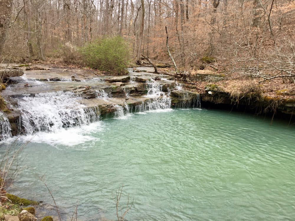
For those who are willing to brave the remoteness of this area and the ruggedness of the trails, the sheer isolation and raw beauty of these southern mountains will keep you from ever wanting to find your way out.
Sources: https://www.singletracks.com/blog/mtb-trails/venturing-arkansas-wilderness-riding-upper-buffalo-headwaters/ https://www.singletracks.com/blog/mtb-trails/5-best-mtb-trails-built-arkansas-last-5-years/
Severe
Widely variable, narrow trail tread with steeper grades and unavoidable obstacles of 15in/38cm tall or less. Obstacles may include unavoidable bridges 24in/61cm wide or less, large rocks, gravel, difficult root sections, and more. Ideal for advanced-level riders.

The trail contains some obstacles such as outcroppings and rock which could cause injury.

In the high mountains or remote conditions, all individuals must be completely autonomous in every situation.
9 routes · Mountain Biking