2.2 km away
Fire Break
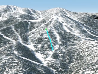
A big, wide swatch of sidecountry that's high-risk, high-reward
Moderate Freeride Skiing
- Distance
- 4 km
- Ascent
- 103 m
- Descent
- 744 m
A massive, rocky zone off the backside of the resort
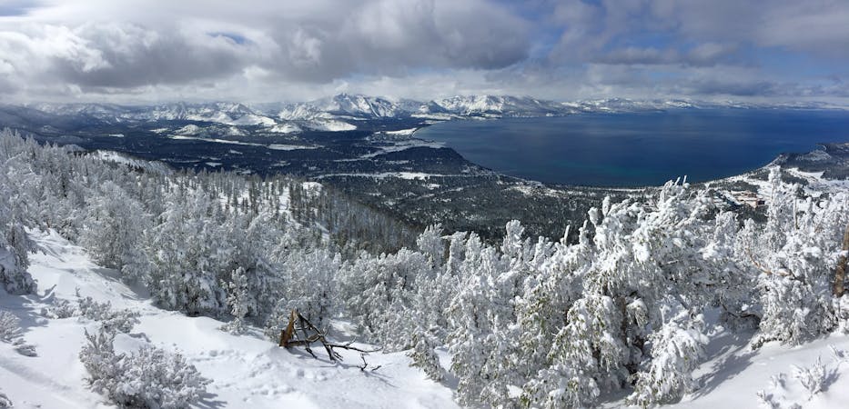
Also in Nevada, United States of America
Freeride Skiing Moderate

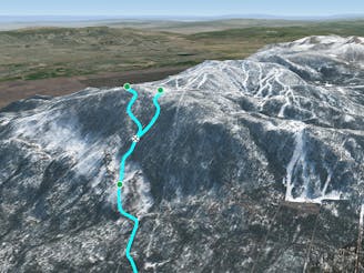
This canyon on the backside of the resort sits just beyond the boundaries of Killebrew Canyon. First things first: be ready to throw a thumb if you decide to drop in, as almost every route through the canyon lead down to the valley floor below, and no lifts (or taxis!) will be in sight. Thankfully, the local culture is supportive of hitchhiking, so you shouldn't have too much trouble getting a ride back up the road. If you stay high and to skier's left after entering, you may be able to cut left and get to the Rim Trail and back to the Mott chair, but that means missing all of the untouched snow for which you entered Fulstone in the first place! The variety of lines available really depends on the season's snow pack; if it's anything less than ultra-deep, you'll want to hug the line just outside of the boundary to ensure you'll have enough coverage to get all the way to the bottom without taking off your skis or board and hiking. The terrain itself pretty closely mirrors that of Killebrew Canyon - it maintains a pretty consistent, steep pitch and you'll alternately weave through tight glades and make big turns through clearings. The canyon is also littered with huge rock outcroppings that can wreck your base if you're not careful... but can also turn the area into a huge playground where massive air is possible (just make sure you know where you're landing!) As you continue descending, you'll see the Kingsbury Grade road on the valley floor below. This is the final destination, but to get there, you'll have a lot of traversing to skier's left towards the bottom. In the spring, watch out for the small creeks that form and grow as the melt continues. Finally, be respectful of the property owners whose land you'll need to cross to get to the road; nearly everything is private property and not everyone takes kindly to skiers / boarders hiking through their backyard (although rumor has it that one newer local leaves a cooler full of beer and water to reward those who make it all the way down!)
Moderate
Slopes become slightly steeper at around 25-30 degrees.

As well as the slope itself, there are some obstacles (such as rock outcrops) which could aggravate injury.

Little chance of being seen or helped in case of an accident.
2.2 km away
A big, wide swatch of sidecountry that's high-risk, high-reward
Moderate Freeride Skiing
2.4 km away
A wide expanse of glades below Nevada Trail
Moderate Freeride Skiing
8 routes · Freeride Skiing