3 m away
Icefall Chute

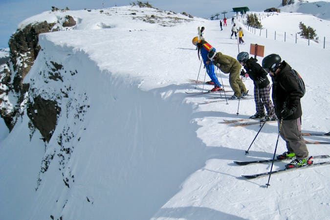
Steep exposed line that has an icefall cliff that leads into a chute
Extreme Freeride Skiing
- Distance
- 188 m
- Ascent
- 0 m
- Descent
- 128 m

Incredibly steep and exposed line that results in a decent amount of adrenaline
Freeride Skiing Extreme

Incredibly steep and exposed line that results in a decent amount of adrenaline due to the technical steep turns required. The run starts out on a nice wide open face that gradually gets steeper as you pass the 'V' Tree. The safest route is to the skier's right. Skiers left is extremely exposed to volcanic cliff bands. If the snow gets too firm, there's a right hand traverse just past 'V-tree' that will follow underneath the Icefall of Icefall Chute.
Extreme
Extreme skiing terrain above 45 degrees. These routes are reserved for experienced experts.
3 m away

Steep exposed line that has an icefall cliff that leads into a chute
Extreme Freeride Skiing
164 m away

The most conservative line in the zone that avoids rocks and cliffs
Difficult Freeride Skiing
516 m away

Great powder hike-to run above Rabbit Runs with a few rock features
Difficult Freeride Skiing
894 m away

Classic early season overhanging chute that funnels into Jim's Run
Difficult Freeride Skiing
935 m away

An extremely steep chute that generally has a cornice with a runout into Chamoix
Severe Freeride Skiing
951 m away

Short and extremely steep and rarely skied line above Chamoix
Extreme Freeride Skiing
993 m away

Hidden gem of a run that has steeps, cliffs, glades and great north facing snow
Difficult Freeride Skiing
1.2 km away

Series of chutes located in Wagon Wheel Bowl off of Chair 6
Difficult Freeride Skiing
1.7 km away

A ‘U’ shaped wide chute just to the left of Heart Chute with incredible steep left wall.
Difficult Freeride Skiing
1.7 km away

A narrow chute shaped like a heart surrounded by large volcanic walls that funnel into a large cliff.
Extreme Freeride Skiing

7 routes · Freeride Skiing