4.7 km away
Oso Creek Trail: Out-and-Back

An easily-accessible multi-use greenway trail.
Easy Hiking
- Distance
- 11 km
- Ascent
- 124 m
- Descent
- 124 m
Enjoy spectacular views from this mellow ridgeline trail.
Hiking Easy

The Aliso Summit Trail traverses an elevated ridgeline, providing stunning views of Orange County and the Pacific Ocean. The hike culminates at Aliso Peak, which towers over the crashing surf and blue waters of the Pacific.
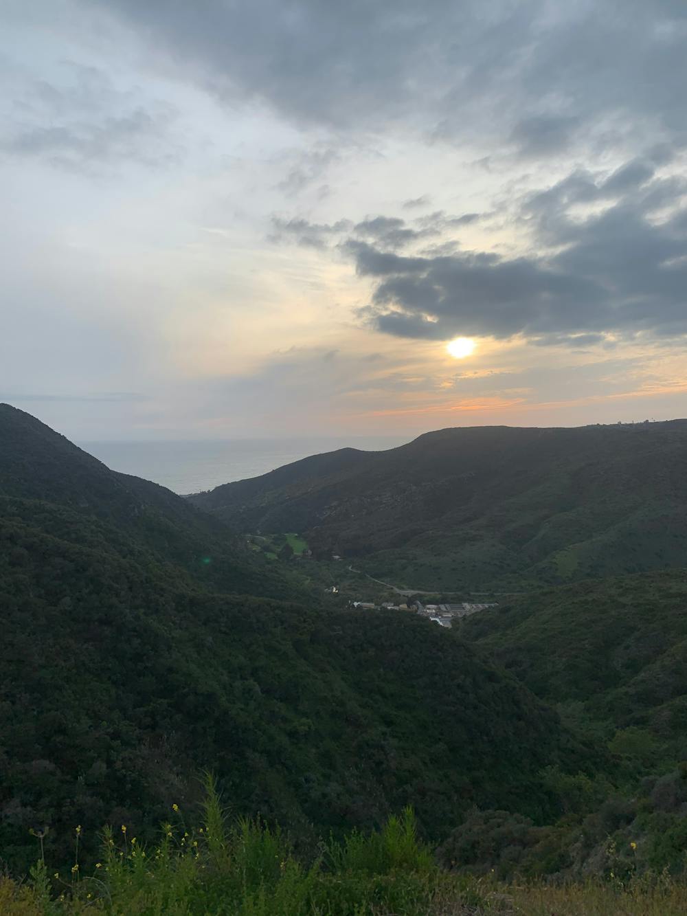
This trail is separated from the bulk of the Aliso Creek trail system, yet even on its own, it is an exceedingly popular hike. This hike is generally fairly mellow and non-technical, with a decomposed granite trail surface. While the trail does undulate up and down the ridge, this is ultimately quite an achievable hike with an incredible effort-to-view ratio.
The route, as mapped, begins on the Aliso Summit Trail and then follows a section of road before joining the Aliso Peak Trail. It's possible to shorten this route by hiking either the Summit Trail or the Peak Trail and not both.
Sources: https://www.cityoflagunaniguel.org/119/Aliso-Summit-Trail https://socalhiker.net/hiking-to-aliso-peak/
Easy
Walking along a well-kept trail that’s mostly flat. No obstacles are present.

The trail contains some obstacles such as outcroppings and rock which could cause injury.

Close to help in case of emergency.
4.7 km away
An easily-accessible multi-use greenway trail.
Easy Hiking
8.5 km away
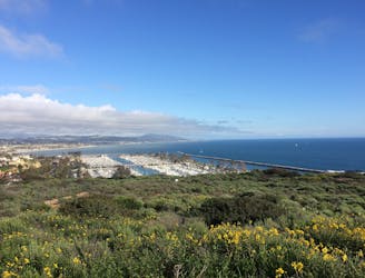
Nature walk with great views over the ocean and a chance of spotting whales.
Easy Hiking

17 routes · Hiking

6 routes · Hiking