5.6 km away
Mariposa Grove
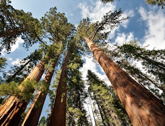
The largest and most famous grove of giant sequoias in Yosemite National Park.
Easy Hiking
- Distance
- 9.9 km
- Ascent
- 346 m
- Descent
- 344 m
Steep hike to the top of a huge waterfall which, at low flow, has calm pools for wading and swimming.
Hiking Difficult

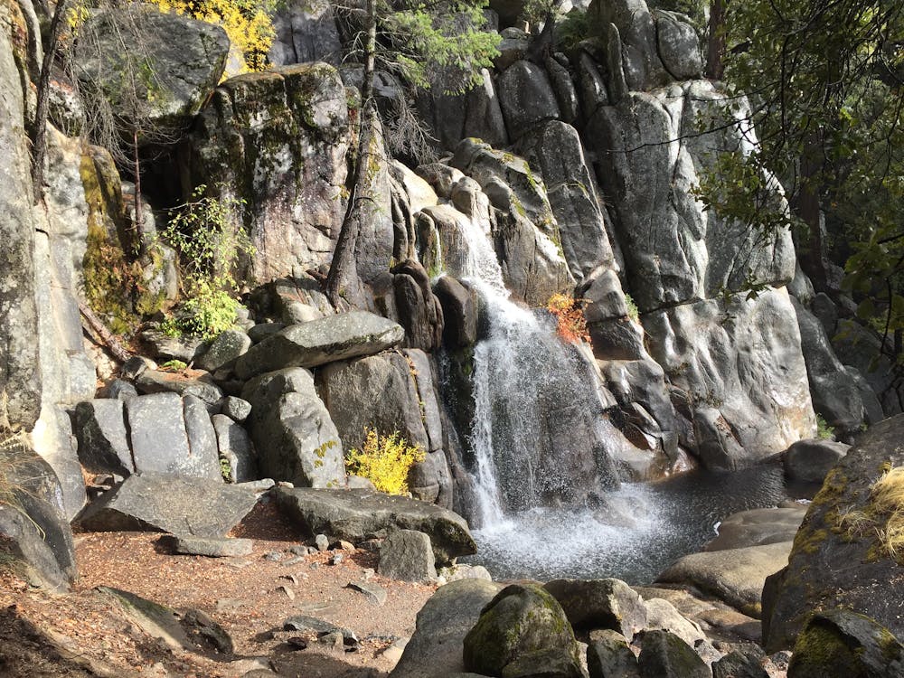
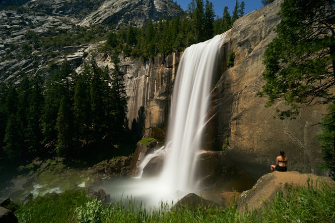
Chilnualna is one of Yosemite’s lesser-known large waterfalls, located in a less-visited corner of the park. It’s near the tiny town of Wawona, where there’s a separate entrance somewhat distant from the rest of the national park. If you have multiple days to explore Yosemite, consider venturing to Wawona and hiking to Chilnualna Falls as a bonus adventure. This hike is best in mid summer when the flow is high enough to make an impressive waterfall, but not too high to safely enjoy a refreshing dip in the creek.
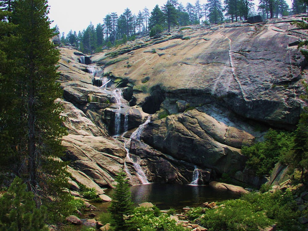
The trail begins from a signed parking area among some vacation cabins and follows the road briefly before heading into the forest along a creek. This is Chilnualna Creek, which flows from the waterfall. In spring it’s a rushing torrent but slows to a steady trickle by fall. You’ll see several smaller waterfalls along the hike, and find beautiful wading pools to enjoy on a hot day.
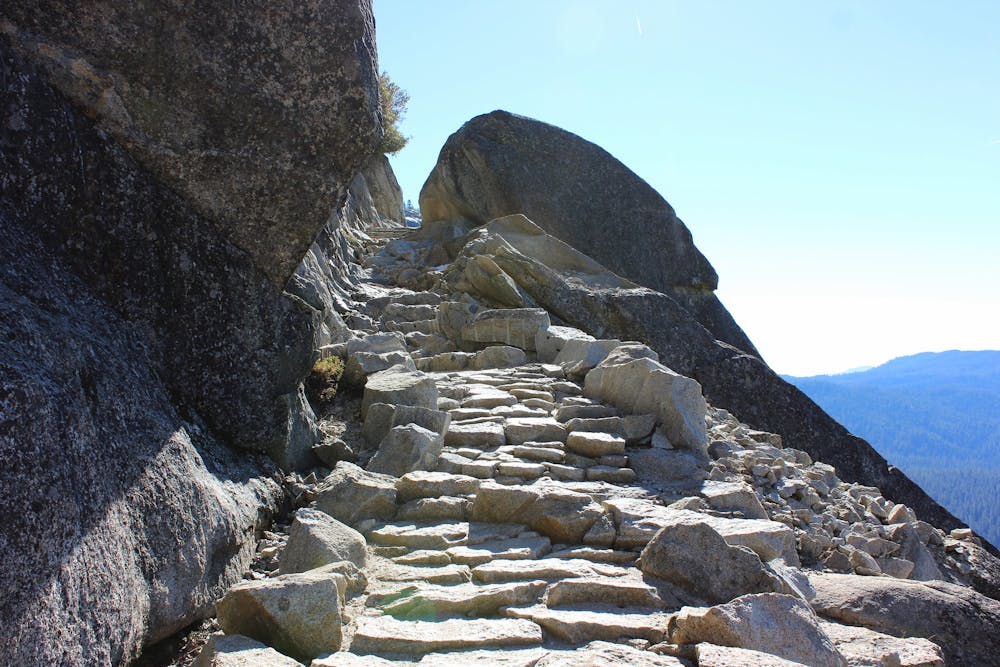
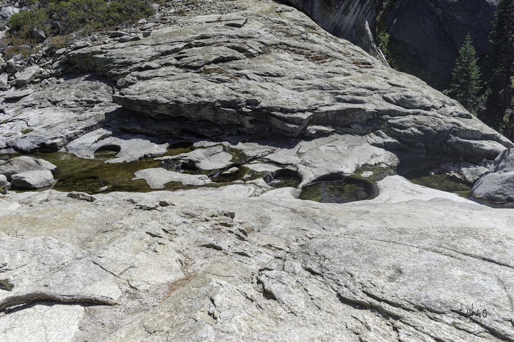
The trail climbs steeply on rocky terrain with some switchbacks, occasionally following constructed stairs to aid the climb. In one spot, a narrow ledge cuts across a sheer cliff face, where those afraid of heights may feel uneasy. It’s safe, though, if not slick with ice in winter. While on this section, you’ll see the lower drops of Chilnualna Falls tumbling away below, then you’ll arrive right above the principal vertical drop in the falls.
At times of low flow (late summer and fall), calm pools form in potholes above the waterfall. You can wade in them, but they sit at the lip of a sheer drop, so use caution. In spring and early summer, the pools are covered by swift water, and there may even be too much flow to get close at all, but you can still admire them from a distance.
The trail does not have any particular endpoint. Beyond Chilnualna Falls it continues switchbacking uphill, finding more waterfalls as it goes, and aiming for the wilderness of the high country. Continue as far as you like, then return the way you came.
Sources: https://www.nps.gov/yose/planyourvisit/upload/WawonaAreaHikeMap.pdf
Difficult
Hiking trails where obstacles such as rocks or roots are prevalent. Some obstacles can require care to step over or around. At times, the trail can be worn and eroded. The grade of the trail is generally quite steep, and can often lead to strenuous hiking.

Some trail sections have exposed ledges or steep ascents/descents where falling could cause serious injury.

Away from help but easily accessed.
5.6 km away
The largest and most famous grove of giant sequoias in Yosemite National Park.
Easy Hiking
13 routes · Hiking
7 routes · Hiking

14 routes · Hiking