4 m away
Icehouse Canyon Trail -> Chapman Trail Loop

A stunning loop hike in the Cucamonga Wilderness.
Difficult Hiking
- Distance
- 14 km
- Ascent
- 825 m
- Descent
- 825 m
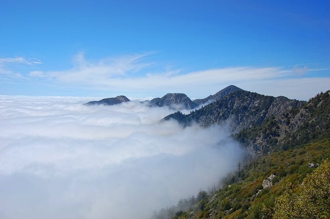
Uphill journey to a jaw-dropping view over San Bernardino Valley.
Hiking Difficult

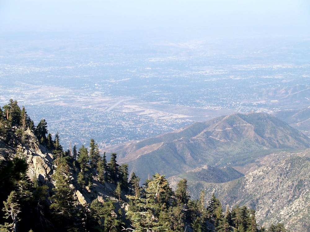
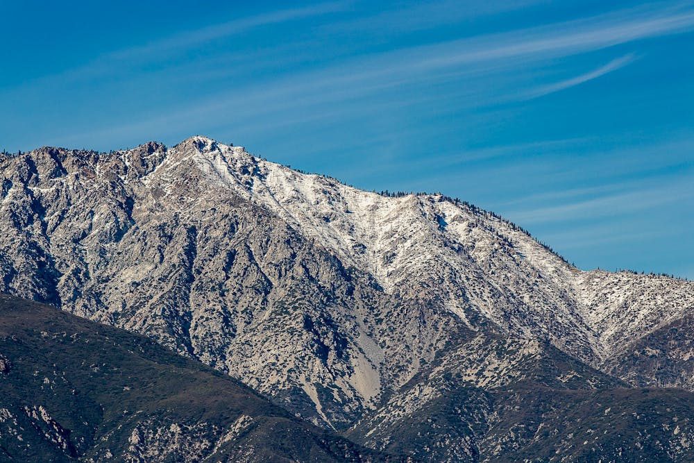
This hike begins in the same vicinity as popular trails on Mount Baldy but leads to a lesser-visited summit. Though Cucamonga is not as tall, its position on the southern front of the San Gabriels grants a view nearly straight down to San Bernardino Valley—a vantage not obtained from Baldy because it’s more interior in the range. That makes Cucamonga very much worthwhile, especially if you want the share the view with fewer people.
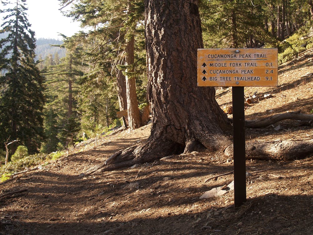
The hike begins from Icehouse Canyon Trailhead, where there’s a large parking lot plus additional parking on the road nearby. A California Adventure Pass is required, as is an additional wilderness permit, but the latter is free and self-issued at the trailhead and the Mount Baldy Visitor Center.
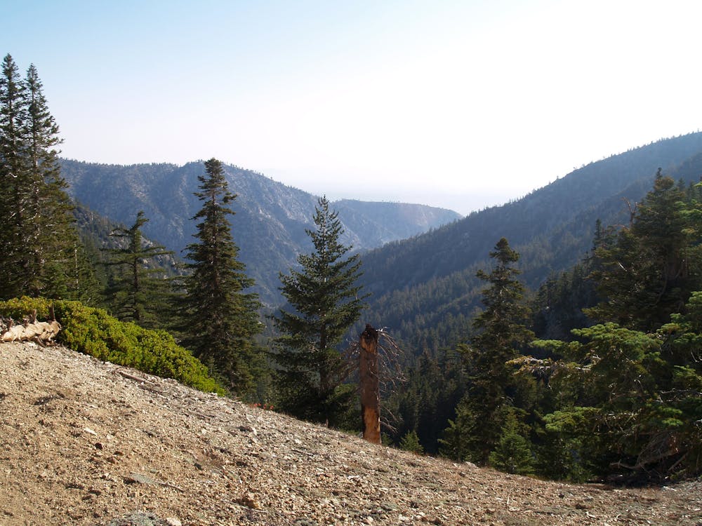
The trail starts out rather rocky, tracing a bouldery creekbed that usually has flowing water. A lush variety of leafy vegetation grows in this shady drainage, contrasting with drier pine forest that surrounds. The trail passes several old cabins, some still standing and others in ruins. These are private property and should not be disturbed. Higher in the canyon, the trail leaves the creek for sunny hillsides dotted with tall conifers, and switchbacks lead gradually upward. The trail here is less rocky than before, but steeper.
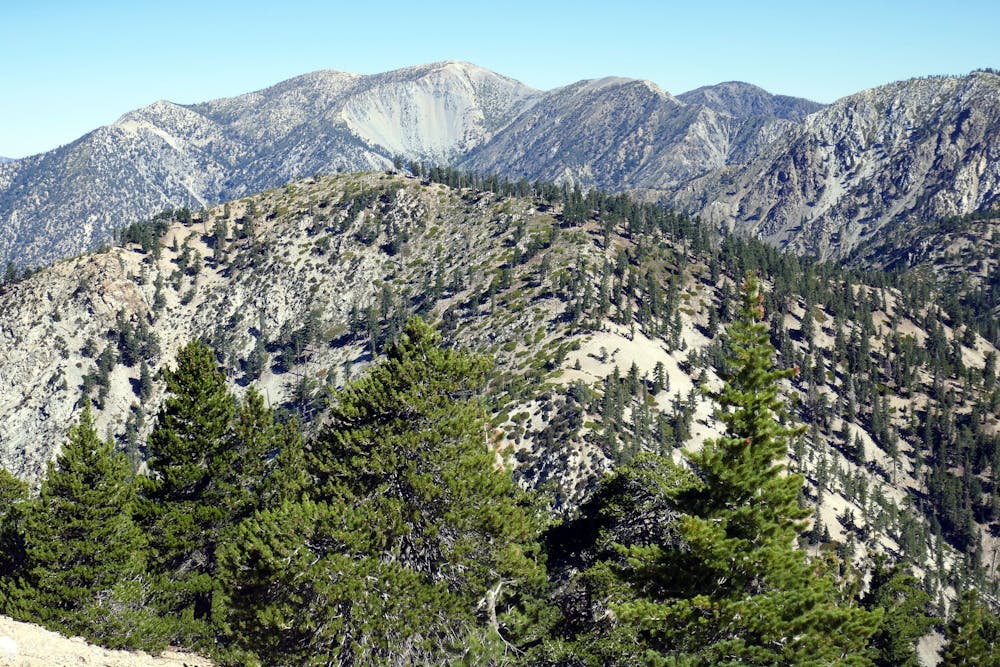
Eventually, you’ll reach Icehouse Saddle, a major milestone on this hike. It’s the saddle between two lesser peaks, forming a kind of gateway to Cucamonga. After crossing the saddle, the trail makes a relatively flat traverse on the slopes of Bighorn Peak. Enjoy this lull while it lasts, because next comes the final push—tight switchbacks to the top of Cucamonga Peak.
On this final climb, you will really feel the altitude, if you haven’t already. Cucamonga’s summit exceeds 8800 feet, scraping into air that holds much less oxygen than at sea level. The sun’s rays can also feel quite intense at this elevation, and sparse trees provide little shade. Be sure to cover up from the sun and save plenty of water for the return hike.
The summit is the highpoint on a broad, airy ridge that drops dramatically away toward the valley below. A few boulder stacks on the ridgeline make especially impressive photo spots if you stand on top of them. Take time to walk some distance along the ridge, find a solitary spot, and take it all in.
Sources: https://www.summitpost.org/cucamonga-peak/150965 https://www.fs.usda.gov/recarea/angeles/recreation/recarea/?recid=42096&actid=50
Difficult
Hiking trails where obstacles such as rocks or roots are prevalent. Some obstacles can require care to step over or around. At times, the trail can be worn and eroded. The grade of the trail is generally quite steep, and can often lead to strenuous hiking.

The trail contains some obstacles such as outcroppings and rock which could cause injury.

Little chance of being seen or helped in case of an accident.
4 m away
A stunning loop hike in the Cucamonga Wilderness.
Difficult Hiking
2 km away
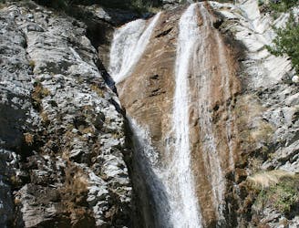
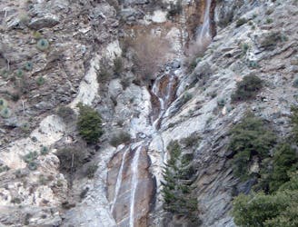
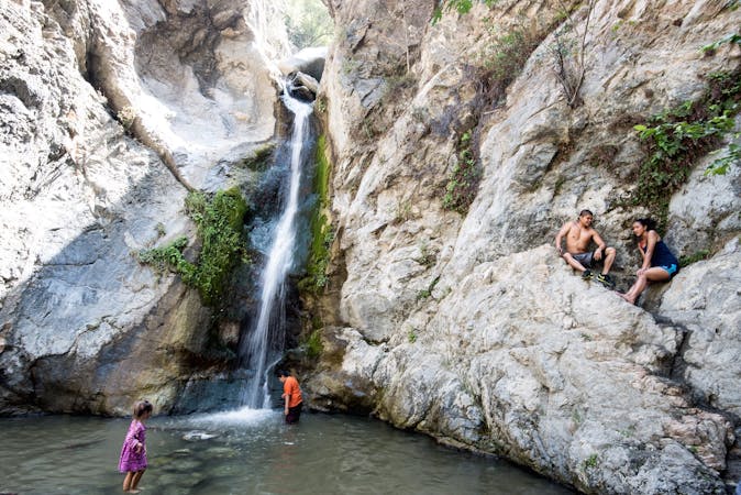
Family-friendly hike to a tiered waterfall on Mount Baldy.
Easy Hiking
2 km away
Challenging and scenic hike in the alpine terrain of Los Angeles County's tallest mountain.
Difficult Hiking
17 routes · Hiking
9 routes · Hiking
10 routes · Hiking