2 m away
Titus Canyon Narrows

A stunning road walk through towering cliff walls.
Moderate Hiking
- Distance
- 7.3 km
- Ascent
- 363 m
- Descent
- 363 m
This deep canyon hike has a true wilderness vibe.
Hiking Moderate

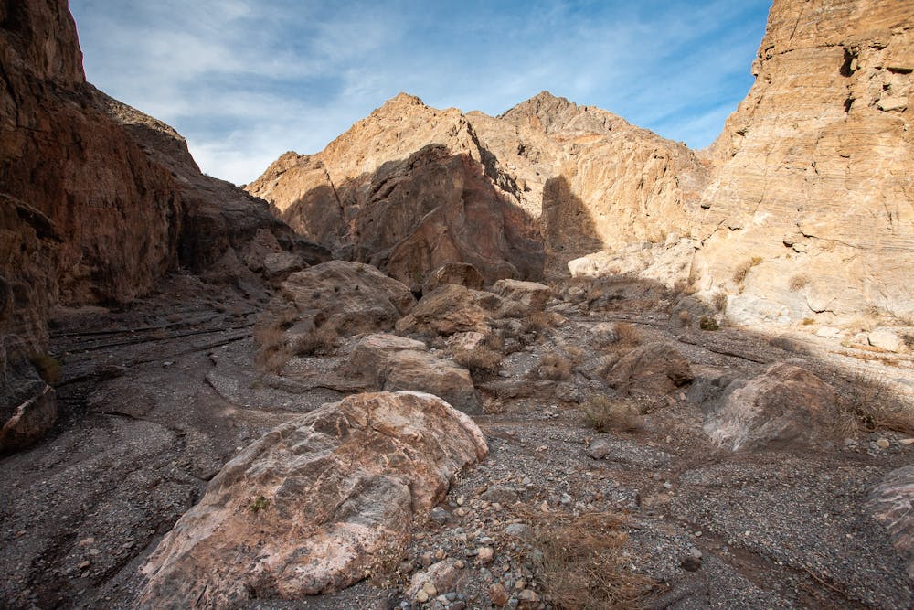
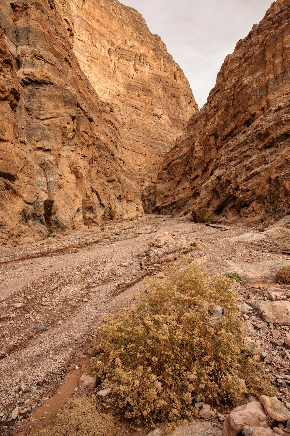
The 6.5-mile out-and-back hike into Fall Canyon is a must-do when visiting Death Valley National Park. Unlike so many others, this route definitely provides quiet solitude. The deep canyon with its striated, colorful walls narrows to around 15 feet in places as it travels farther and farther along.
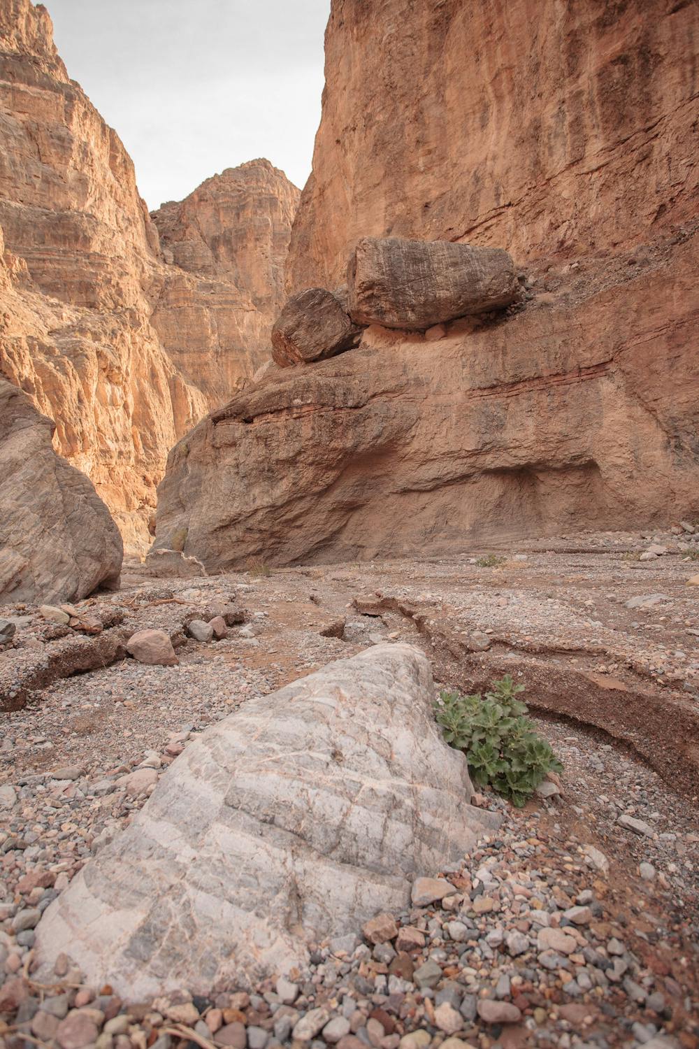
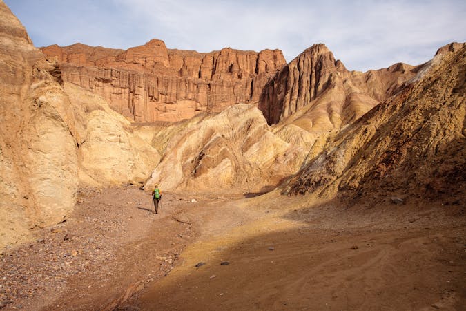
The hike begins on a path located just behind the outhouse at the mouth of Titus Canyon. From there, the most tiring part of the trek is walking across the alluvial fan en route to Fall Canyon. Many canyon hikes in Death Valley involve navigating such terrain, and it's fairly exhausting. An alluvial fan is the collection of alluvium (gravel, sand, sediment, etc.) washed out from something like a canyon to spread out in a fan-shape when it comes to a flat area. Walking on one is somewhat akin to hiking uphill on various-sized marbles!
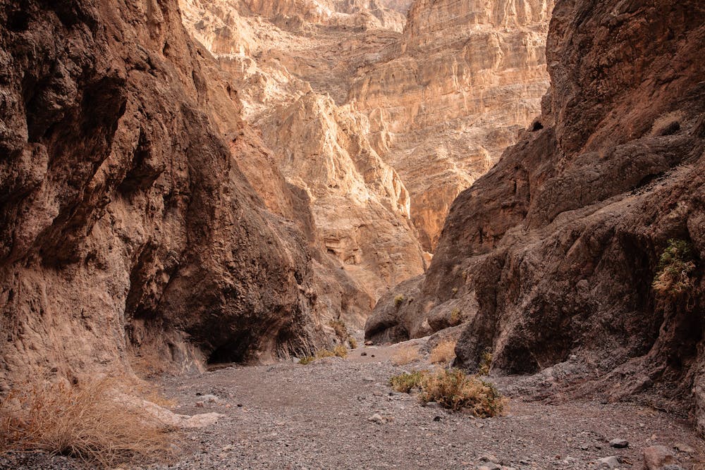
About a mile in, having crossed the fan, the path drops into a wash. Follow the wash just a bit until the mouth of Fall Canyon appears before you. The physically challenging part of the hike is behind you as the jaw-dropping journey through the canyon unfolds ahead.
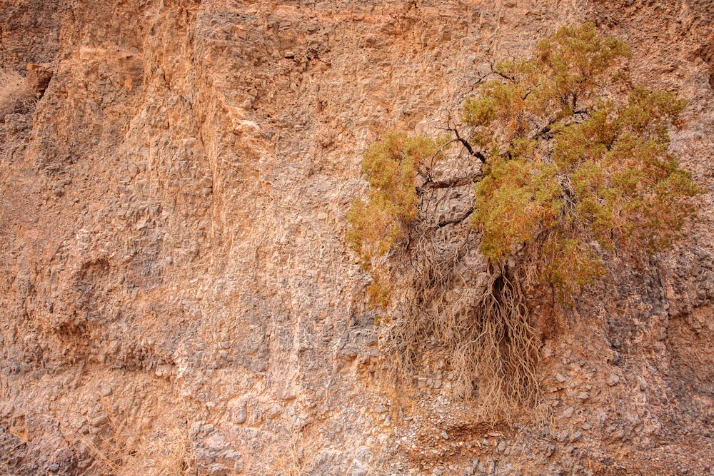
Simply stated, this is a very cool place to hike! The rock varies every time one rounds a curve, so take the time to stop and gaze up frequently. There is awesome plant life all around, including beautiful hanging gardens on the canyon walls.
Canyon hiking in Death Valley is well-suited for exploring little side openings. It really can't be said enough: slow down and drink it all in!
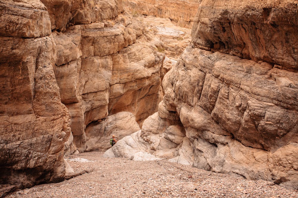
Unless you are a skilled climber, the 25-feet-high dryfall at 3.25 miles in is the de facto turnaround point. Follow the same route back—it will be a mite easier negotiating the loose footing on the descent.
Be prepared for this wilderness hike by carrying the 10 essentials, including sunscreen, brimmed hat, sunglasses and lots and lots of water! Understand that you will likely be on your own on this hike, so self-sufficiency is required. Fall Canyon is a wonderful hike in December, when temps typically hit around 70°. In the summertime, it is far too hot to venture into such a harsh location.
Access to Fall Canyon is via the 2.7-mile unpaved two-way section of Titus Canyon Road, which is 11.9 miles north of CA-190 on Scotty's Castle Road.
Sources: https://www.nps.gov/deva/planyourvisit/fall-canyon.htm
Moderate
Hiking along trails with some uneven terrain and small hills. Small rocks and roots may be present.

The trail contains some obstacles such as outcroppings and rock which could cause injury.

Little chance of being seen or helped in case of an accident.
2 m away
A stunning road walk through towering cliff walls.
Moderate Hiking
11 routes · Hiking