129 m away
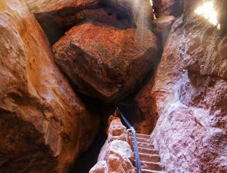
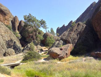
Bear Gulch Cave
One of the most popular hikes in Pinnacles National Park
Moderate Hiking
- Distance
- 2.3 km
- Ascent
- 112 m
- Descent
- 112 m
Exciting trail along the jagged backbone of the Pinnacles, with steep stairs and drop-offs protected by metal rails.
Hiking Difficult

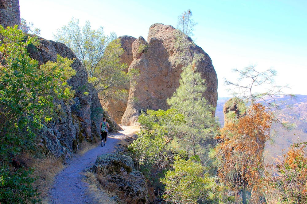
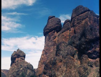
The High Peaks are the apex of Pinnacles National Park, and their jagged spires epitomize the geology for which this place is named. When driving into the park, the silhouette of the High Peaks dominates the skyline. Many hiking trails weave through the valleys and canyons around their base, but there is one trail that climbs over the crest of this formidable mountain––the High Peaks Trail. As you might expect, it’s not an easy one, but it is doable for those with decent fitness, good determination, and preparation for a long hike in the sun and wind.
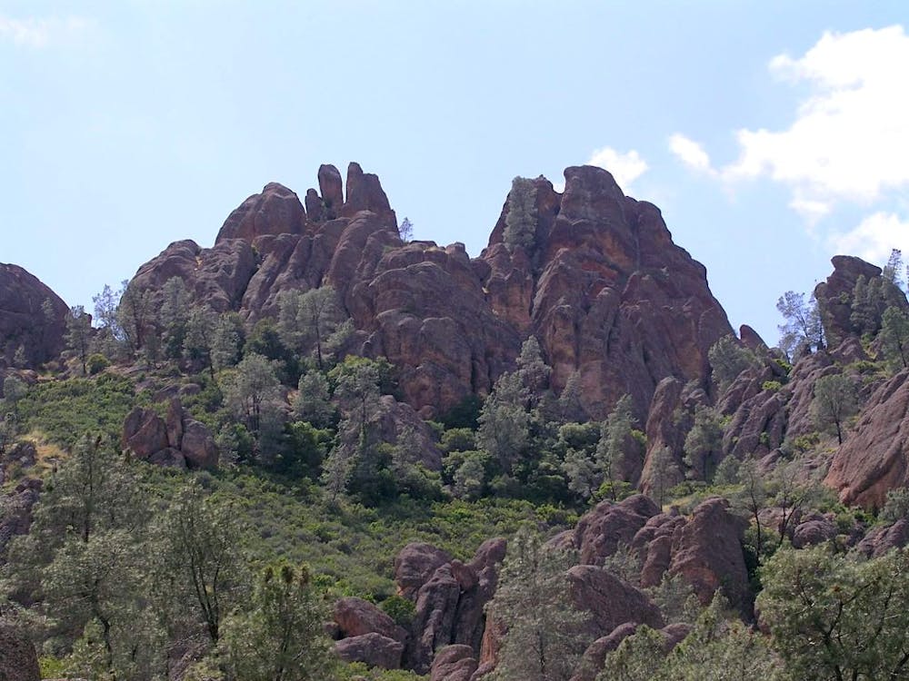
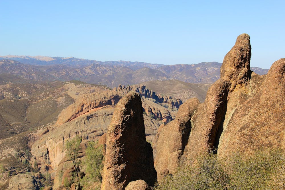
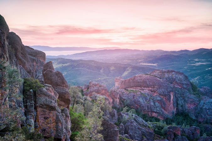
Other park trails connect with High Peaks Trail, so you can get there more than one way, from either the east or west entrance. The route mapped here utilizes Condor Gulch to make a loop from Bear Gulch Day Use Area. Note that you could make longer or shorter variations to this loop if you prefer. Condor Gulch is a very popular trail on its own, because it climbs steadily to an impressive overlook of the High Peaks. From this point you’ll get a preview of the rugged terrain you’re about to traverse––a mountainside studded with pointed boulders and crowned with vertical cliffs. It appears almost impassable, yet the trail continues toward it. Many people turn around at this first overlook, but Condor Gulch keeps climbing to a ridgeline where the views get even better. The trail becomes rockier and sunnier up here, and gains even more elevation before reaching the fortress of stone at the very top of the ridge.
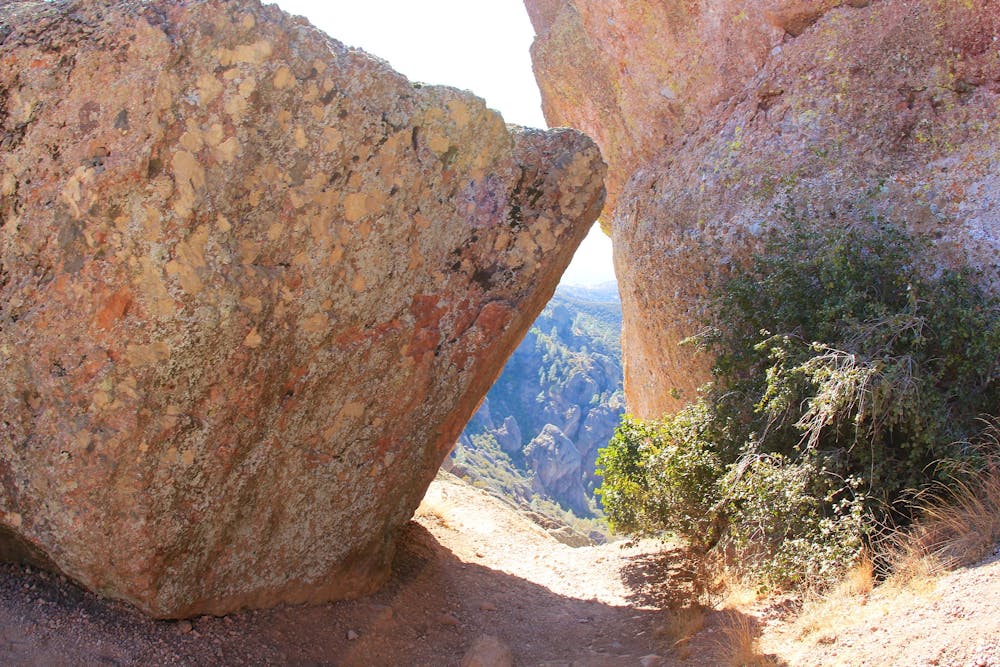
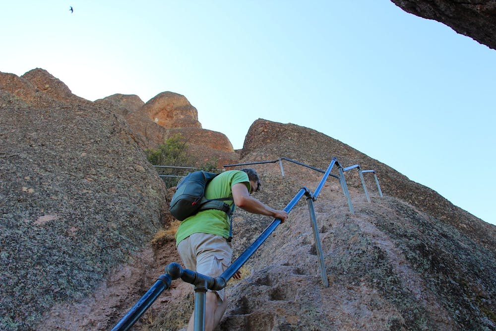
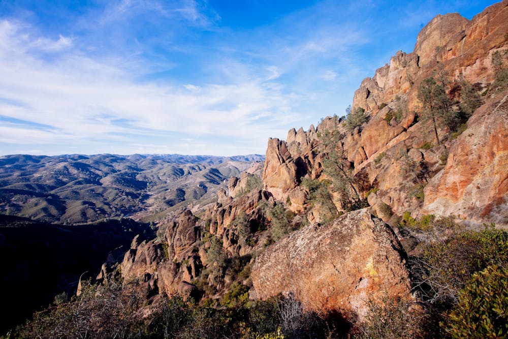
Continuing on the trail, you’ll weave among the rock walls to work your way along the ridgeline. There are tight corridors and airy ledges, accompanied by up-close nature as well as distant views. Wildflowers bloom in spring, and lizards scurry among the rocks. On a clear day you can see a mountainous horizon on every side. You’ll want to go slow and take it all in. Then comes the “Steep and Narrow section” as it’s officially called by the national park. This consists of cliffside traverses and footholds hewn into near-vertical rock. The most dangerous dropoffs are protected with handrails, but those afraid of heights may not enjoy themselves here. If you’re comfortable with a bit of exposure, however, you’ll likely relish this rocky ride in the sky.
After that section you’ll come to a trail junction where there’s a toilet building. Beyond there, the trail makes a quick descent using several switchbacks to get down the mountain. It then wanders along a rolling ridge with scattered rock formations and wide-open views, and returns to Bear Gulch. The route mapped here does not include the side trip to Bear Gulch Cave and Reservoir, but that’s an easy and worthwhile extension if you’ve not yet seen those highlights of the park. Just follow Rim Trail and Moses Spring Trail to loop through the cave before returning to the trailhead.
Sources: https://www.nps.gov/pinn/planyourvisit/trails.htm https://www.hikespeak.com/trails/high-peaks-trail-condor-gulch-pinnacles-national-monument/
Difficult
Hiking trails where obstacles such as rocks or roots are prevalent. Some obstacles can require care to step over or around. At times, the trail can be worn and eroded. The grade of the trail is generally quite steep, and can often lead to strenuous hiking.

Some trail sections have exposed ledges or steep ascents/descents where falling could cause serious injury.

Away from help but easily accessed.
129 m away
One of the most popular hikes in Pinnacles National Park
Moderate Hiking
129 m away
The highest peak in Pinnacles National Park, rising to a height of 3,306 feet above sea level.
Difficult Hiking
2.7 km away
A main attraction of Pinnacles National Park is the Balconies Cave––a cool passageway beneath giant boulders jumbled in a deep canyon.
Moderate Hiking
2.7 km away
This lollipop loop provides a little-hiked and quite technical approach to the High Peaks in Pinnacles National Park.
Severe Hiking
5 routes · Hiking

63 routes · Alpine Climbing · Hiking