3 m away
Warren Peak
Climb out of Black Rock Canyon to an airy summit overlooking much of Joshua Tree National Park.
Difficult Hiking
- Distance
- 8.4 km
- Ascent
- 328 m
- Descent
- 328 m
Hike through canyons and along a panoramic ridgeline, on this unique trail in an isolated corner of the national park.
Hiking Difficult

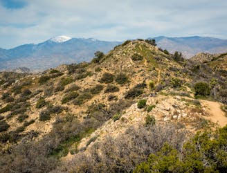
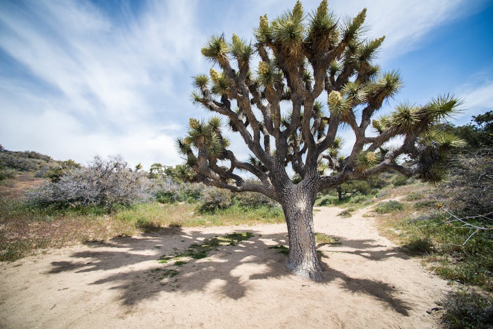
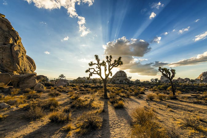
Panorama Loop is a bit off the beaten path in Joshua Tree because it’s not within the main park entrances. It’s accessed from Black Rock Canyon Campground, outside the town of Yucca Valley. The scenery is a bit different than what’s in the central area of the park. This western corner has more mountainous terrain and less of the scattered rock jumbles, but still has plenty of Joshua trees and its fair share of rock formations.
If you aren’t camping at Black Rock, you can use the day use parking at the visitor center there, and walk a short distance through the campground to access the trail. From the campground, the trail goes up toward a water tank, then down into a wash, and more or less follows the sandy streambed for a while. Rocky slopes close in on either side, forming a narrow canyon with cactus and brush-covered walls. You’ll notice Black Rock Spring, a trickle of water that's too muddy for drinking. Then comes a fork in the drainage, where you’ll choose left or right to begin the loop. The direction doesn’t matter much, but going right (counterclockwise) makes for more gradual elevation gain.
Soon comes another junction where one fork leads to Warren Peak and Morongo View, and the Panorama Loop continues up the other fork. This becomes a broad, sandy valley with some fine Joshua trees. Eventually, the drainage steepens, and the trail joins a high ridge, thus beginning the “panorama” section of the loop. On this windswept ridgeline are many flowering shrubs, but few trees, and views stretch over Coachella Valley toward Mount San Jacinto, often capped with snow. You can also see the San Bernardino Mountains and the hulking San Gorgonio.
To descend from the ridge, the trail takes some rocky switchbacks into another valley. Some robust pine trees and leafy oaks provide a little shade, which will be welcome on a hot day. Continuing downward, Joshua trees become plentiful once more. The drainage gradually necks down to become quite narrow and rocky again, then meets the junction that completes the loop, and you’ll backtrack the initial stretch of trail to the starting point.
Even though some of this hike is in canyons that stay relatively cool, most of it is quite exposed. Because of the distance and elevation gain, this one is best saved for the cooler seasons, but be prepared for chilly wind on the ridgeline.
Sources: https://modernhiker.com/hike/panorama-loop-from-black-rock-canyon-campground/ https://www.americansouthwest.net/california/joshuatree/panorama-trail.html
Difficult
Hiking trails where obstacles such as rocks or roots are prevalent. Some obstacles can require care to step over or around. At times, the trail can be worn and eroded. The grade of the trail is generally quite steep, and can often lead to strenuous hiking.

The trail contains some obstacles such as outcroppings and rock which could cause injury.
Away from help but easily accessed.
3 m away
Climb out of Black Rock Canyon to an airy summit overlooking much of Joshua Tree National Park.
Difficult Hiking
9 routes · Hiking