
72 routes · Hiking
Miles 454.5-485.7 of the northbound PCT: Beginning California Section E, with meandering miles through the desert hills.
Hiking Moderate

This is the start of California Section E, which is from Agua Dulce to Tehachapi Pass. It’s the section that links the Transverse Ranges of Southern California with the southern tip of the Sierra Nevada, crossing a valley of the Mojave Desert in between. Headed north from Agua Dulce, hikers spend a few more days in the hills before descending to face the flatlands, then a couple days of dusty walking to climb back out.
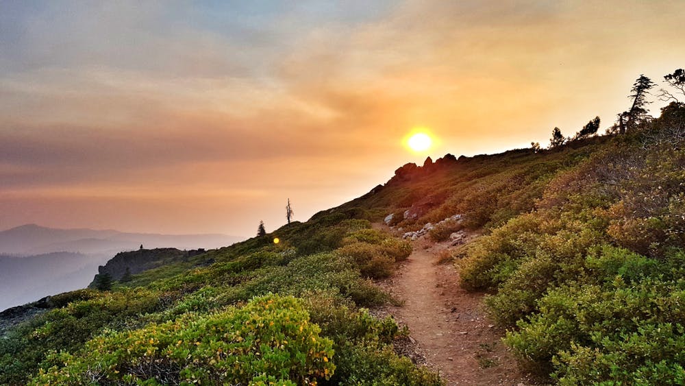
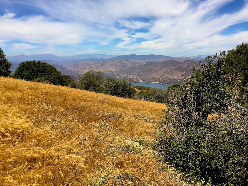
The journey begins as a road walk through the town of Agua Dulce (NB mile 454.5), where hikers can find restaurants but not much for resupply shopping. North of town the PCT becomes a dirt path and heads into the hills. Steadily winding upward through typical desert chaparral, the trail crests a ridge with a view of the town on one side, and Bouquet Reservoir on the other.
Shortly after starting the descent from this ridge, the trail passes Bear Spring (NB mile 463.2). It’s a piped water source that flows strong in early season, but can slow to a trickle or perhaps go dry by late season. Check the PCT Water Report for updated conditions on this and other sources. There could also be a cache at Bouquet Canyon Road farther down the hill, but it shouldn’t be relied upon.
After crossing the road, the PCT turns uphill once more. After another substantial ridge climb, the trail begins more of a contouring route northward. Scrub vegetation offers little shade, so this can be a very hot walk. The next water comes at Green Valley fire station from an outdoor spigot, reached by a short detour on San Francisquito Canyon Road (NB mile 478.2). The town of Green Valley is farther down this road, where hikers can find food and lodging.
From San Francisquito Canyon the trail makes a steep climb to cross over Grass Mountain, then steadily descends to Lake Hughes Road (NB mile 485.7). Two miles north is the tiny town of Lake Hughes which has one small store, a restaurant, and a post office.
Permits: In this part of Angeles National Forest, permits are not required for hiking through or for backcountry camping, but an Adventure Pass is required for parking at trailheads, and campgrounds may charge their own fees. Campfires are not generally allowed, but anyone camping overnight may still need the California Fire Permit for use of a camp stove.
Sources: https://pctmap.net/trail-notes/ https://pctwater.com/
Moderate
Hiking along trails with some uneven terrain and small hills. Small rocks and roots may be present.

The trail contains some obstacles such as outcroppings and rock which could cause injury.
Away from help but easily accessed.
72 routes · Hiking