
72 routes · Hiking
Miles 342-369.4 of the northbound PCT: A long and waterless ascent into the San Gabriel Mountains.
Hiking Difficult

This is the first part of California Section D, which is from Cajon Pass to Agua Dulce. The segment mapped here ends at Highway 2, a common place to start/end a section hike or hitch off the trail for resupply.
From Cajon Pass northbound, the PCT makes a long and sun-exposed climb into the San Gabriel Mountains, rising steadily into pine forest and much cooler air. It’s a net gain of about 5400 feet in less than 25 miles, and of course, there are downhill portions that must be regained as well. Camp spots with water are few or nonexistent, so you can expect a long and challenging day. The huge elevation gain is one difficulty, but then there are the dual hardships of miles without water plus early-season snow and ice. Relief can be found in the town of Wrightwood, reached by hiking or hitching a detour from the trail. Because of the logistical difficulties and potentially hazardous terrain, a hike of any distance here requires careful research and planning for conditions.
It is quite a rewarding feat, however, to travel from the desert to the mountains in one big day. Some hikers opt for a hotel at Cajon Pass in order to properly rest up, but another option is camping just to the east in Crowder Canyon (NB mile 341.4), where a seasonal creek might have water. Dispersed camping elsewhere near the interstate is also viable, though there are no other water sources. No matter where you spend the night, you’ll want to fill up at one of the businesses near the interstate exit, because the next water may not come for a long time.
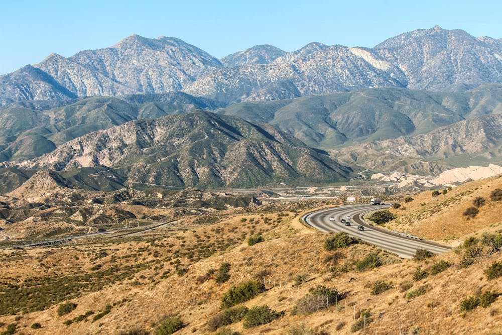
The journey begins as the PCT tunnels under the interstate and a railroad track, then makes a dusty climb into the foothills. It traces a ridgeline among house-sized blocks of sandstone, then drops to Swarthout Canyon Road (NB mile 347.3). This location often has a water cache maintained by trail angels, but it should not be relied upon. Check the PCT water report for recent updates.
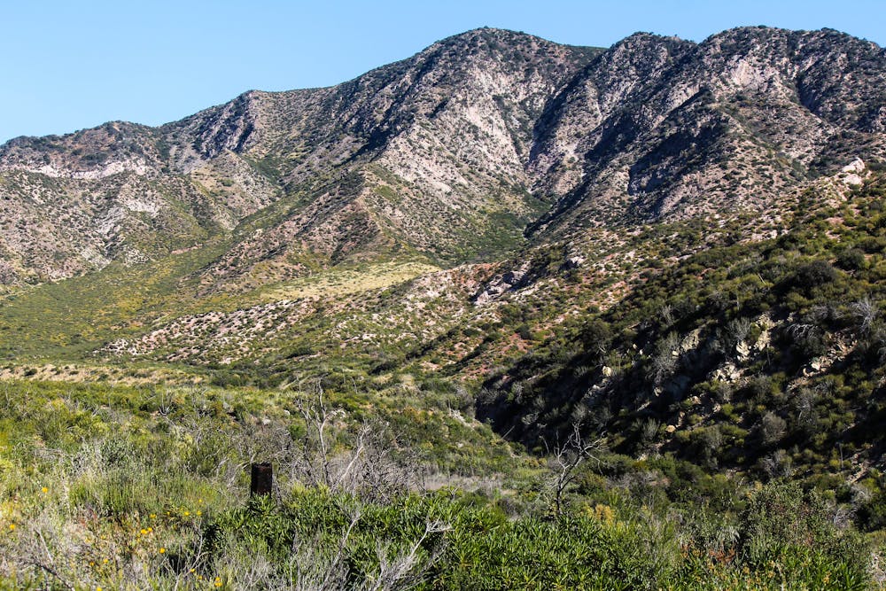
From there, the uphill resumes and barely relents for the rest of the day, as the PCT climbs an arm of the mountain range called Blue Ridge. Views are nearly constant to the high peaks of the San Gabriels, dominated by the north side of Mount Baldy. Throughout this segment the PCT frequently intersects with dirt roads, but still feels wildly remote in the middle reaches, where it’s far from any trailheads or highways.
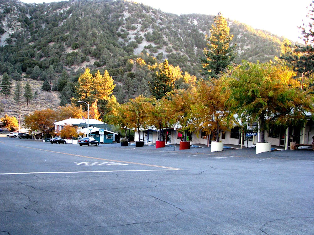
In early season you may reach snow around Wright Mountain, if not before. You may even notice a memorial to “Jodi & Jerry” who died in a fall down a chute in the winter of 1983. Just past Wright Mountain, the intersection with Acorn Trail (NB mile 363.4) provides the first option to leave the PCT for Wrightwood. This welcoming trail town has food, lodging, and handy resupply shopping at the local hardware store, which is next door to the post office. If you’d rather avoid the descent of 2000+ feet via Acorn Trail, you can instead try to hitch from the highway later on (NB mile 369.4).
Guffy Campground (NB mile 364.4) has a spring that may provide your first water along this section. However, according to the PCT Water Report, the spring has become less reliable in recent years. Moving farther up the Blue Ridge from there, the PCT meets some ski slopes at the top of Mountain High Resort. Then it’s just a bit farther to Inspiration Point, a popular overlook and trailhead on the Angeles Crest Highway (Highway 2). There are toilets and trash cans, but no water. It’s commonplace for hikers to hitch from there into Wrightwood for the night. Just a bit farther on the trail is Grassy Hollow Visitor Center, which normally has water. However, the visitor center closed due to COVID-19 and the spigot was turned off. A date for reopening has not been announced as of May 2021. The next water is not until Lamel Spring (NB mile 375.9).
Permits: In this part of Angeles National Forest, permits are not required for hiking through or for backcountry camping, but an Adventure Pass is required for parking at trailheads. Campfires are not generally allowed, but anyone camping overnight may still need the California Fire Permit for use of a camp stove.
Sources: https://pctwater.com/ https://pctmap.net/trail-notes/ https://www.trailjournals.com/journal/entry/619638
Difficult
Hiking trails where obstacles such as rocks or roots are prevalent. Some obstacles can require care to step over or around. At times, the trail can be worn and eroded. The grade of the trail is generally quite steep, and can often lead to strenuous hiking.

The trail contains some obstacles such as outcroppings and rock which could cause injury.

Little chance of being seen or helped in case of an accident.
72 routes · Hiking