1.9 km away
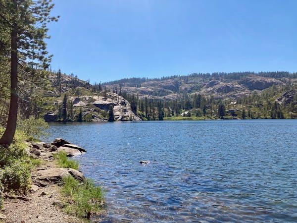
Pacific Crest Lakes Basin Loop
A stunning hike on the Pacific Crest Trail and the spine of the Sierras.
Difficult Hiking
- Distance
- 18 km
- Ascent
- 618 m
- Descent
- 618 m
Steep but well-traveled trail to the imposing summit of Sierra Buttes, and an airy platform on a historic fire tower.
Hiking Difficult

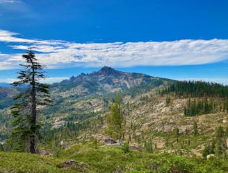
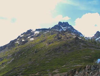
The mountain called Sierra Buttes is a stand-out landmark near Downieville, California. This cliff-lined peak is the tallest in the area, and it’s crowned with multiple craggy pinnacles. Atop one of these granite outcrops is a fire lookout tower, dated but still sturdy, that grants a royal view for those who ascend all the way to it.
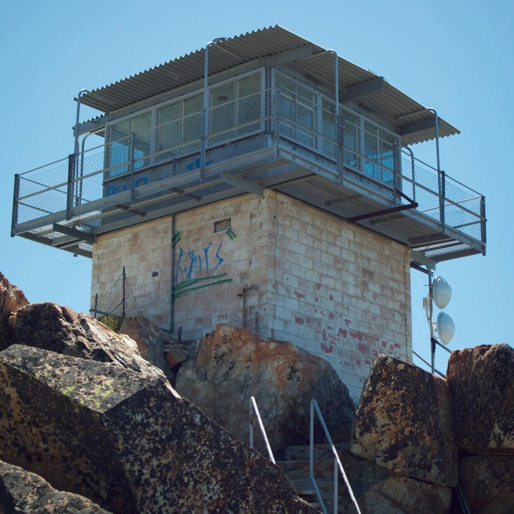
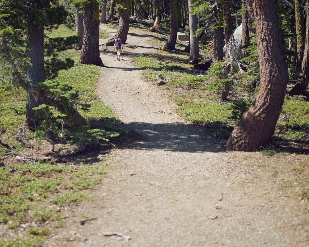
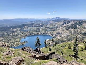
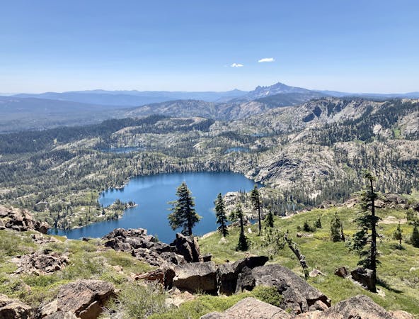
The hike begins at Sierra Buttes Trailhead, and follows the Pacific Crest Trail for a little while before the path to the lookout branches off. It’s a wide and well-traveled trail, but steep the whole way. It traces the main ridgeline of the mountain through meadows and scattered trees. Eventually, the vertical cliffs near the top of the mountain come into view, and you can glimpse some blue lakes in the forested basin below. Continue up steepening switchbacks to go around the backside of some dramatic cliffs. You’ll then reach a metal staircase, which scales the final 150 feet up a rock face to the tower. The interior of the lookout is closed, but the outside platform is accessible and safely guarded with a handrail. It’s an airy perch with phenomenal views.
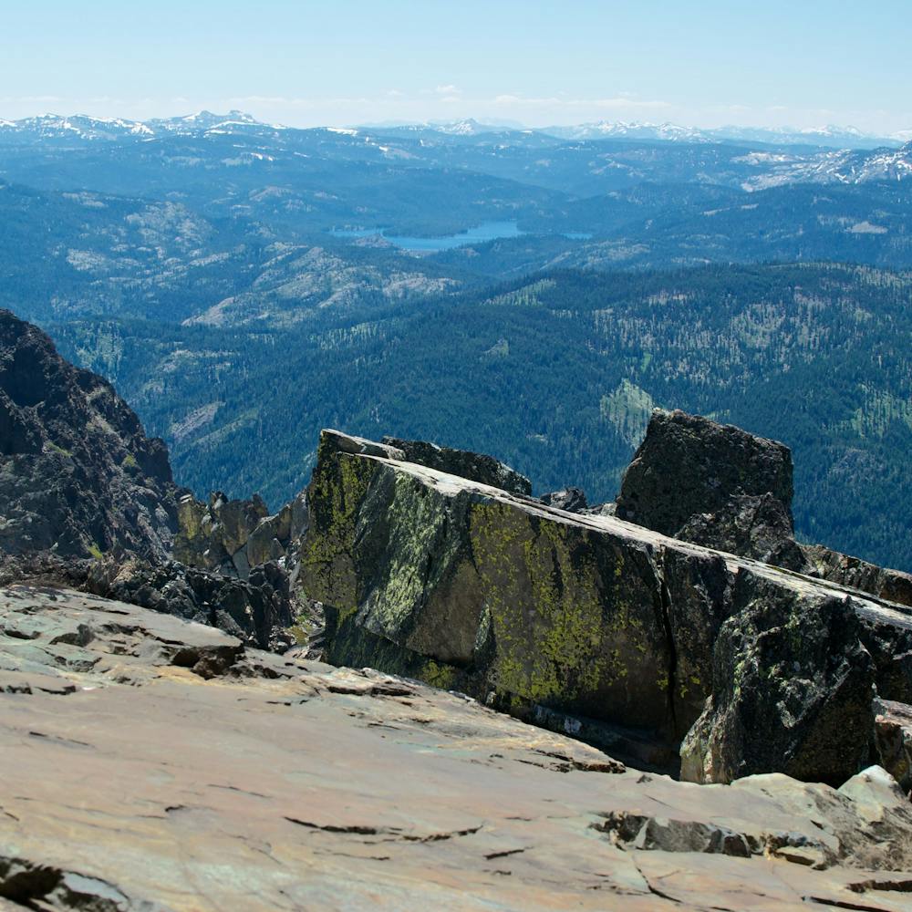
On a clear day with no smoke in the air, you can easily see 100 miles in all directions. The panorama includes mountains around Lake Tahoe and Lassen Peak in Lassen Volcanic National Park. Even if the horizon is hazy, you can enjoy the view into the Yuba River Valley and gaze at the Sardine Lakes far below.
Sources: https://californiathroughmylens.com/sierra-buttes-fire-lookout https://www.fs.usda.gov/recarea/tahoe/recreation/hiking/recarea/?recid=55962&actid=50
Difficult
Hiking trails where obstacles such as rocks or roots are prevalent. Some obstacles can require care to step over or around. At times, the trail can be worn and eroded. The grade of the trail is generally quite steep, and can often lead to strenuous hiking.

Some trail sections have exposed ledges or steep ascents/descents where falling could cause serious injury.

Away from help but easily accessed.
1.9 km away
A stunning hike on the Pacific Crest Trail and the spine of the Sierras.
Difficult Hiking
6 km away
Miles 1195.4-1234.8 of the northbound PCT: A big climb from the river to the crest, then a stroll along ridges and forest mosaic to the edge of an extensive burn area.
Moderate Hiking
9.1 km away
Gain stunning views above the Lakes Basin area from the summit of Mt. Elwell.
Difficult Hiking
9.1 km away
Dip your toes into Lakes Basin hiking!
Difficult Hiking

5 routes · Hiking
7 routes · Hiking
4 routes · Hiking · Stand Up Paddle

72 routes · Hiking