1.9 km away
Sierra Buttes Fire Lookout
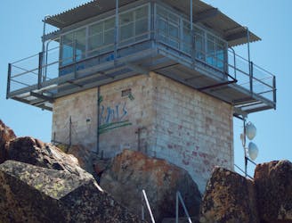
Steep but well-traveled trail to the imposing summit of Sierra Buttes, and an airy platform on a historic fire tower.
Difficult Hiking
- Distance
- 7.6 km
- Ascent
- 478 m
- Descent
- 478 m
A stunning hike on the Pacific Crest Trail and the spine of the Sierras.
Hiking Difficult

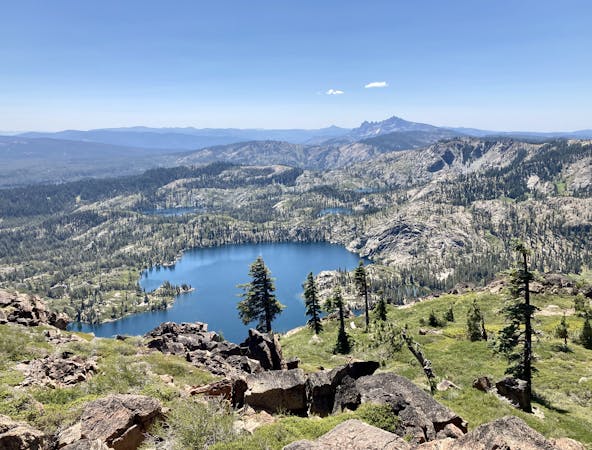
Pair the stunning Lakes Basin area with mountain top singletrack running along the spine of the Sierras on this epic high-mountain loop!
The route begins at a trailhead on Packer Lake Road, quickly making for the top of the ridge via the Pacific Crest Trail. This section of the PCT is a new alignment, as is the section that you’ll run as you descend from the ridge. The original alignment of the Pacific Crest Trail in this area followed the spine of the ridge, which you’ll hike as well. In essence, this loop combines the new PCT section with the old one into a stunning loop!
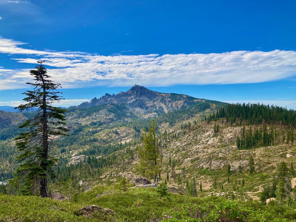
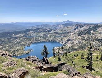
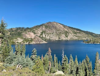
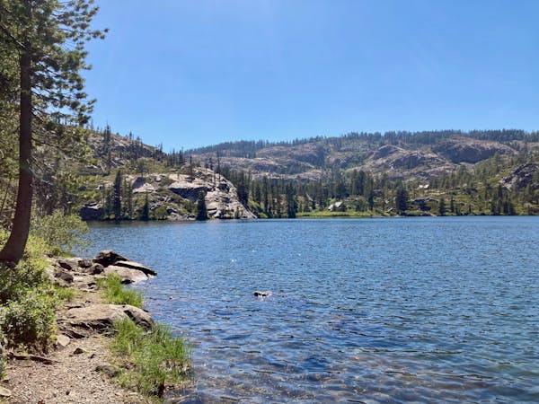
During your climb from the Basin, you’ll get to enjoy views of the Tamarack Lakes—a couple of the crystal-clear alpine lakes that the Lakes Basin is named for. After the lakes, keep switchbacking up the mountainside in earnest, eventually gaining the mountain ridge.
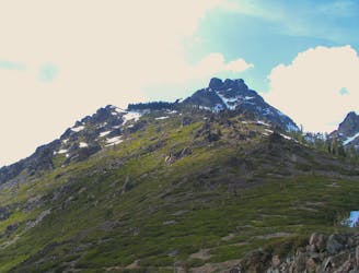
Once on the ridge, you’re not far from the Sierra Buttes Fire Lookout, which provides an incredible 360-degree view of the Lost Sierras! If you’re interested in a stunning view and a few bonus miles, consider turning left to tag the lookout before heading right along the ridge.
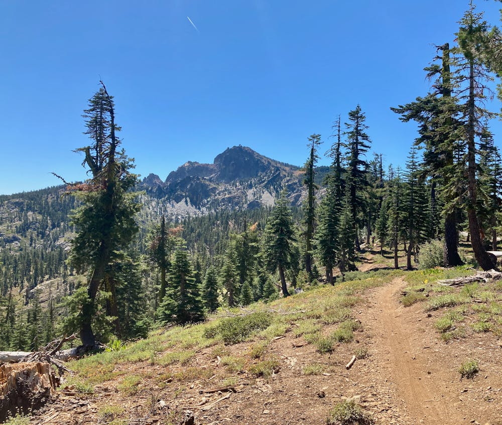
After a couple miles of hiking, you’ll pass Packer Saddle and continue on the original PCT alignment, now known as the Gold Valley Rim Trail. This section of trail is now shared with mountain bikers, but it isn’t nearly as popular as the downhill trails descending toward Downieville.
The Gold Valley Rim singletrack is flowy and scenic, providing absolutely stunning views of the Lakes Basin spread out below you and the Sierra Buttes behind you. A few turns in the trail even provide stunning vistas of the Sierra Buttes in all their glory!
After several miles of the best ridgetop hiking imaginable, you’ll turn right again just above Deer Lake to descend the new PCT alignment, dropping back down into the Basin, ending your loop exactly where you began.
Difficult
Hiking trails where obstacles such as rocks or roots are prevalent. Some obstacles can require care to step over or around. At times, the trail can be worn and eroded. The grade of the trail is generally quite steep, and can often lead to strenuous hiking.

The trail contains some obstacles such as outcroppings and rock which could cause injury.

Little chance of being seen or helped in case of an accident.
1.9 km away
Steep but well-traveled trail to the imposing summit of Sierra Buttes, and an airy platform on a historic fire tower.
Difficult Hiking
6.2 km away
Miles 1195.4-1234.8 of the northbound PCT: A big climb from the river to the crest, then a stroll along ridges and forest mosaic to the edge of an extensive burn area.
Moderate Hiking
7.7 km away
Gain stunning views above the Lakes Basin area from the summit of Mt. Elwell.
Difficult Hiking
7.7 km away
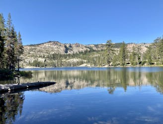
Dip your toes into Lakes Basin hiking!
Difficult Hiking
9.4 km away
One of the most popular sights in the Lakes Basin.
Easy Hiking
9.8 km away
Challenging hike in the Lakes Basin.
Severe Hiking

5 routes · Hiking
7 routes · Hiking
4 routes · Hiking · Stand Up Paddle

72 routes · Hiking