4.7 km away
San Francisco Bay Trail: Sunnyvale to Sand Point
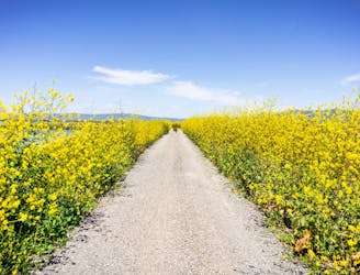
An extremely scenic portion of the San Francisco Bay Trail.
Easy Hiking
- Distance
- 16 km
- Ascent
- 37 m
- Descent
- 36 m
A flat, easy and easily-alterable stroll through San Jose's suburbs
Hiking Easy

The Stevens Creek Trail spans approximately 5 miles along the banks of Stevens Creek, with multiple access points throughout San Jose and neighboring communities. Popular trailheads include Shoreline Park, Baylands Park, and the NASA Ames Research Center, but regardless of where you enter, you can choose how far to hike and then just turn around and head back to the car. We've drawn the route going all the way the trail's northern and southern terminuses but it can easily and logically be shortened.
As you traverse the Stevens Creek Trail, you'll be treated to picturesque views of the creek, surrounding wetlands, and nearby mountain ranges. The trail winds through diverse landscapes, including marshlands and open fields, so despite not being remote it's a nice fix of nature. The trail is wide and well-maintained, so it's suitable for the whole family.
Several parks and picnic areas are located along the trail, providing plenty of opportunities for a picnic or a scenic rest stop. Find a lovely spot and soak it all in!
Easy
Walking along a well-kept trail that’s mostly flat. No obstacles are present.

The path is on completely flat land and potential injury is limited to falling over.
Close to help in case of emergency.
4.7 km away
An extremely scenic portion of the San Francisco Bay Trail.
Easy Hiking

13 routes · Hiking · Trail Running