6.7 km away
Winnemucca Lake Wildflower Hike
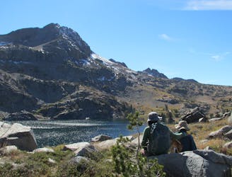
Hike among especially colorful wildflowers and open meadows to a cliff-lined alpine lake.
Moderate Hiking
- Distance
- 7.8 km
- Ascent
- 192 m
- Descent
- 192 m
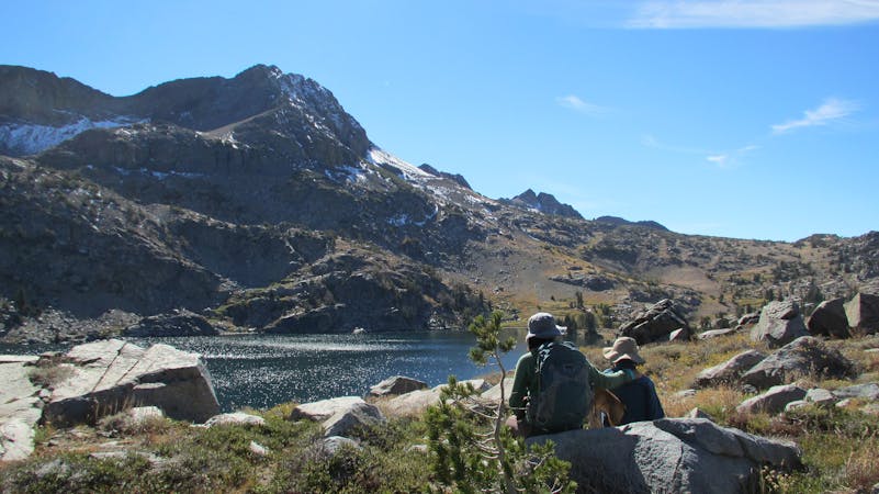
Forested canyon with a flowing creek where an isolated mining town used to thrive, leading to a panoramic mountain pass.
Hiking Moderate

Summit City was a boom-and-bust gold and silver mine established in the 1860s. A few families lived in the canyon now named after their town, tucked high into the mountains, and hoped to strike it rich. Even today Summit City Canyon is remote. An under-traveled trail leads through its quiet forest and alongside a tumbling creek, eventually climbing to a panoramic pass shared with the Pacific Crest Trail.
The journey begins from Upper Blue Lake Campground on the Evergreen Trail. This trail ascends sharply to a forested pass then drops into the drainage of Summit City Creek. It crosses the creek then joins the path of a long-abandoned road that used to reach Summit City. Little remains of the town and the mines. Wildfires and the regenerating forest have reclaimed their territory in the past century.
At a three-way junction, the trail along the creek continues toward Fourth of July Lake, but the Summit City Trail turns and climbs out of the canyon through hillside meadows. It eventually reaches Forestdale Divide and a junction with the Pacific Crest Trail. From here, near treeline on a windswept pass, you can see mountains for miles and a few blue lakes cradled among them. Return the way you came, or continue a backpacking trip on the Pacific Crest Trail. Camping requires a backcountry permit from the Eldorado National Forest, Amador Ranger District.
Sources: https://www.fs.usda.gov/recarea/eldorado/recarea/?recid=80481 https://www.fs.usda.gov/recarea/eldorado/recarea/?recid=80473 https://backcountrypost.com/threads/summit-city-canyon.7083/ https://tahoetowhitney.org/content/historical-history-summit-city-creek
Moderate
Hiking along trails with some uneven terrain and small hills. Small rocks and roots may be present.

The trail contains some obstacles such as outcroppings and rock which could cause injury.
Away from help but easily accessed.
6.7 km away
Hike among especially colorful wildflowers and open meadows to a cliff-lined alpine lake.
Moderate Hiking
4 routes · Hiking