5 routes · Trail Running
Varied and hilly terrain along the San Andreas Fault, with redwood groves in the valley and wide-open views on the ridge.
Trail Running Difficult

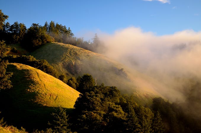
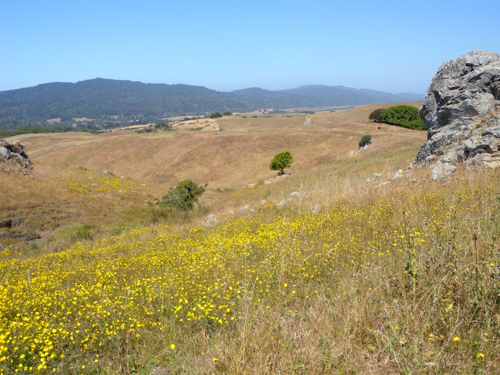
This long, hilly loop is great for distance training, and for exploring the geography surrounding one of California’s most famous features—the San Andreas Fault. Olema Valley is actually a rift zone, while Bolinas Ridge to the east and Inverness Ridge to the west are the uplifts on either side of the fault. Highway 1 runs practically on top of the fault through the valley. The surroundings are a pastoral setting of rolling grassland and chaparral, enclosed by quiet redwood forest on the hillsides.
This loop uses trails in both Golden Gate Recreation Area and Point Reyes National Seashore to cover much of Olema Valley and the most scenic stretch on Bolinas Ridge. There are multiple designated trailheads along the loop, giving different options for starting points. As mapped, it begins at Bolinas Ridge Trailhead along Sir Francis Drake Blvd. Starting there, you’ll run a little more than a mile along the road, mostly downhill, through the town of Olema to meet Rift Zone Trail. From there, the rest of the loop is dirt trails and fire roads.
Rift Zone Trail takes you through shady forest and small meadows, with gentle ups and downs, and leads to Five Brooks Trailhead. Olema Valley Trail continues from there, and soon makes a somewhat steep and rocky ascent on a forested flank of Inverness Ridge, then gradually drops back to the valley floor and crosses Olema Creek. Cross Highway 1 at Randall Trailhead, and get ready for the real climbing to begin.
Randal Trail is an old fire road that makes a determined ascent to Bolinas Ridge. It’s steep and sustained, but luckily shaded beneath a mixed-conifer canopy. At the top of this slog comes the real reward—the downhill return on Bolinas Ridge.
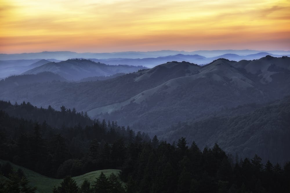
Running Bolinas in this direction grants fantastic views on a clear day. You can see the blue of Tomales Bay dead ahead, among a sea of green hills all around. The trail is a fire road through wide-open, grassy pasture on the ridgeline. At the bottom is the same trailhead where you started.
Sources: https://www.nps.gov/goga/planyourvisit/bolinas.htm https://www.parksconservancy.org/parks/olema-valley https://www.nps.gov/pore/planyourvisit/upload/mapdogareasgoga.pdf
Difficult

The trail contains some obstacles such as outcroppings and rock which could cause injury.
Away from help but easily accessed.
5 routes · Trail Running