8.8 km away
Redcloud and Sunshine Peak
A relatively mellow climb up two beautiful 14ers deep in the San Juans.
Severe Hiking
- Distance
- 16 km
- Ascent
- 1.3 km
- Descent
- 1.3 km
Escape the crowds and climb this popular 14er, known for its beauty, by hiking the Grouse Gulch route to 14,048' Handies Peak.
Hiking Severe

Though 1-3 miles longer than the more commonly used routes, the Grouse Gulch route can be accessed without a 4wd vehicle and provides 3 miles of sheer solitude before joining the hikers coming from the American Basin trailhead.
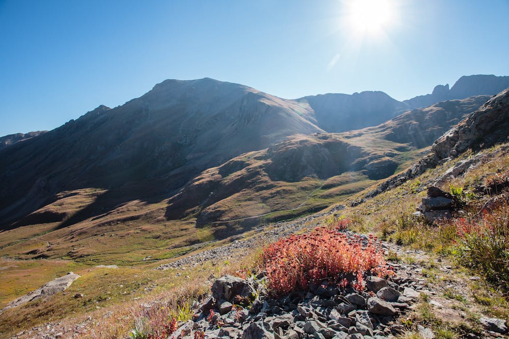
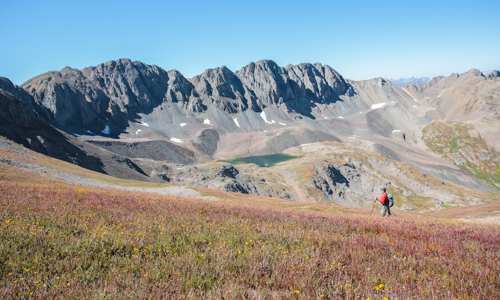
One of the advantages of a non-standard route like Grouse Gulch is the solitude. One of the reasons for the solitude is the rougher trail and longer distance. Those factors are well-worth the glory of hiking miles without encountering other people.
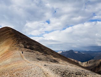
As the trail snakes through the lovely Grouse Gulch, the Handies Gulch Trail comes into view, with the expected increase in users. Since this is not a wilderness area, even stalwart mountain bikers can be seen trudging uphill, pushing their bikes. Their payoff is the ride back down!
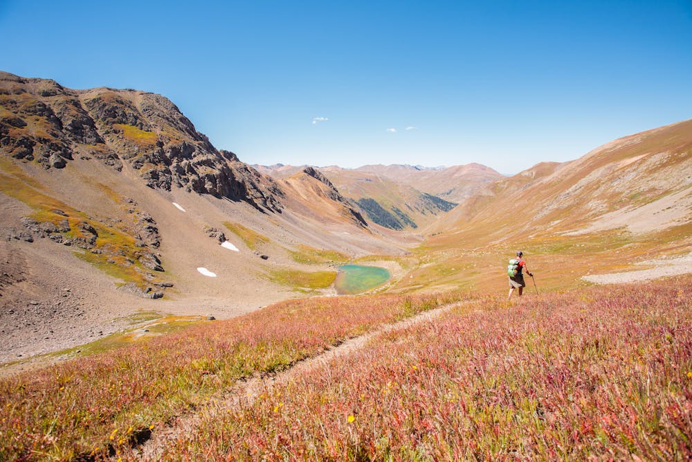
Leaving the solitude behind, the Handies Peak Trail is well-used and defined all the way to the summit.
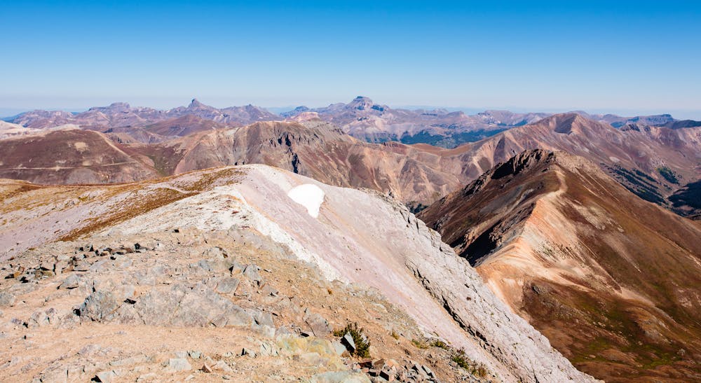
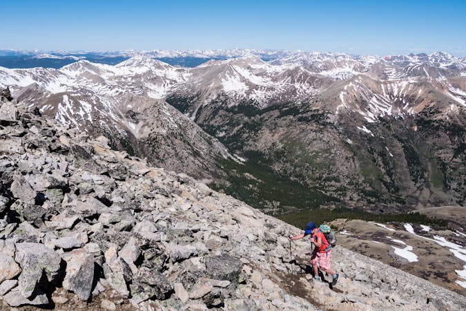
The true reward for hiking to Handies' 14,048' summit is its renowned views. The San Juans are stunning and Handies' vantage point provides glorious 360° jaw-dropping visual access to the best of the San Juans. It would be impossible to gaze in any direction from this spot and remain blasé.
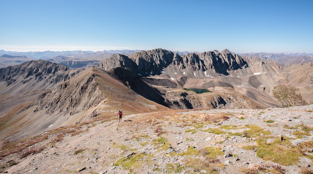
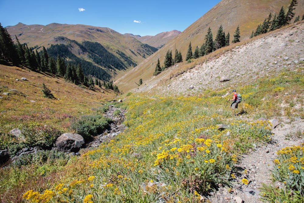
After soaking in the beauty for as long as desired, start the descent back to American Basin. Be sure to take a short detour to enjoy Sloan Lake along the way.
As American Basin is left behind, solitude returns. A wonderful part of out-and-back mountain hikes is that things can be seen coming back that were hidden on the way out. A sweet treat on the return trip through Grouse Gulch is an emerald-hued pond nestled in a low spot.
Severe
Hiking challenging trails where simple scrambling, with the occasional use of the hands, is a distinct possibility. The trails are often filled with all manner of obstacles both small and large, and the hills are very steep. Obstacles and challenges are often unexpected and can be unpredictable.

Some trail sections are extremely exposed where falling will almost certainly result in serious injury or death.

Away from help but easily accessed.
8.8 km away
A relatively mellow climb up two beautiful 14ers deep in the San Juans.
Severe Hiking
10 routes · Alpine Climbing · Hiking
6 routes · Alpine Climbing · Hiking

46 routes · Alpine Climbing · Hiking