3 km away
Echo Canyon Trail
A short hike to a lovely box canyon.
Moderate Hiking
- Distance
- 4.4 km
- Ascent
- 187 m
- Descent
- 187 m
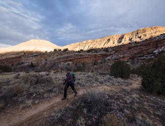
A stunning, easily-accessible hike to the Lunch Loops high point.
Hiking Severe

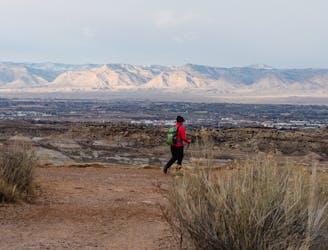
While the Lunch Loops trail system might be best-known for mountain biking, the easy access from Grand Junction makes it a hotspot for hikers and trail runners alike! This easily-accessible trail system received its colloquial name due to its close proximity to downtown—which you’ll be able to see from this hike. This network is close enough that the locals can easily snag a quick hike or run during their lunch hour, after work, between meetings… you get the idea.
While a plethora of shorter options are available close to the trailhead, this loop heading up Holy Cross and down Eagle’s Wing reaches the high point of the trail system, and the subsequently stunning views from the top of the ridge!
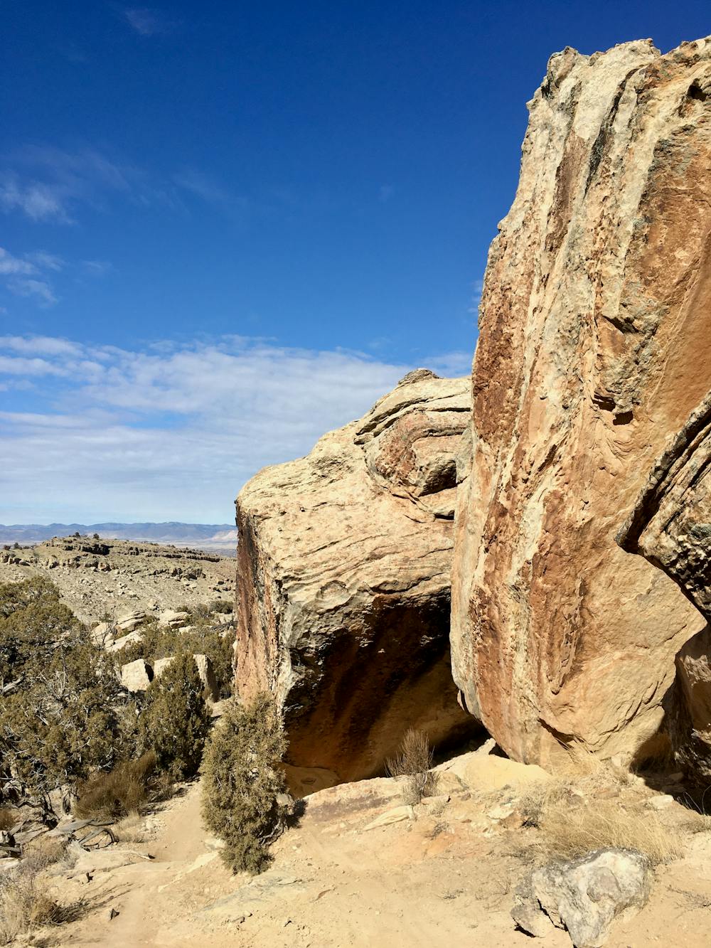
After climbing up Curts and Ali Alley, you’ll soon reach the Holy Cross trail, which is your main ascent through the trail system. This beautiful trail winds through towering sandstone rock formations and up a series of rocks and boulders, gaining elevation slowly but steadily.
Holy Cross is one of the most popular downhill mountain bike trails in the network, and while it’s open to two-way multi-use traffic, it’s a good idea to remain vigilant of bikes coming downhill. That’s why the loop is mapped in this direction: you’ll be able to see the bikes coming as you climb up the mountain.
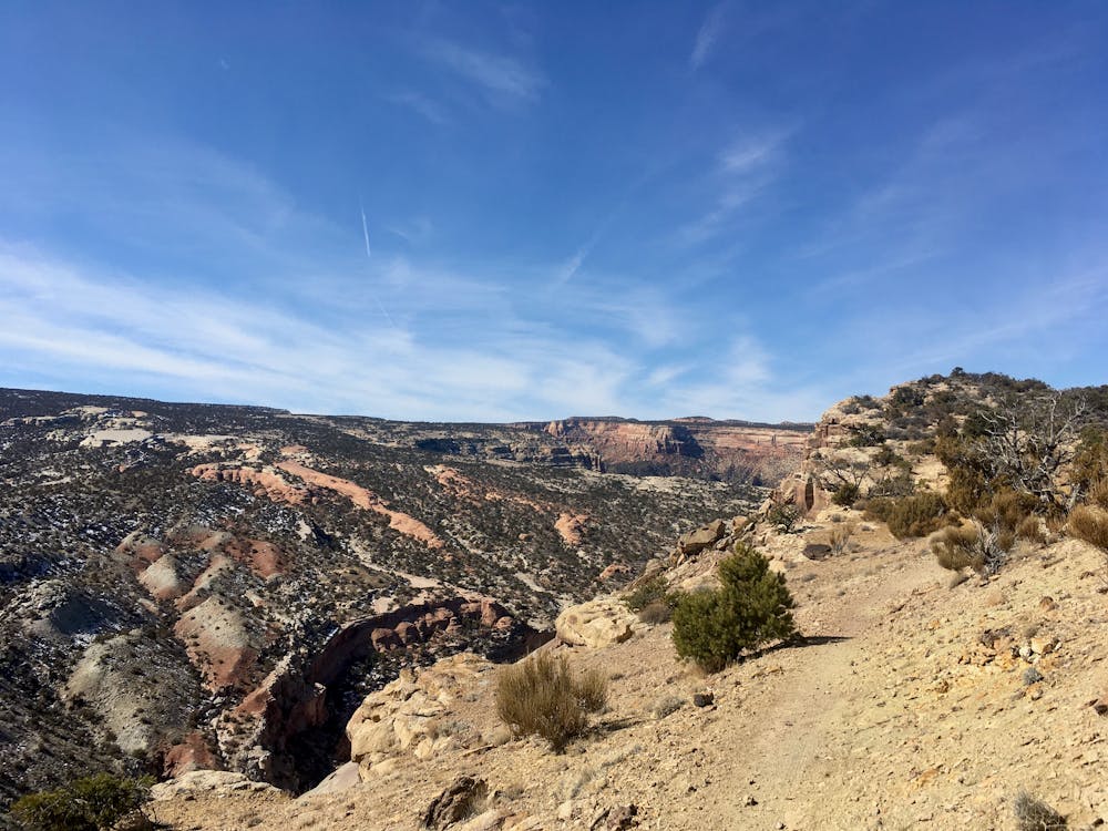
After completing Holy Cross, continue climbing on the Tabeguache Trail to reach Lunch Line.
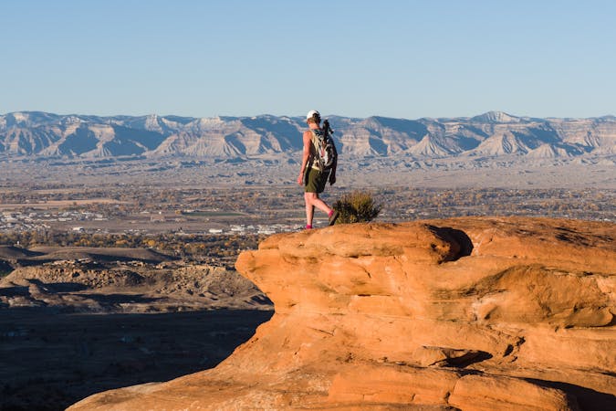
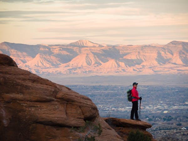
Once on Lunch Line, the views really crank up to 11, with narrow bench cut singletrack and gorgeous views of Colorado National Monument, the Ribbon, and more.
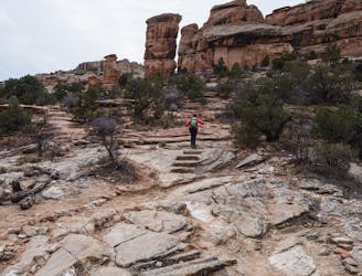
Eagle’s Wing provides a steep, visually-stunning descent down a knife-edge ridge. The trail winds its way down the airy, exposed ridge over massive rock boulders, ledges, and loose sections. After safely negotiating the knife-edge ridge, the trail turns away from the rim, and the exposure and fall danger diminishes substantially. The rocks and ledges continue, but the airy feeling is gone.
About halfway down the mountain, you have a decision: either continue following Eagle Tail all the way down or, if you so desire, you could also cut across on High Noon and descend Pet-E-Kes. If you’d prefer a lower-angle trail to spare your knees and joints, opting for Pet-E-Kes is a smart option. Otherwise, keep following Eagle Tail or come back the next day and try out the other option!
Severe
Hiking challenging trails where simple scrambling, with the occasional use of the hands, is a distinct possibility. The trails are often filled with all manner of obstacles both small and large, and the hills are very steep. Obstacles and challenges are often unexpected and can be unpredictable.

Some trail sections have exposed ledges or steep ascents/descents where falling could cause serious injury.

Away from help but easily accessed.
3 km away
A short hike to a lovely box canyon.
Moderate Hiking
3 km away
A short hike to a lovely rock grotto.
Moderate Hiking
3 km away

A gorgeous slickrock route with plenty of scrambling opportunities.
Moderate Hiking
3 km away
16 switchbacks take hikers up a historic old road.
Moderate Hiking
6 routes · Hiking
10 routes · Hiking