3 m away
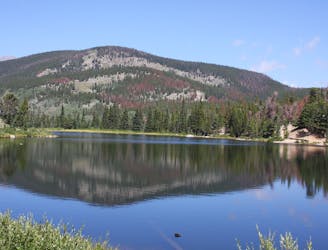
Lost Lake
Waterfalls, flowers, aspen trees, and an alpine lake—a colorful sample of Colorado in one simple day hike.
Difficult Hiking
- Distance
- 6.6 km
- Ascent
- 275 m
- Descent
- 275 m
Long day hike or overnight trip into a wilderness area, with pristine alpine lakes near the Continental Divide.
Hiking Difficult

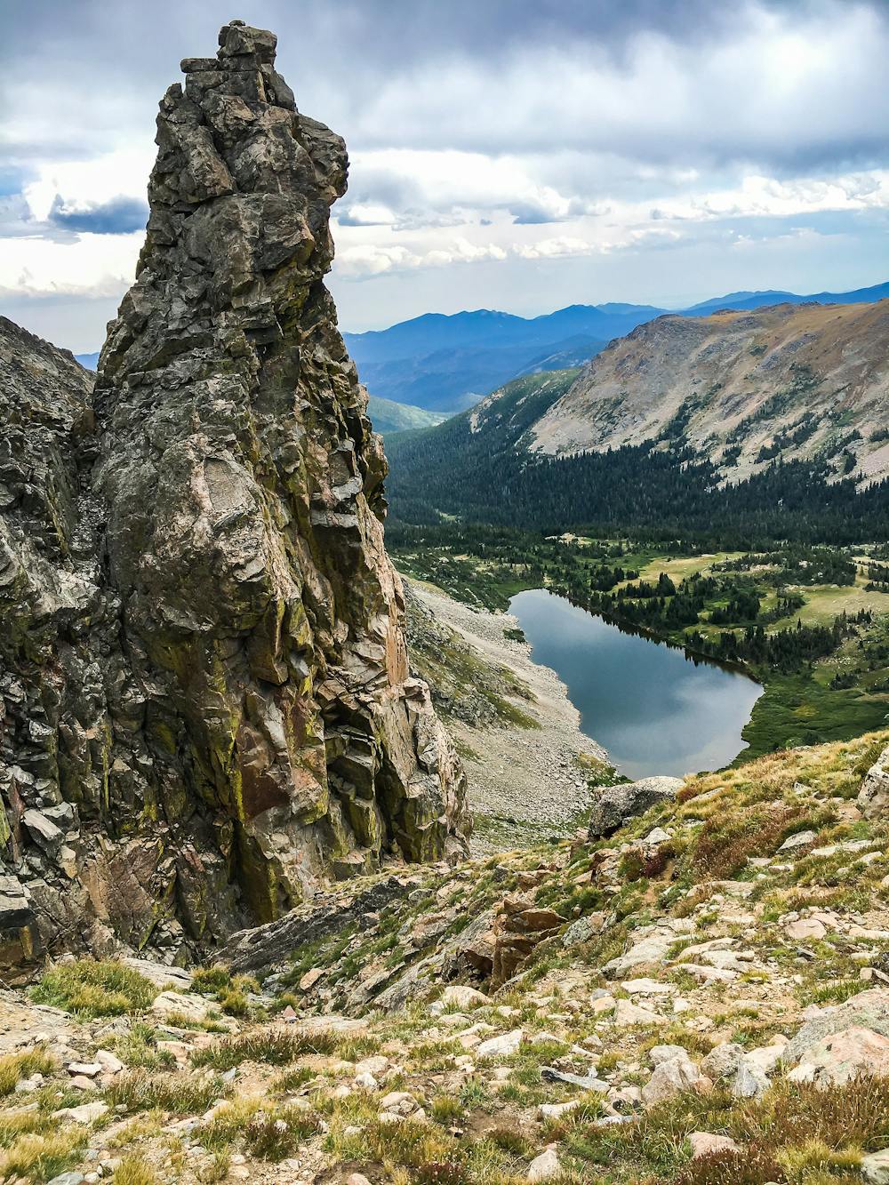
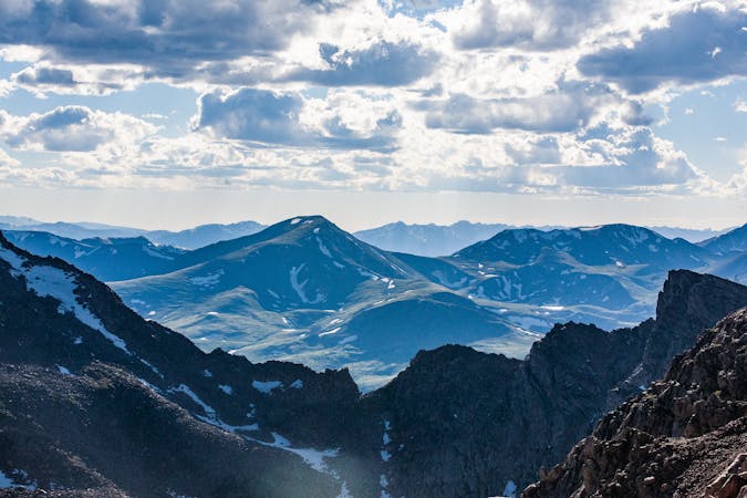
Jasper Lake and Devils Thumb Lake are two sparkling gems in the Indian Peaks Wilderness. Jasper Lake comes first and makes a good turnaround point if you don’t want to take on the full distance. Pushing to the next lake is an extra challenge but well worth it. It’s named for the Devils Thumb rock formation that towers overhead, protruding from a barren ridgeline that is the Continental Divide.
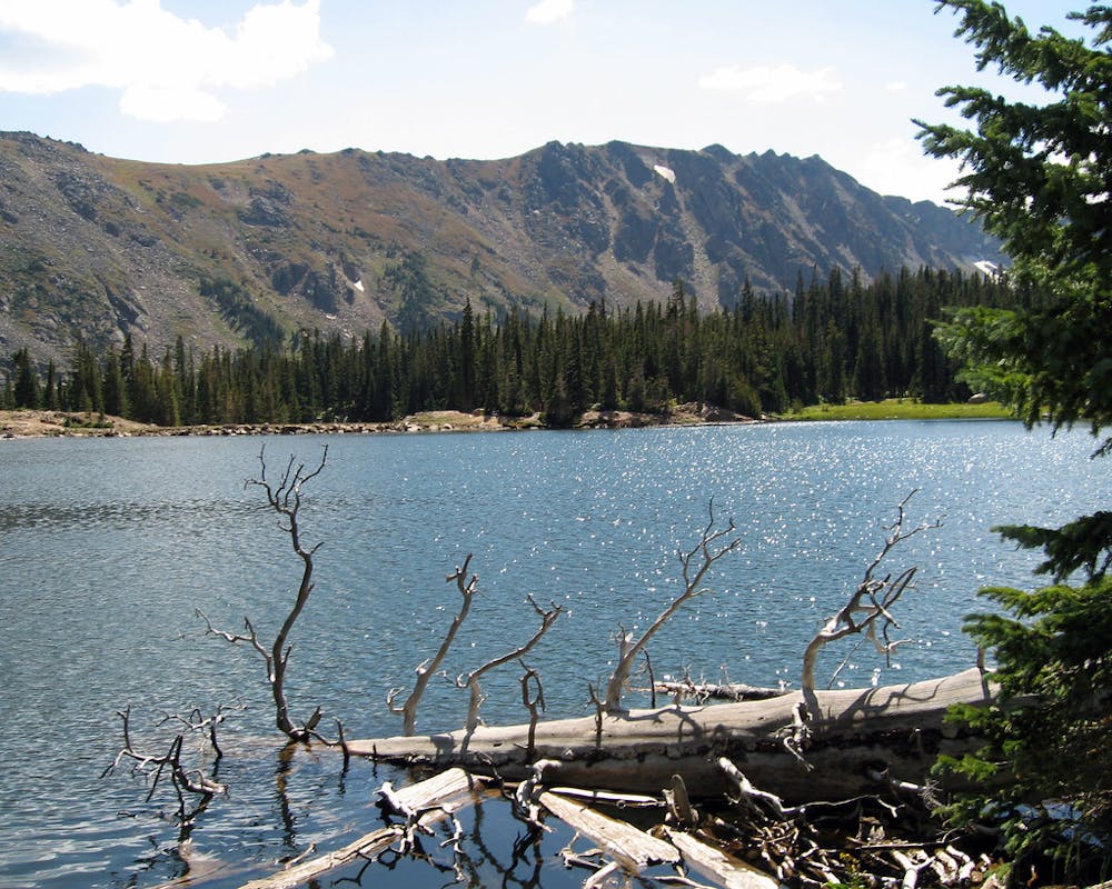
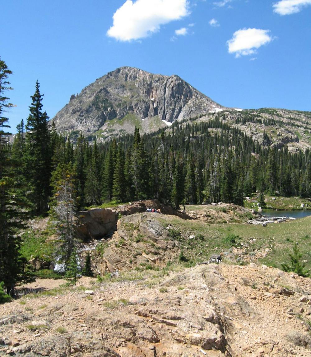
At both Jasper Lake and Devils Thumb Lakes, you’ll enjoy eyefuls of Rocky Mountain grandeur. Tall peaks with permanent snowfields tower over verdant, spruce-speckled basins, and as a hiker, you’ll feel tiny in the middle of it. This is one of the more demanding day hikes in the area if you choose to do it as a day hike. You can alternatively tackle this as an overnight backpacking trip, but you need to reserve a permit through the Forest Service. Turning around at Jasper shaves about 2 miles and considerable elevation change off the round trip.
The hike begins from Hessie Trailhead on Fourth of July Road, where parking is limited and often fills up. On Saturdays and Sundays in summer and fall, you can take a free shuttle from the nearby town of Nederland. Most of the crowds head to Lost Lake, however, a much shorter hike than Jasper. Once you pass the turnoff for Lost Lake, you’ll see far fewer people on the trail.
Much of the trail to Jasper Lake is an abandoned mining road, but just because it’s wide don’t expect it to be easy. The grades are still steep and the surface uneven. Parts may be muddy or loose. It runs alongside a creek that tumbles in bouldery cascades, among shady conifer and aspen forest. Occasionally it pops out in sunny meadows that are colored with wildflowers in the warm months. In these clearings, you’ll also get great views of the peaks that lie ahead.
Keep working steadily upward, and soon you’ll come to Jasper Lake. If you decide to continue to Devils Thumb, you’ll follow a narrower and steeper trail that climbs nearly to treeline, where this next stunning pool lies. The trail actually continues past the lake and climbs to the pass above as well. There it intersects with the Continental Divide Trail and reaches a spectacular view at eye level with the Devils Thumb formation. Hike to it only if you time and energy, and if the weather seems good. Watch the weather closely, because storms pop up suddenly and the terrain around Devils Thumb Lake is exposed to lightning strikes. Don’t hesitate to let the weather dictate the length of your hike.
Sources: https://www.fs.usda.gov/recarea/arp/recreation/hiking/recarea?recid=28244&actid=51 https://www.fs.usda.gov/Internet/FSEDOCUMENTS/fsm91058151.pdf https://www.hikingincolorado.org/devi.html https://www.bouldercounty.org/open-space/parks-and-trails/hessie-trailhead/
Difficult
Hiking trails where obstacles such as rocks or roots are prevalent. Some obstacles can require care to step over or around. At times, the trail can be worn and eroded. The grade of the trail is generally quite steep, and can often lead to strenuous hiking.

The trail contains some obstacles such as outcroppings and rock which could cause injury.

Little chance of being seen or helped in case of an accident.
3 m away
Waterfalls, flowers, aspen trees, and an alpine lake—a colorful sample of Colorado in one simple day hike.
Difficult Hiking
7 routes · Hiking
6 routes · Alpine Climbing · Hiking