3 m away
Jasper and Devils Thumb Lakes
Long day hike or overnight trip into a wilderness area, with pristine alpine lakes near the Continental Divide.
Difficult Hiking
- Distance
- 18 km
- Ascent
- 712 m
- Descent
- 712 m
Waterfalls, flowers, aspen trees, and an alpine lake—a colorful sample of Colorado in one simple day hike.
Hiking Difficult

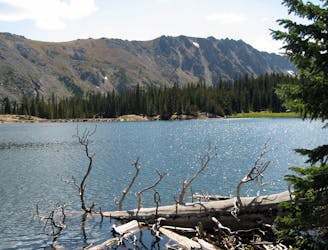
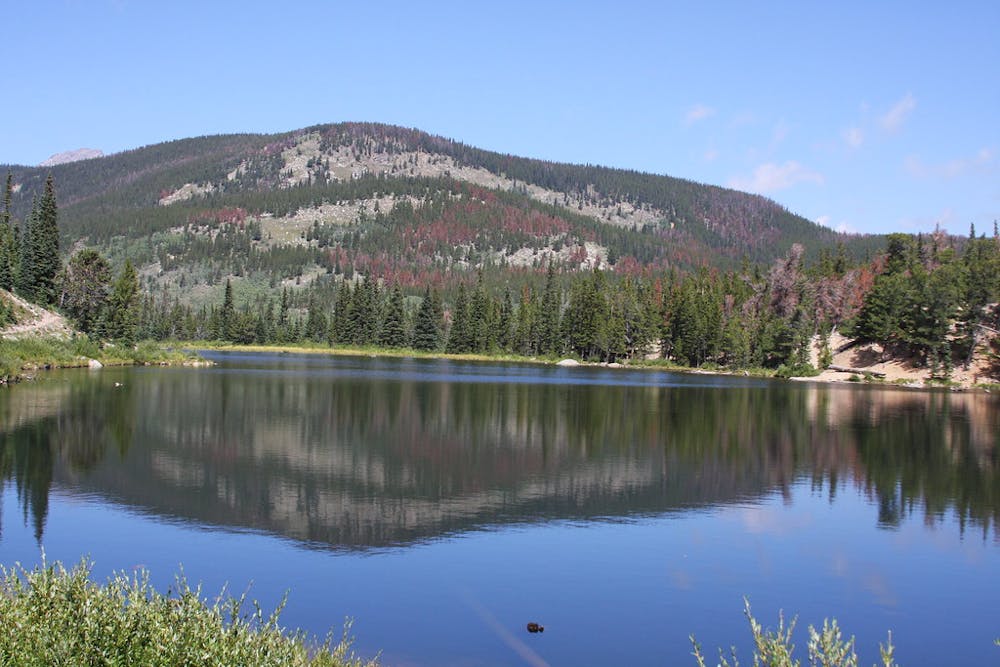
Imagine the quintessential image of an alpine lake in Colorado: a shimmering pool surrounded by deep green conifers, against a backdrop of snow-capped peaks. Lost Lake is exactly that. It’s a picture-perfect sample of the Rockies, but you don’t have to enter Rocky Mountain National Park or make a staggering hike to reach it. It’s a straightforward day hike in the national forest near Nederland, Colorado.
If Lost Lake was ever lost, it’s certainly been found now. The place is no secret, and easy access from Denver gives lots of people the opportunity to discover this lake. The trail ascends steadily up a forested valley, among aspen and mixed conifer, and along a tumbling stream. You’ll see waterfalls, wildflowers, and maybe some wildlife along the way. The hike itself is very much part of the reward, not just the lake itself.
But the destination does not disappoint. At the top of a final steep section, the trail breaks through the trees, and the scene of your imagination suddenly appears. Enjoy the spectacle, splash in the frigid water, and relax on the shore. You can hike farther along the lake and even complete a loop around it. Camping is allowed without any permit, but only in eight designated sites that are first come first served, so don’t count on being able to stay overnight.
Lost Lake is actually the nearest of many lakes reached from the same trailhead. The others are within Indian Peaks Wilderness and require a longer trip into the backcountry. Consider visiting some of them if you want an overnight backpacking trip or a tougher day hike.
Lost Lake is a destination in winter as well, when it’s frozen over and everything is covered in snow. The road is closed during winter, however, so it’s a longer journey and requires snowshoes or skis. Even when the road opens (typically mid-May), snow can linger on the trail to Lost Lake for several more weeks.
The trail is mapped here from the parking lot along 4th of July Road, which is suitable for passenger cars when it’s dry. 4WD vehicles can make it another half mile to the official trailhead, but a connector allows you to hike a trail instead of the road from the 2WD parking. Both parking areas usually fill up, especially on weekends in summer and fall. A free shuttle runs from Nederland on Saturdays and Sundays from late May to early October. Using the shuttle is highly recommended over trying to find parking at the trailhead.
Sources: https://www.fs.usda.gov/recarea/arp/recreation/hiking/recarea/?recid=28294&actid=50 https://www.fs.usda.gov/Internet/FSEDOCUMENTS/fsm91058151.pdf https://www.bouldercounty.org/open-space/parks-and-trails/hessie-trailhead/ https://dayhikesneardenver.com/lost-lake-hike-near-nederland/
Difficult
Hiking trails where obstacles such as rocks or roots are prevalent. Some obstacles can require care to step over or around. At times, the trail can be worn and eroded. The grade of the trail is generally quite steep, and can often lead to strenuous hiking.

The trail contains some obstacles such as outcroppings and rock which could cause injury.
Away from help but easily accessed.
3 m away
Long day hike or overnight trip into a wilderness area, with pristine alpine lakes near the Continental Divide.
Difficult Hiking
7 routes · Hiking
6 routes · Alpine Climbing · Hiking