8.9 km away
Brown's Creek Falls
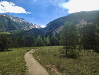
A scenic hike to a roaring waterfall nestled in a gorgeous mountain canyon.
Difficult Hiking
- Distance
- 9.5 km
- Ascent
- 308 m
- Descent
- 308 m
One of the most easily-accessible trailheads in Chaffee County leads to two of Colorado's famous 14ers.
Hiking Extreme

Chaffee County, Colorado boasts the most mountain peaks over 14,000 feet of any county in the lower 48 states. The closest 14er trailhead to the county seat, located in the bustling mountain town of Salida, is the starting point for this hike. Known as the Mount Shavano or Blank's Cabin Trailhead, the route mapped here is actually a two-for-one: you'll summit both Mount Shavano and Tabeguache Peak, bagging two of Chaffee County's most accessible 14ers in one hike.
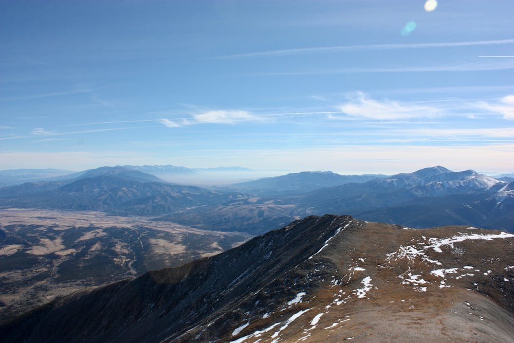
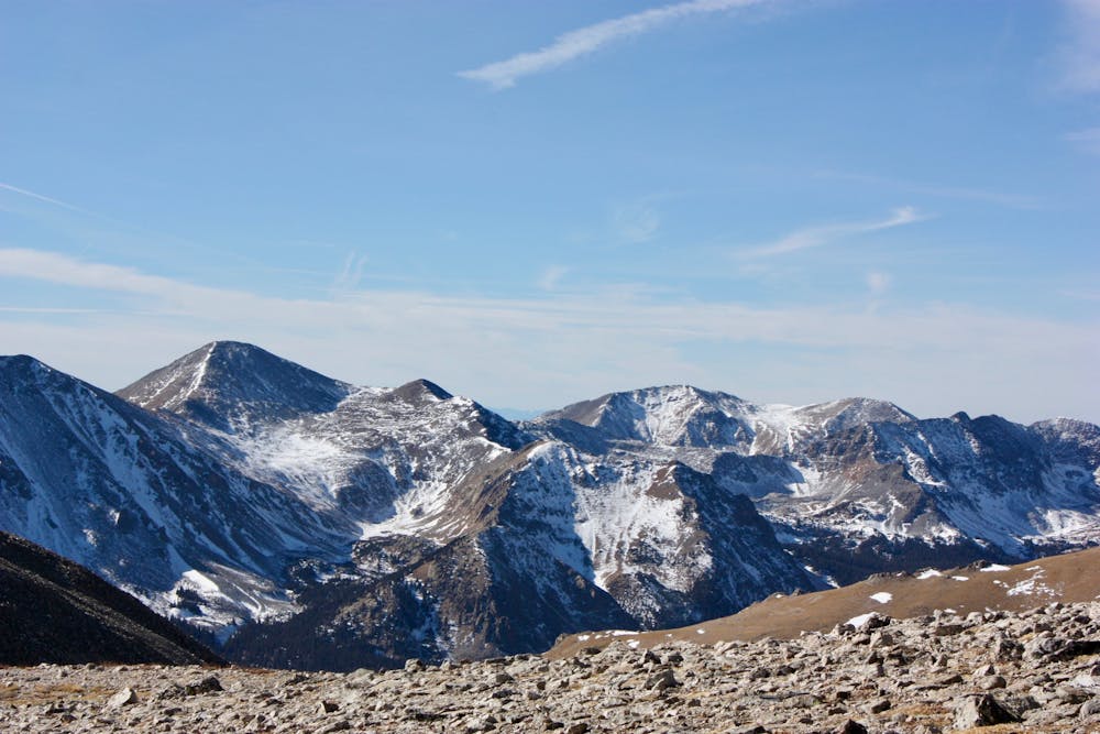
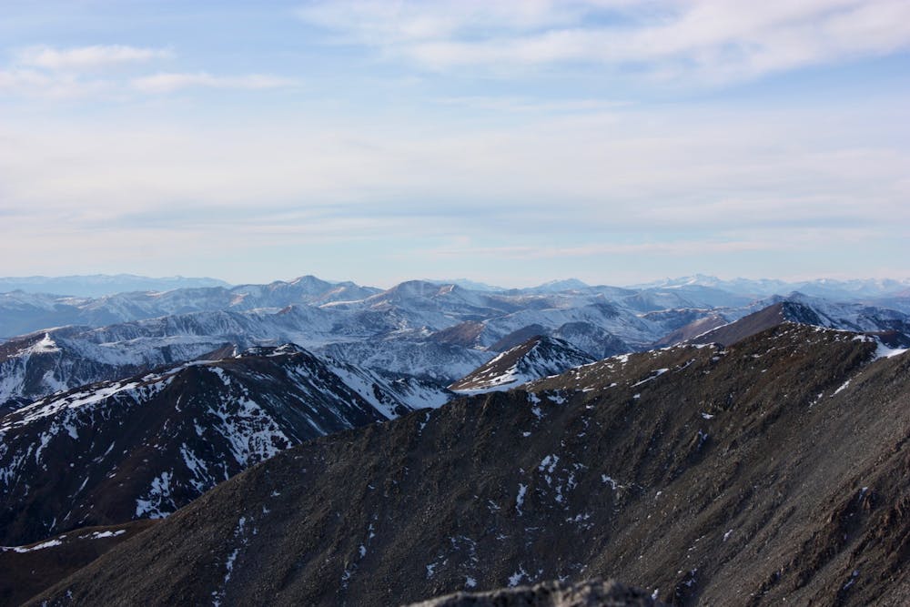
The mountains in the Sawatch Range, of which Shavano and Tabeguache are a part, are renowned for being massive piles of rubble. By that, hikers mean the rock and dirt on these mountains is usually loose and crumbly, with the summits consisting of big boulders and scree fields. The climb up to Shavano is no exception, with a heavily-eroded climb straight up the mountainside.
Once the trail breaks out into the alpine, it traverses the mountainside before gaining a ridge. From there, it follows the ridge up to the 14,229-foot summit of Mount Shavano, offering panoramic views of the Arkansas Valley and surrounding Sawatch Range.
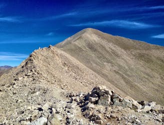
If you've already had a full day, it's best to turn around here and head straight down. But if you've gotten an early enough start that you think you can make it to Tabeguache Peak, back to Shavano, and back and down below treeline before noon (when the afternoon thunderstorms generally roll in), then you can add in the second peak as well.
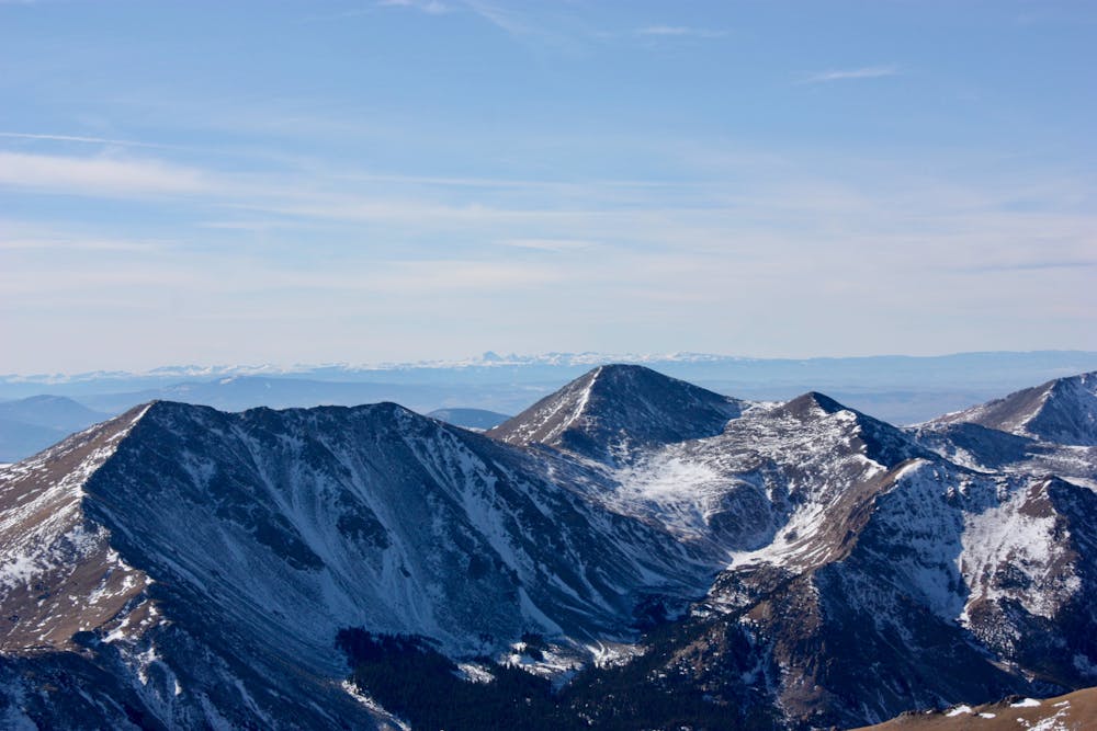
A relatively short ridgeline traverse down and up a saddle brings you to 14,155-foot Tabeguache Peak. Once you've snapped your photos, head back to Shavano, and then down the way you came
Note that it's best to descend these mountains via the main trail on the east side of Mount Shavano. Some older shortcuts down the north and northeastern faces tend to cliff out, leading to Search and Rescue missions almost every year. Descending by an alternate route should only be attempted by well informed and experienced mountaineers.
Extreme
Scrambling up mountains and along technical trails with moderate fall exposure. Handholds are necessary to navigate the trail in its entirety, although they are not necessary at all times. Some obstacles can be very large and difficult to navigate, and the grades can often be near-vertical. The challenge of the trail and the steepness of the grade results in very strenuous hiking. Hikes of this difficulty blur the lines between "hiking" and "climbing".

The trail contains some obstacles such as outcroppings and rock which could cause injury.

Little chance of being seen or helped in case of an accident.
8.9 km away
A scenic hike to a roaring waterfall nestled in a gorgeous mountain canyon.
Difficult Hiking
8.9 km away
The most scenic and adventurous route to the summit of Mount Antero.
Extreme Hiking
9.8 km away
Hike up a gorgeous mountain valley along a rushing stream.
Difficult Hiking
11 routes · Alpine Climbing · Hiking