2.7 km away
Mount Sherman: Southwest Ridge from Fourmile Creek
While not "easy," Sherman is renowned as one of Colorado's easiest and most accessible 14ers.
Severe Hiking
- Distance
- 7.8 km
- Ascent
- 611 m
- Descent
- 611 m
For a short-and-sweet 14er summit hike with only 2,150' of elevation gain, the West Slopes of 14,036' Mt. Sherman is a wonderful choice.
Hiking Difficult

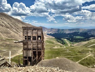
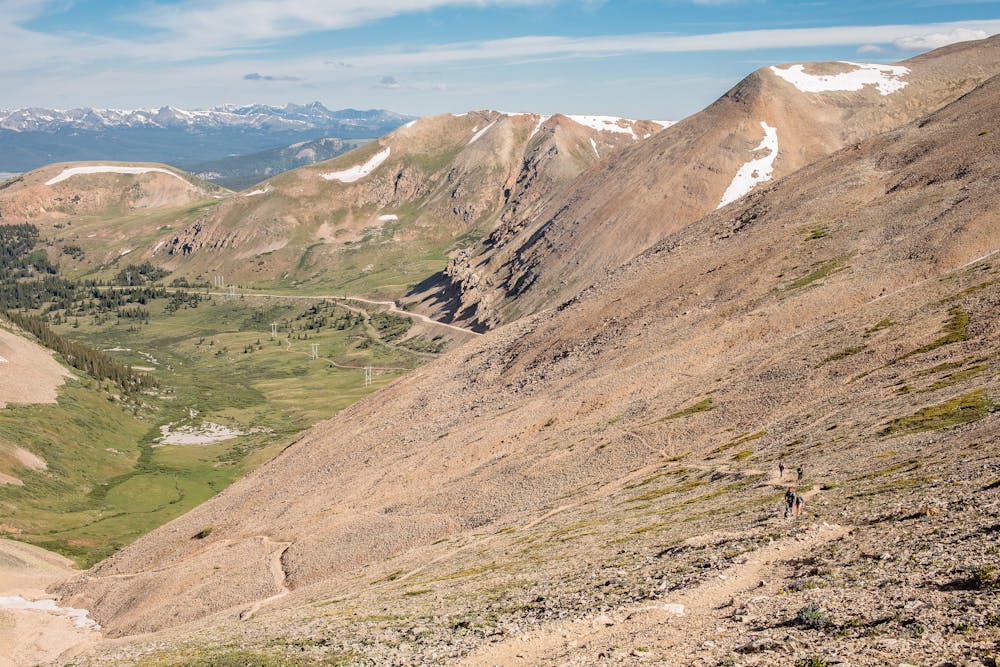
Just out of Leadville, the highest city in the U.S. at 10,152', is the Iowa Gulch trailhead accessing the West Slopes route to Mt. Sherman's summit. The trailhead is at 11,840', which makes for an unusually short hike for a 14er.
This route is not the most frequently-used one, but is a truly delightful option that also makes an apres hike lunch and/or libations stop in Leadville very convenient.
The only slightly challenging route-finding issue is finding the start of the trail from the trailhead. Once located, the rest of the trail is obvious all the way to the saddle between Mt. Sherman and its neighbor, 13,748' Mt. Sheridan. At the saddle, the standard Fourmile Creek route, with its numerous hikers, meets the West Slopes route.
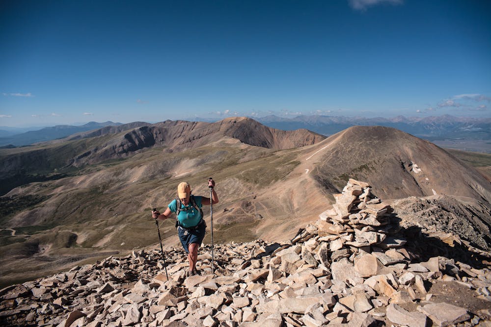
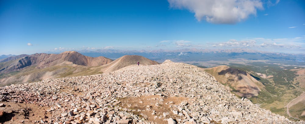
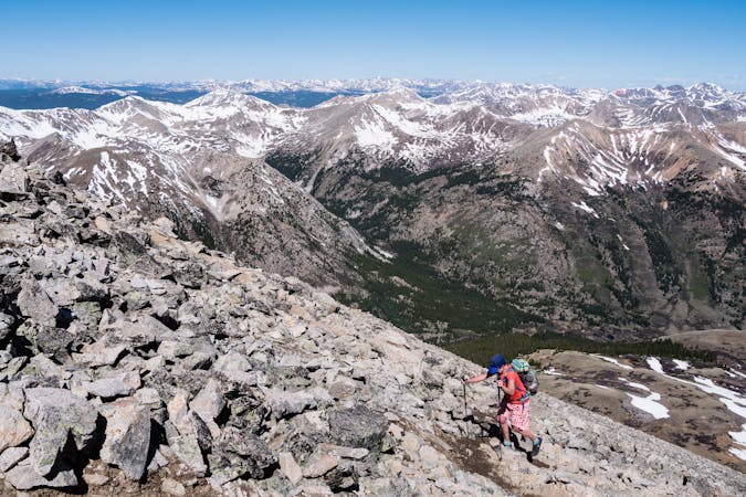
From the saddle, join the rest of the Sherman hikers heading up the trail leading up to the somewhat narrow, rocky ridge. The ridge allows expansive views en route to the summit.
At the 14,036' summit of Mt. Sherman, enjoy a break while contemplating whether to add another summit on the way back. If the skies are clear and the answer is “yes”, when reaching the Sherman-Sheridan saddle on the descent, it is an extra 6/10 mile to the summit of Mt. Sheridan—1.2 miles round trip to get back to the saddle.
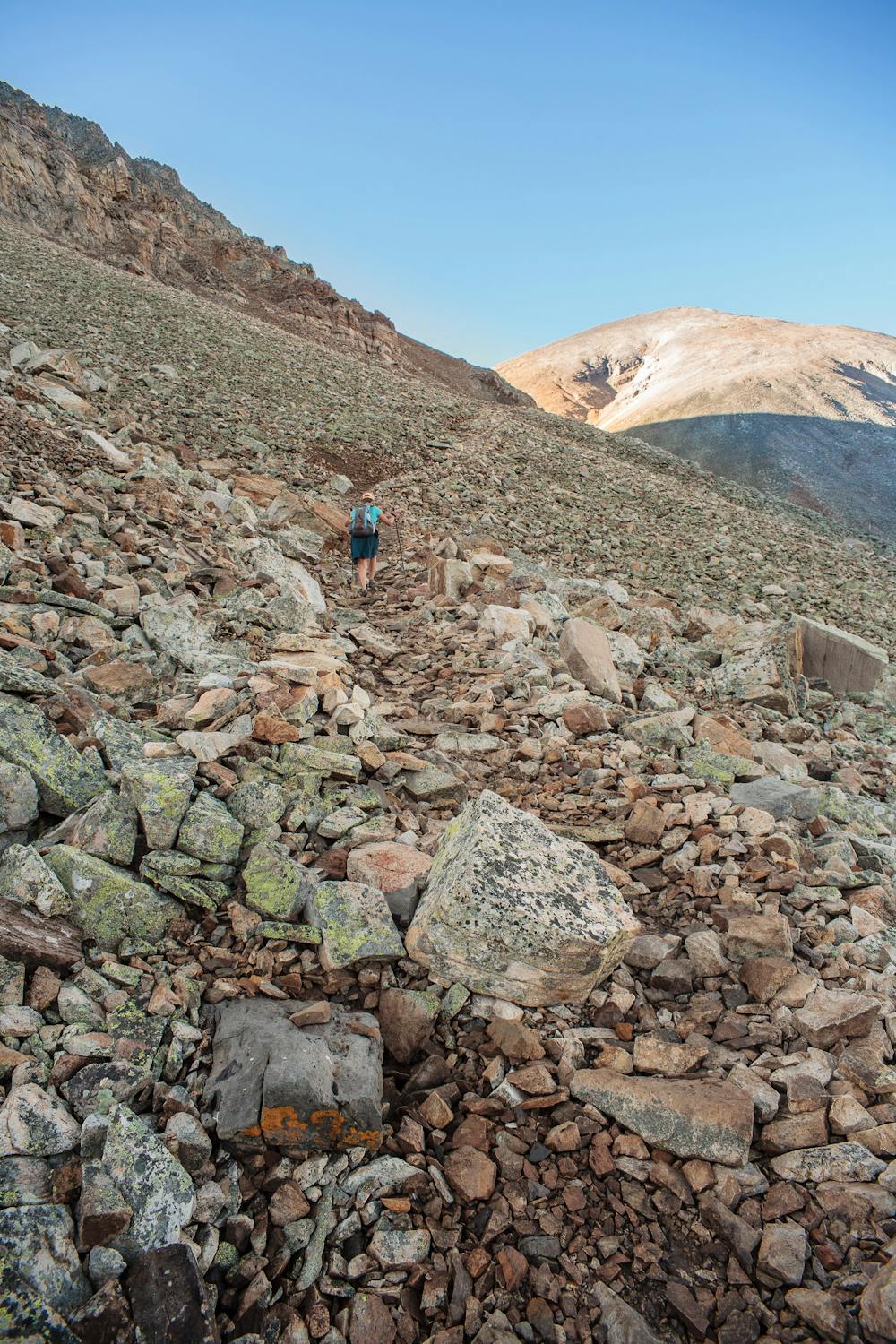
From the saddle, the steep, scree trail allows for some light jogging to make the short descent even faster. Trekking poles will help with balance here.
Take advantage of the brevity of the 4.5-mile (5.7 if Sheridan was added) hike by re-fueling in Leadville before heading home.
Difficult
Hiking trails where obstacles such as rocks or roots are prevalent. Some obstacles can require care to step over or around. At times, the trail can be worn and eroded. The grade of the trail is generally quite steep, and can often lead to strenuous hiking.

Some trail sections are extremely exposed where falling will almost certainly result in serious injury or death.

Close to help in case of emergency.
2.7 km away
While not "easy," Sherman is renowned as one of Colorado's easiest and most accessible 14ers.
Severe Hiking
9.5 km away
Hike to a little-visited alpine lake from a trailhead on a 4x4 road
Moderate Hiking
6 routes · Alpine Climbing · Hiking

46 routes · Alpine Climbing · Hiking